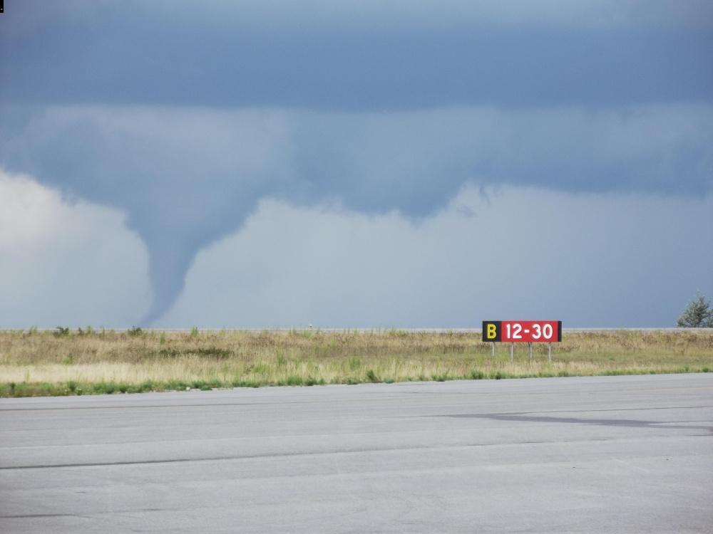
This F1 tornado moved in a northeasterly direction and passed just north of Dryden and its regional airport, levelling 300 hectares of forest in its path. This was the most significant tornado that occurred during a family of twisters moved through Northwest Ontario. It touched down at approximately 4:15 pm and was on the ground for half an hour, travelling for 24 km with a width of 100 metres.
Many eyewitnesses captured photos and videos of the photogenic cone tornado, making it one of the most well-documented twisters ever in Northwest Ontario. After reviewing aerial images of the damage which were provided by the Ontario Ministry of Natural Resources, Environment Canada noted in its report that the tornado likely would have earned a higher rating had any structures been impacted.
This was one of four tornadoes that touched down on August 16, 2011.

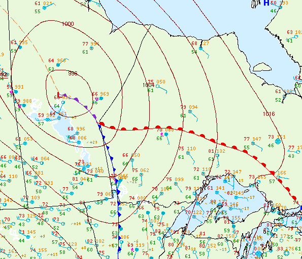
Figure 2 depicts the surface observations at 4:00 pm EDT, which shows an occluding low pressure in northern Manitoba, bringing a cold front near the ON/MB border and a warm front in northwestern Ontario. The warm front became the focus for intense thunderstorms throughout the afternoon and evening hours, which ultimately led to three tornadoes across northwestern Ontario on this day. The cold front moved east throughout the afternoon and triggered some more thunderstorms, one of which was responsible for this long-track F1 tornado north of Dryden.
Sources
Miller, M. (2011, August, 16). Tornado – Aug.16/11 – Dryden, ON. DarkSky. Retrieved from http://www.ontariostorms.com/showthread.php?t=799
NWS Weather Prediction Center Surface Analysis Archive. (2017). Surface analysis 21Z Tue Aug 16 2011. Retrieved from: https://www.wpc.ncep.noaa.gov/archives/web_pages/sfc/sfc_archive.php

