

At around 4:55pm, this tornado developed near Dunnville and then tracked for over 50 km toward Crystal Beach. Several farms were extensively damaged with barns and outbuildings destroyed. Trees were snapped, uprooted and shorn off at their tops.
This was one of four tornadoes to touch down in Southern Ontario on June 2. The others:
- F0 at Fergus
- F1 at Norwich
- F1 at Elmvale
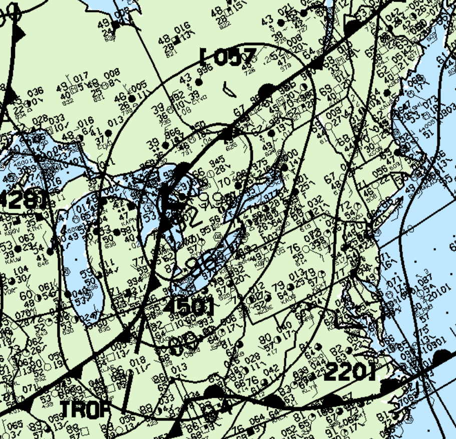
Figure 1 depicts the surface observations at 2:00 pm EDT, which depicts a strong low pressure over Lake Huron with a stationary front extending into central Ontario/Quebec and a cold front crossing the Great Lakes. The cold front became the focus for intense thunderstorms in the afternoon/evening hours of June 2nd.
According to Environment and Climate Change Canada (2018), an F1 tornado touched down at 4:53 pm EDT near Dunneville, ON. The path and width of the tornado was not documented by ECCC. The tornado caused no fatalities, injuries or property damage.
Sources
NWS Weather Prediction Center Surface Analysis Archive. (2017). Surface analysis 18Z Tue Jun 2 1998. Retrieved from: https://www.wpc.ncep.noaa.gov/archives/web_pages/sfc/sfc_archive.php
Environment
and Climate Change Canada Data. (2018). Canadian National
Tornado Database: Verified Events (1980-2009) – Public. Retrieved
from: http://donnees.ec.gc.ca/data/weather/products/canadian-national-tornado-database-verified-events-1980-2009-public/