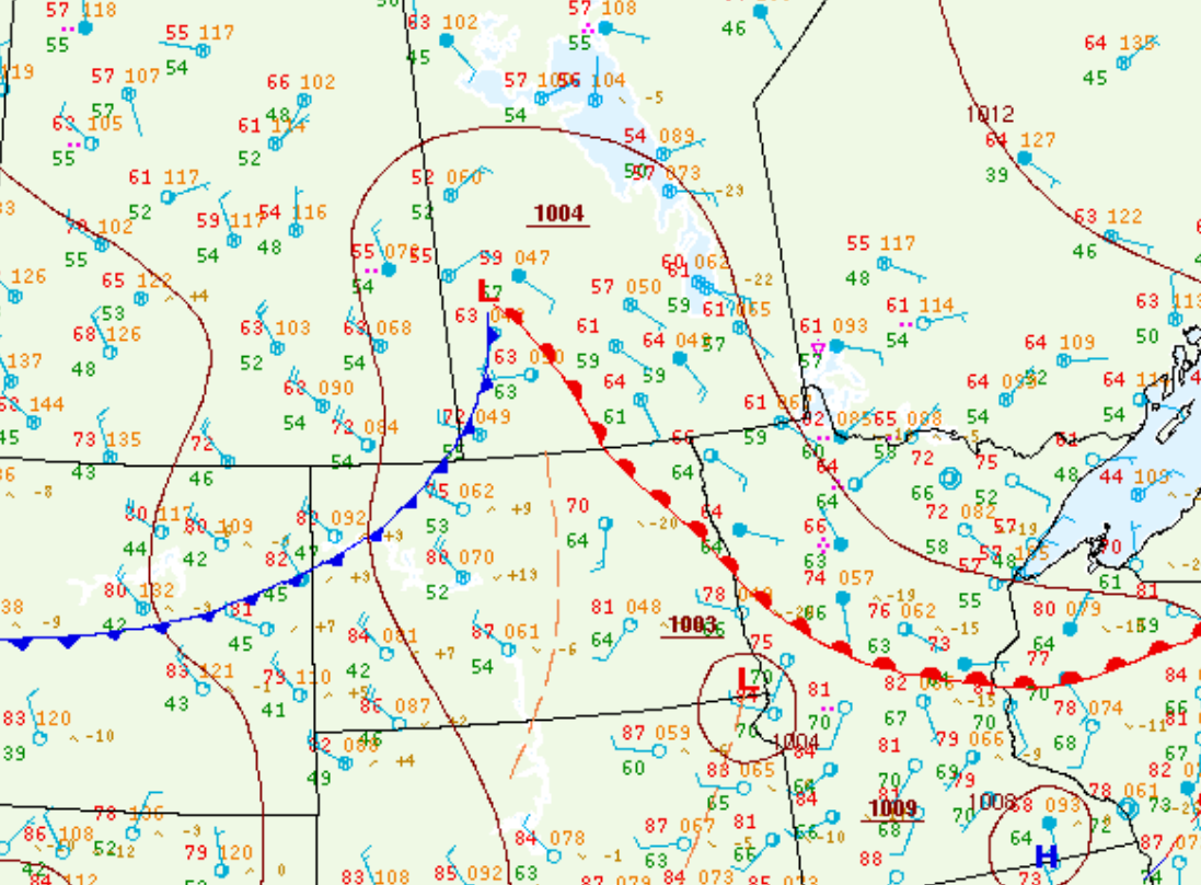
Figure 1 depicts the surface observations at 4:00 pm CDT, which shows a low pressure in Western Manitoba with a cold front extending across Southwestern Manitoba and Northwestern North Dakota and a warm front extending across Southern Manitoba. The cold front became the focus for intense supercell thunderstorms in the afternoon and evening hours of July 7th, which ultimately resulted in several tornadoes across North Dakota.
There were a total of 8 tornadoes on this day. Below are the tornadoes that occurred in North Dakota, seemingly from the same supercell:
- Lake Metigoshe, ND EF0 Tornado
- Dunseith, ND EF0 Tornado
- Belcourt, ND EF3 Tornado
- Munich, ND EF1 Tornado
- Munich, ND EF1 Tornado
- Lankin, ND EF0 Tornado
- Grafton, ND EF0 Tornado

According to Environment and Climate Change Canada (2018), an F1 tornado touched down at 2:24 pm CDT near Lake Metigoshe, MB. The path and width of the tornado was not documented by ECCC. No property damage was documented for this tornado.
Sources
NWS Weather Prediction Center Surface Analysis Archive. (2017). Surface analysis 21Z Mon Jul 7 2008. Retrieved from: https://www.wpc.ncep.noaa.gov/archives/web_pages/sfc/sfc_archive.php
Environment and Climate Change Canada Data. (2018). Canadian National Tornado Database: Verified Events (1980-2009) – Public. Retrieved from: http://donnees.ec.gc.ca/data/weather/products/canadian-national-tornado-database-verified-events-1980-2009-public/

