Embedded in a line of severe thunderstorms that caused wind damage across Southern and Central Ontario, this was the first of a pair tornadoes that struck the Newmarket area at 10:15 pm. It travelled along Stonehaven Avenue for half a kilometre and had a width of 30 metres. Play sets were knocked over, fences thrown for hundreds of metres and power poles blown down. Minor damage was done to a garage and several houses had windows broken and shingles torn off, one of which was found impaled in a wooden doorframe.
This was one of two tornadoes that struck the Newmarket area in Southern Ontario on July 17. The other was an F1 that passed from Cedar Valley to Vivian.
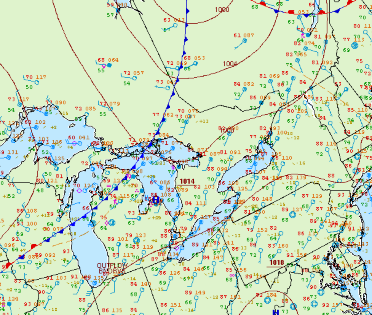
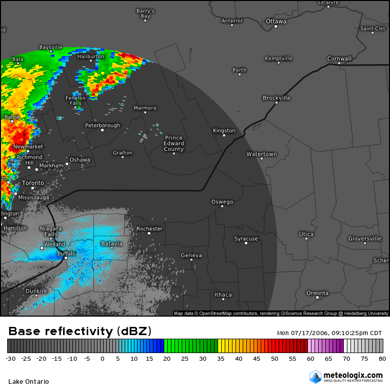
Figure 1 depicts the surface observations at 8:00 pm EDT, which shows a cold front slicing through the Great Lakes. Pre-frontal storms developed in southern Ontario in the form of a cluster of storms (Figure 2), which ultimately led to two tornadoes in Newmarket and Cedar Valley.

Figure 2 shows the Doppler radar reflectivity at 10:10 pm moments before the tornadoes developed near Newmarket.

According to Environment and Climate Change Canada (2018), an F0 tornado touched down at 10:15 pm near Newmarket, ON. The tornado travelled for 500 metres with a maximum width of 30 metres. The tornado caused no fatalities, injuries or property damage.
Sources
NWS Weather Prediction Center Surface Analysis Archive. (2017). Surface analysis 00Z Tue Jul 18 2006. Retrieved from: https://www.wpc.ncep.noaa.gov/archives/web_pages/sfc/sfc_archive.php
Environment and Climate Change Canada Data. (2018). Canadian National Tornado Database: Verified Events (1980-2009) – Public. Retrieved from: http://donnees.ec.gc.ca/data/weather/products/canadian-national-tornado-database-verified-events-1980-2009-public/

