

The final tornado of the August 7th outbreak was this EF1 that left a swath of tree damage across the West Guilford area, about 5 km northwest of Haliburton. The twister touched down at around 5:30 pm and was confirmed based upon aerial images of the damage. They showed a long and narrow swath of trees that had been snapped or uprooted and left in a pattern indicative of a tornado. This was the only tornado of the day that was not captured in photos or on video.
This was one of five tornadoes that touched down on August 7, 2013. The others:
- Orillia (EF0)
- Carnarvon (EF1)
- Arthur (EF0)
- Head Lake (EF0)
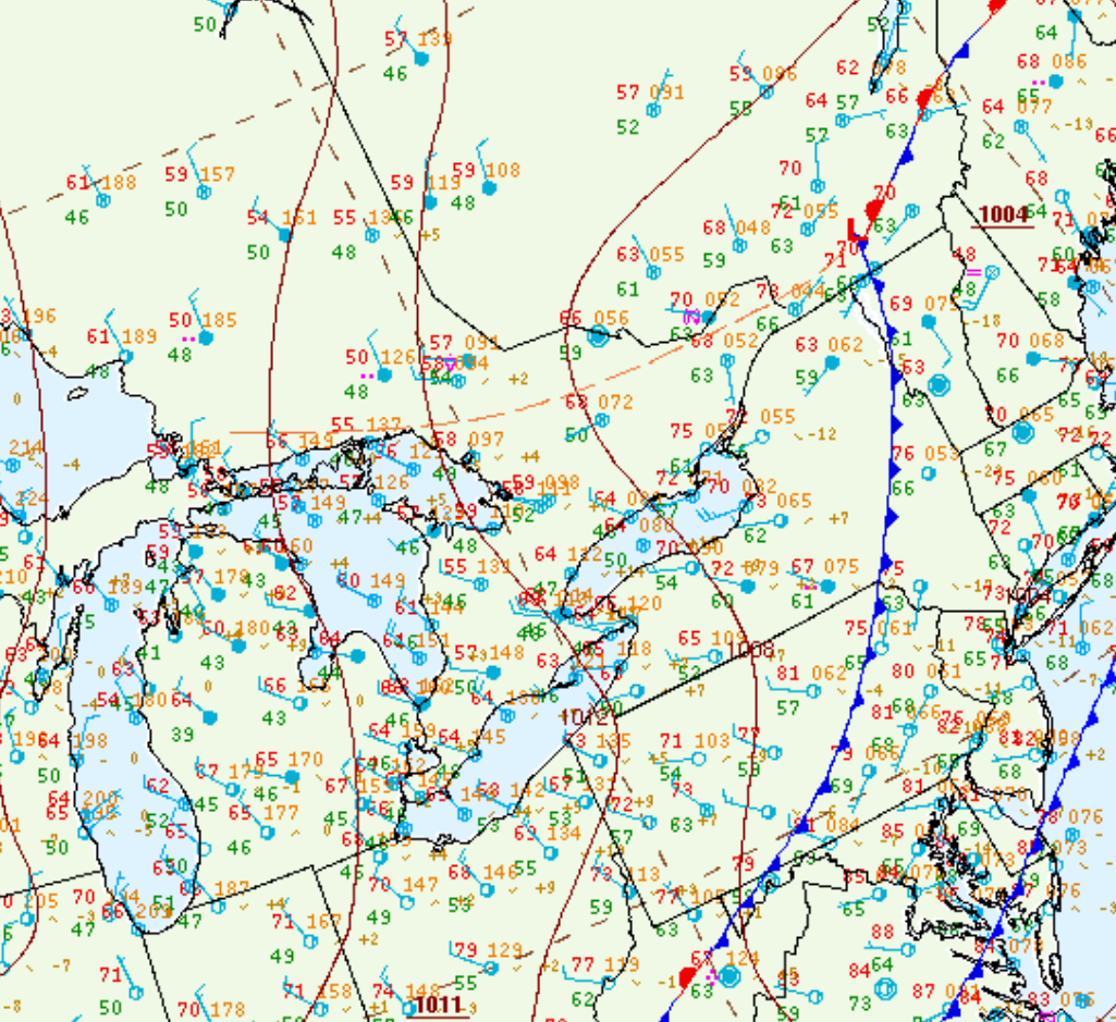
Figure 1 depicts the surface observations at 5:00 pm EDT, which shows a trough of low pressure in central Ontario behind a cold from over the northeastern United States. This trough promoted convergence and thunderstorm development in the afternoon and evening hours of August 7th, which led to a tornado outbreak across central Ontario.
Sources
NWS Weather Prediction Center Surface Analysis Archive. (2017). Surface analysis 21Z Tue Aug 13 2013. Retrieved from: https://www.wpc.ncep.noaa.gov/archives/web_pages/sfc/sfc_archive.php