

Published on
Often times, storm chasing is indescribably frustrating. Think of it like trying to piece together a puzzle — except the puzzle is on a table that keeps moving and you don’t really ever know which way its going to move next. Even for the most experienced forecasters/chasers, Mother Nature has a way of throwing something at you you just never expect. That’s what made May 24, 2016 so incredible…we made a perfect forecast. Now before I go any further, I’m not writing this to toot my own horn. This particular day, a day in which a storm near Dodge City, KS put on a once in a lifetime tornado show for thousands of chasers to see was one in which again thousands of chasers made great forecasts. We all should be very proud of that.
When it comes to chasing, 2016 was a bit of a weird year for me. Being that I was living in Wisconsin at the time, much of my chasing was done on a sort of “one-off” basis where I’d drive down from Madison for a couple of days at a time when there was an event that was worthy of the trip. This system worked well, but was different than my annual week-long chasecation with my Dad and friends Adam and Kevin. By mid-May however, it started to become apparent that there was going to be a nearly week-long stretch of severe weather on the central and southern Plains worth taking some time to chase. My dad and I met up with Kevin and Adam on May 21 (missing the gorgeous Leoti, KS supercell and tornadoes) and begin chasing storms the next day. May 22nd and 23rd proved to be good storm days, producing substantial supercells and tornadoes each day — just not really for us. We always seemed to be in the wrong place at the wrong time or make a seemingly small decision that would blow up in our faces. While many other chasers watched a huge nighttime wedge tornado near Turkey, TX on May 23rd, we sat in the Big Texan eating dinner after having chosen the wrong storm to chase. Needless to say, we needed some redemption.
The morning of May 24th, we woke up in Amarillo, TX. The play seemed obvious: get to the dryline/outflow boundary intersection in southwest Kansas and wait. The environment was primed; substantial wind shear overspread more than ample instability and moisture in nearly perfect chasing terrain. I like to say that big tornado days have “a feel”. You get out of the car and the air is nearly dripping with moisture. You can see clouds at different heights moving in different directions (a sign of good wind shear). You can almost smell it. I’m not sure what “it” is, but trust me, it smells good. That day was no different. We got up to near Dodge City in the early afternoon and began the “hurry up and wait” stage of the chase. Not long after arriving, a storm went up well to the north near Scott City, KS and almost immediately began producing tornadoes. As many chasers will tell you, this is a near nightmare scenario: you’ve chosen the wrong storm. We were in near agony as the first pictures of a beautiful elephant trunk tornado came across social media. I’d be lying to you if we didn’t discuss heading north for the storm that was already producing. We discussed our options and began to comfort ourselves with the thought that the environment in our location was just as good if not better than the environment where that storm was. Fatefully, we stayed put, not knowing what we were soon in store for.
Not long thereafter, the first puffs of cumulus started to develop. One in particular caught our eye. It was a mile or two away, and we decided to go sit ourselves underneath it. Once in position, we watched as this single puff of white marshmallowy goodness developed a broad, dark, circular base. The volatility of the atmosphere was apparent as the cloud above us bubbled with convection. Over the next hour we watched as our little puffy cloud developed into an absolutely monstrous supercell thunderstorm. To make matters all that much more exciting, there was that silly little outflow boundary our storm was about to play with.
Outflow boundaries are a magical phenomenon in the severe convective storm world. When a thunderstorm dies, it often spits out a current of cold, dense air that sinks towards the surface while moving away from the thunderstorm core. Often times these currents, known as outflow boundaries, can persist many hours if not days after the death of a storm, and may provide a focus for storm development at a later time. Additionally, these boundaries almost always cause a significant shift in the mean surface wind, thus generating surface vorticity. Vorticity, as you may guess from the name (think vortex), is effectively a measure of the spin in the air. Storms that develop in the presence of high surface vorticity are far more likely to produce tornadoes than storms that don’t. Outflow boundaries usually manifest themselves visually (to the naked eye and on satellite imagery) and on radar as thin lines of clouds and precipitation that sometimes intersect storms. As our storm continued to develop, we noticed that the outflow boundary that had been draped over the region from previous days’ convection was now feeding directly into the updraft. To us, this was all the evidence we needed to know the storm was about to go bonkers.
Not ten minutes after boundary became entangled within the updraft, the first wall cloud began to form. It wasn’t long thereafter that the most perfect funnel you could possibly imagine stretched towards the ground, touching down to become a tornado complete with perfect concentric vortices. From our angle, the tornado appeared as a menacing black rope with an expanding debris fan at the surface. The perfect Kansas beast.

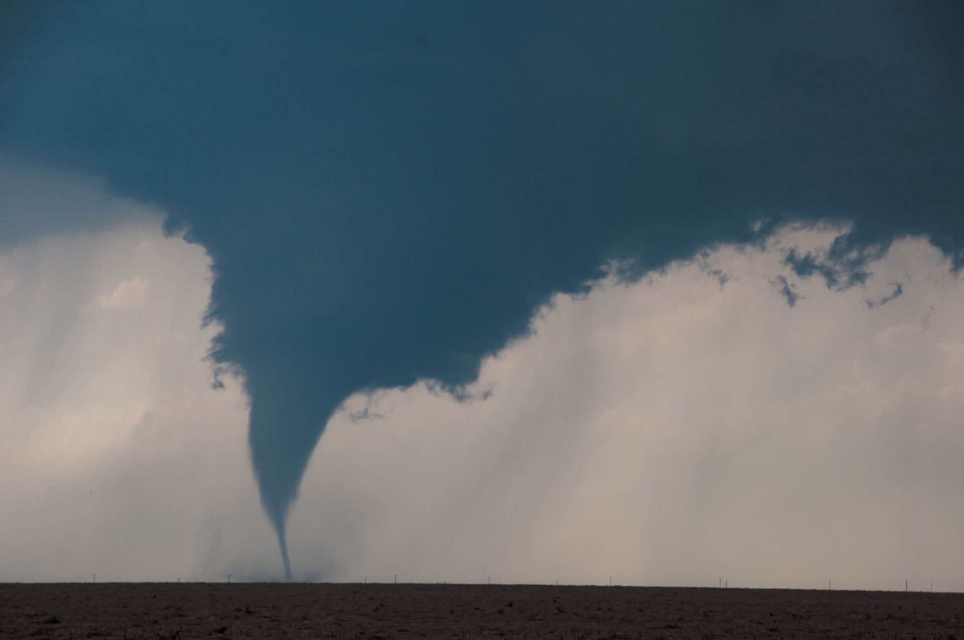
We watched in awe for the next 20 or so minutes as the tornado expanded and intensified while moving at a snail’s pace. This was any chaser’s dream scenario. It didn’t take long for the tornado to become an absolute monster, expanding to nearly a quarter mile wide and exhibiting violent motion in its base. This was only the beginning however…
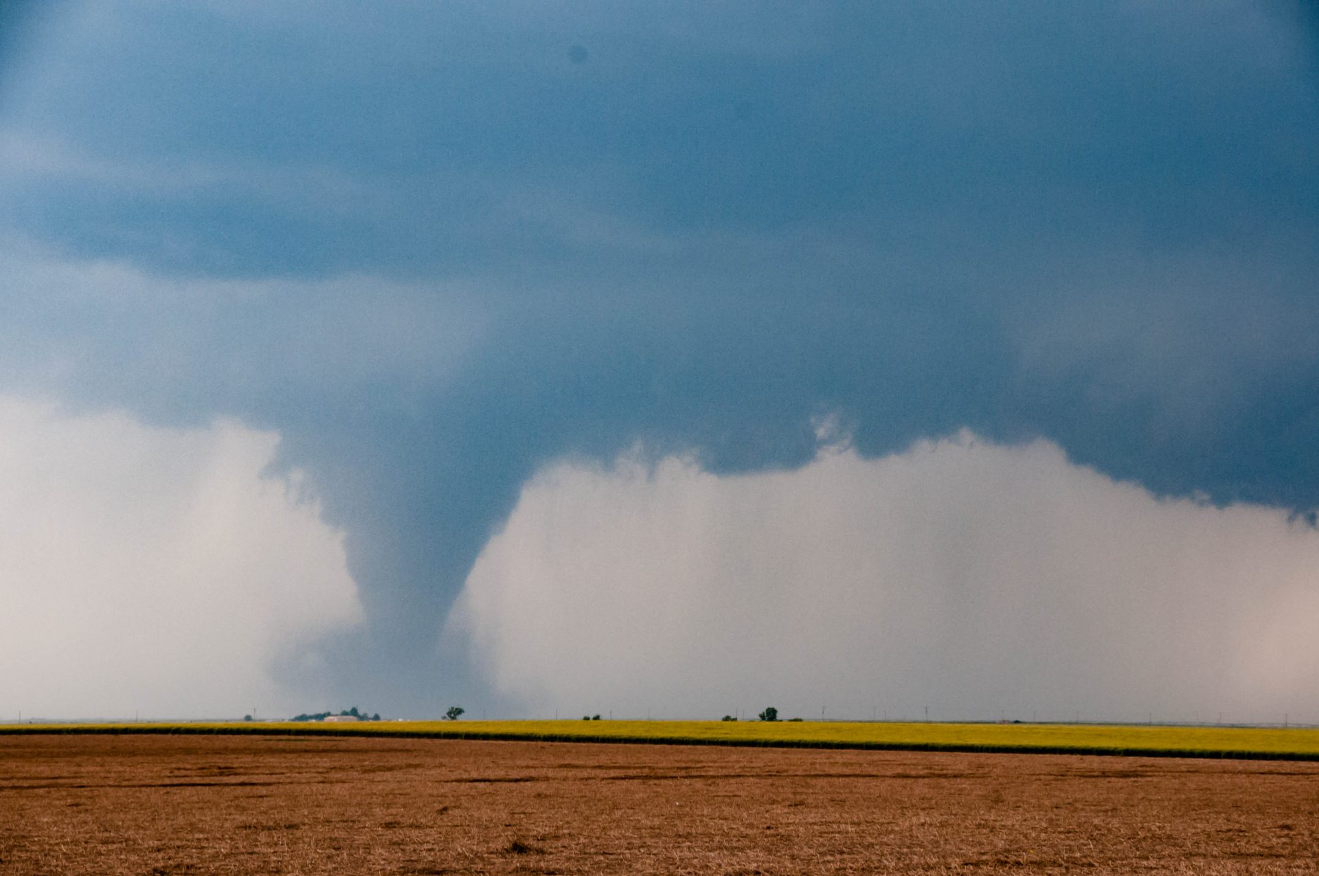
The tornado intensifies 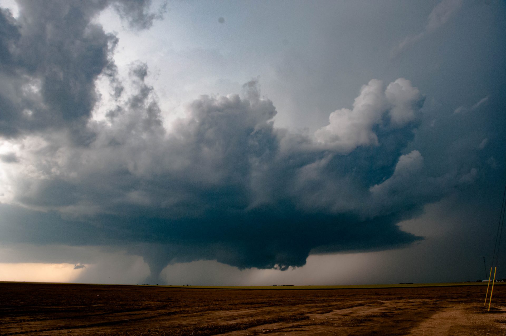
A full structure shot
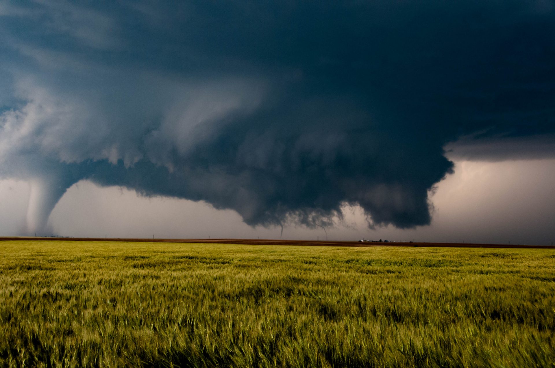
As the first tornado began to occlude and move become wrapped in rain, a second region of rotation began to form off to the right of the original circulation. It wasn’t long before we were treated to a show the likes of which I don’t think I’ll ever see again. We saw over a dozen more tornadoes that day. Tornadoes of all shapes and sizes. Sometimes two or three (at least) on the ground at once. It was a spectacle to behold. By the end of the day, we’d lost count of the tornadoes we’d seen. I would later find out that at least a couple of these tornadoes were likely violent (EF4+ strength), as evidenced by mobile doppler radar data. One tornado was likely capable of EF5 damage. The town of Dodge City, which was under a tornado emergency for much of this tornado sequence, was immensely lucky to be spared the worst of this storm.
Triplets! 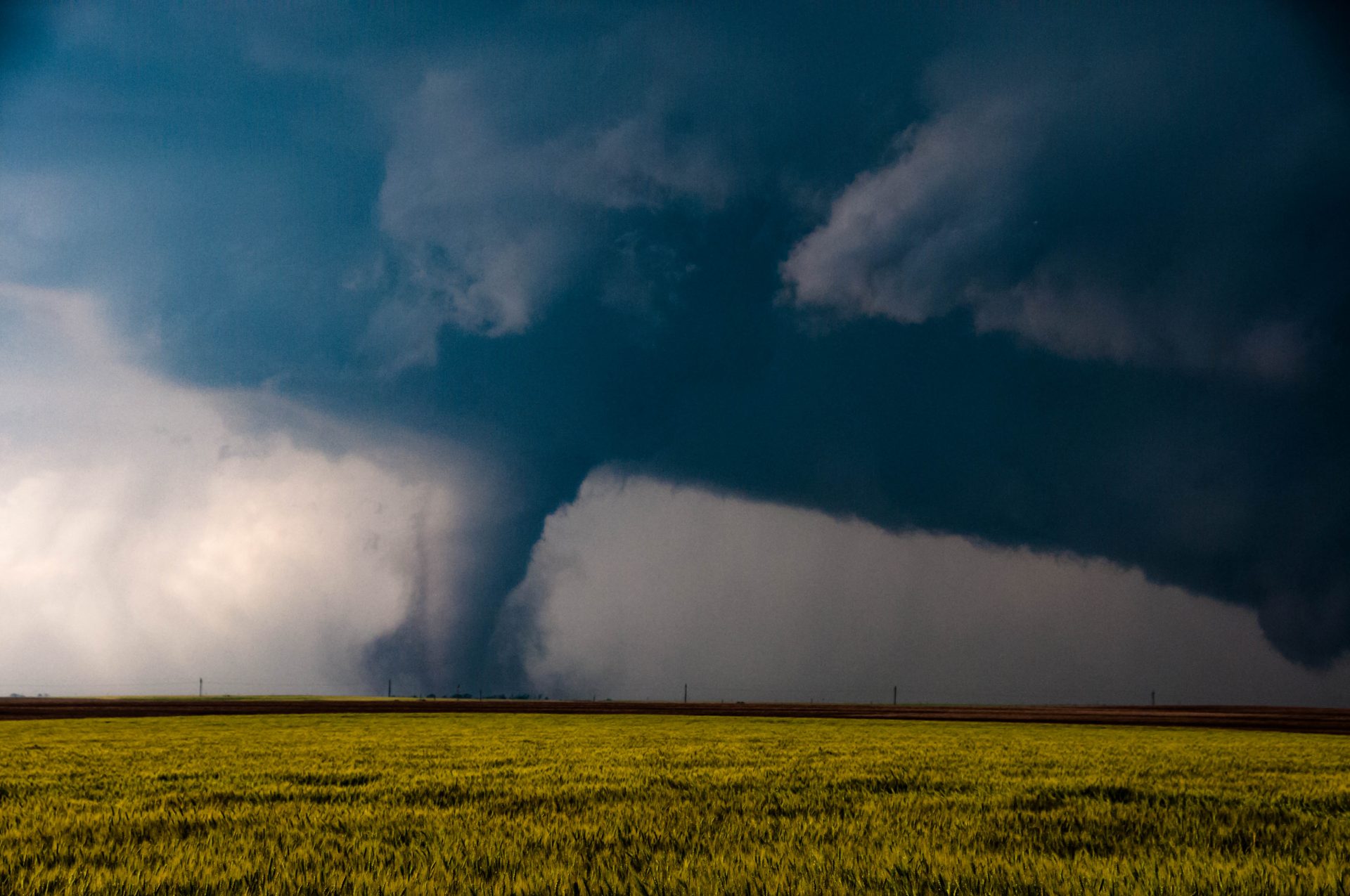
No words really necessary 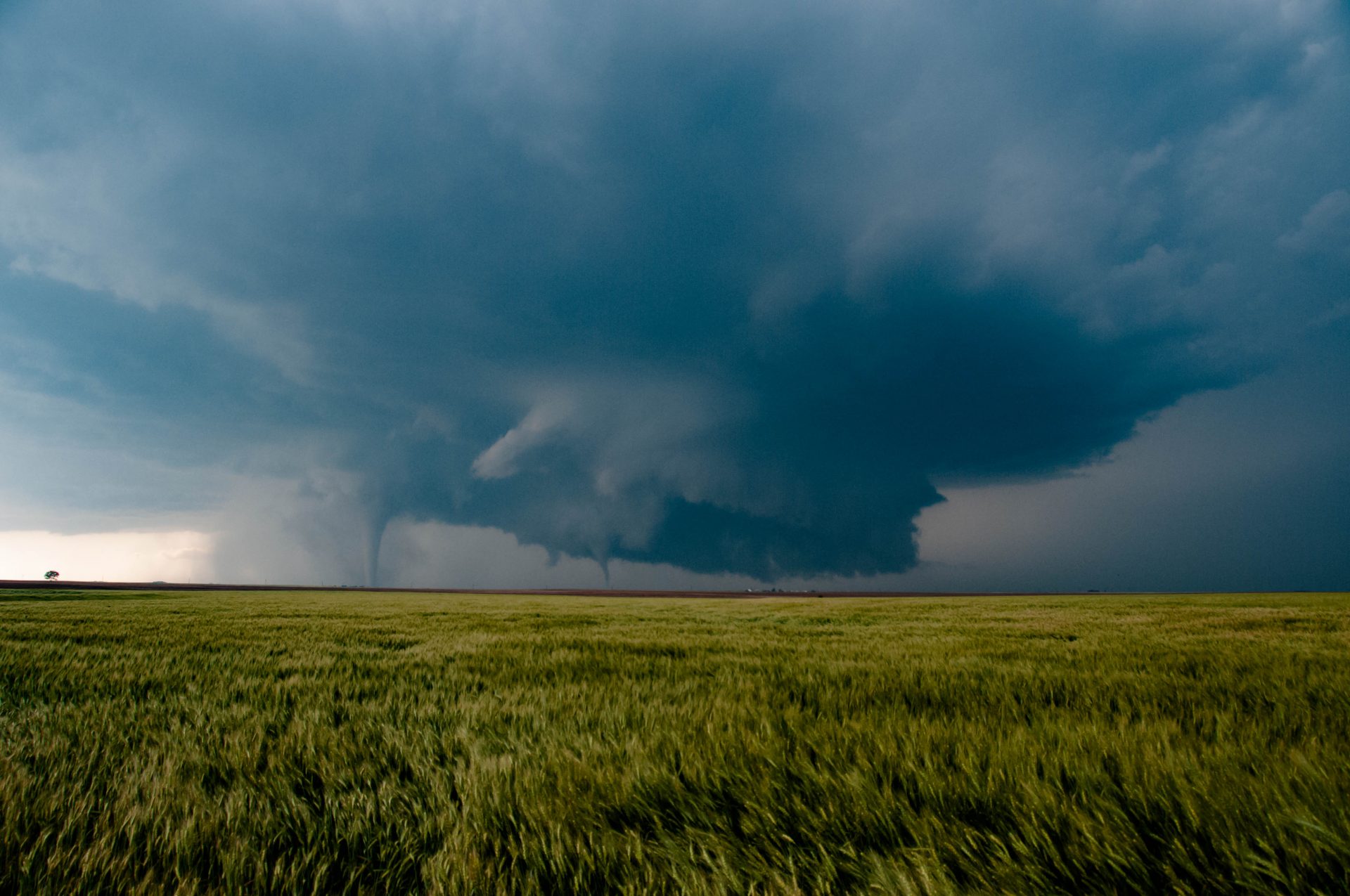
Twins! 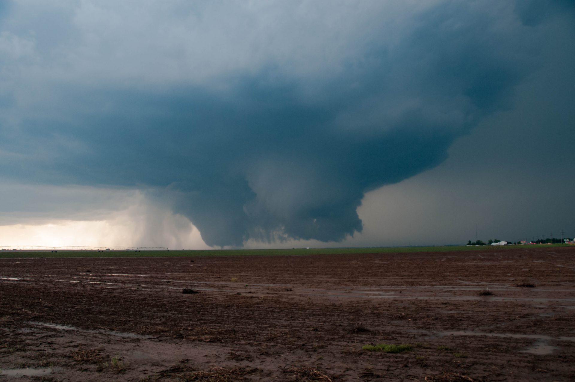
A large multi-vortex tornado. 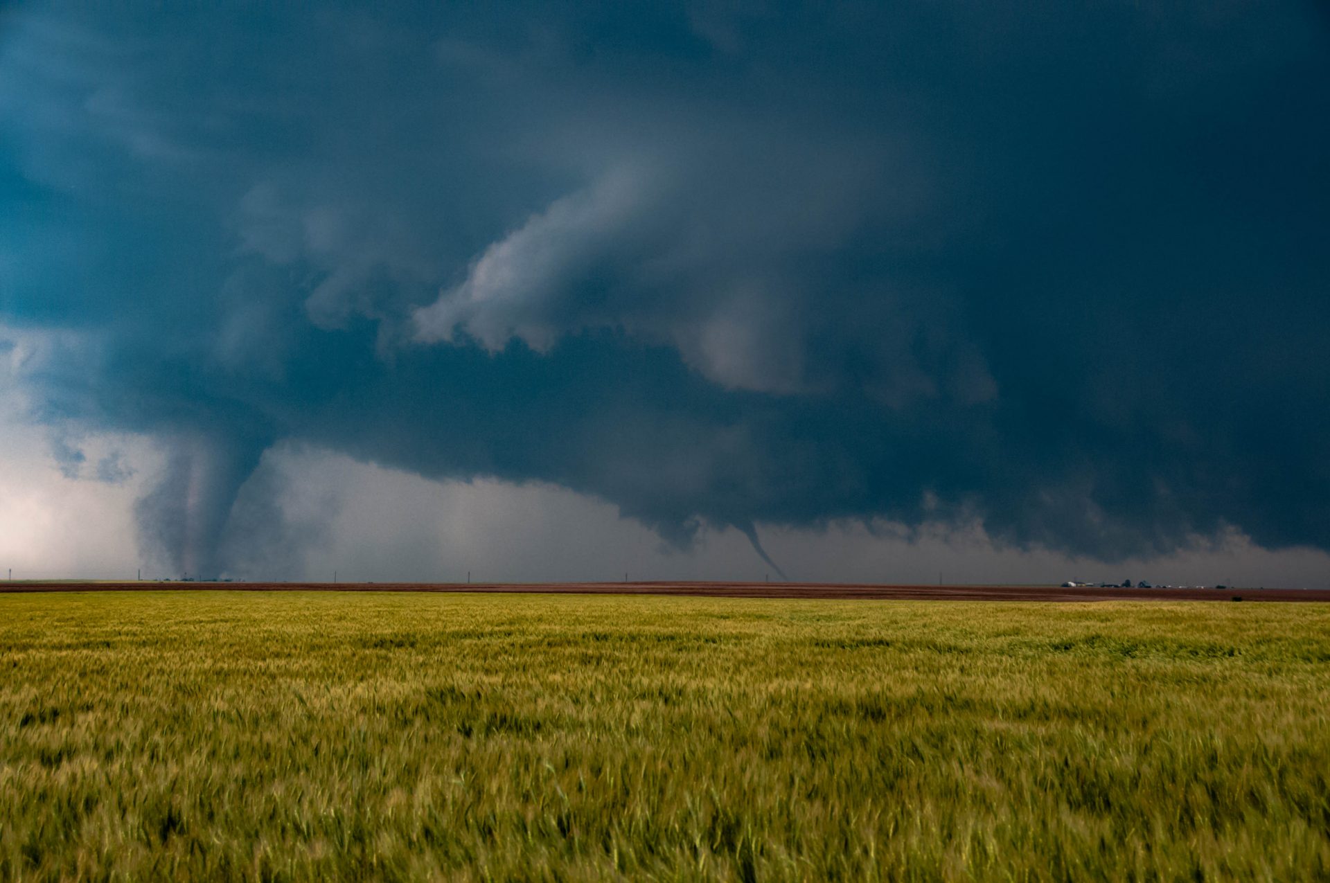
More twins!
After a chase, its always good to do a little post-mortem review. What did we do well? What could we have done differently. This was a chase characterized almost exclusively by the former. We made a really good forecast and we stuck to it. We didn’t go flying off the handle when the storm to the north near Scott City started producing. We sat under the first puff of cumulus and watched as it turned from fair weather cloud to a tornadopalooza. We made the perfect forecast, and I’m damn proud of it.
Community Comments
There are no comments on this post
Want to leave a comment? Join our community → OR Login →