

Published on
April 10th, 2021
Timeline of Severe Weather in West Michigan
4:30 PM.
I headed out to Grand Rapids driving towards warned storm.
4:51 PM.
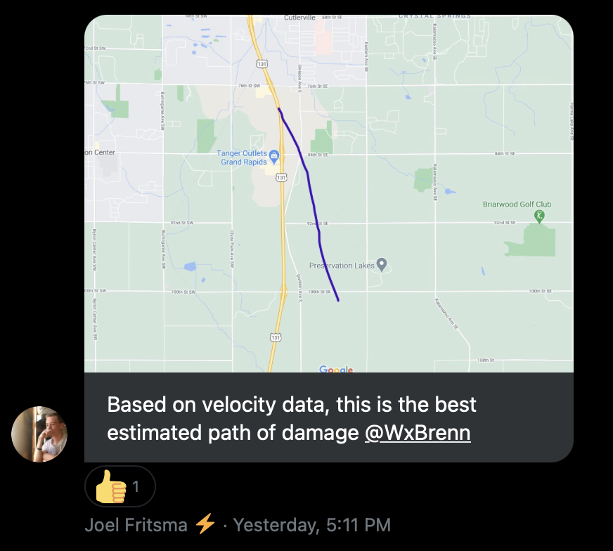
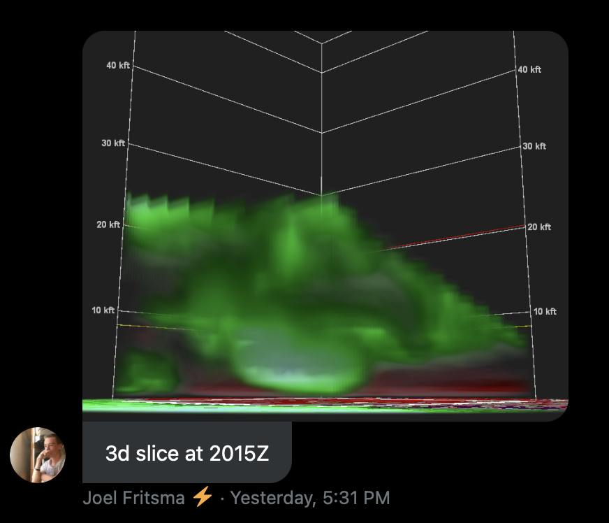
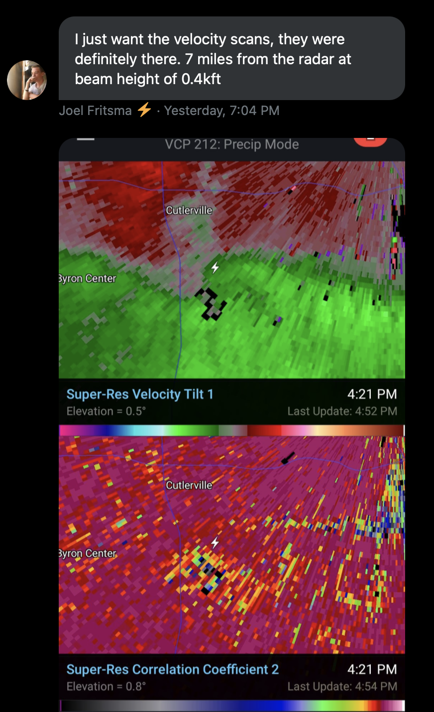
Joel Fritsma (@Joel_Fritsma) sees possible rotation on radar and alerts storm chasers group chat.
“Trying to figure out whether or not we had a brief spinup south of Cutlerville, so I’m checking previous data right now. Small patch of power outages lines up almost perfectly with the strongest rotation” – Joel
Joel address? I’ll head over there – Brennan
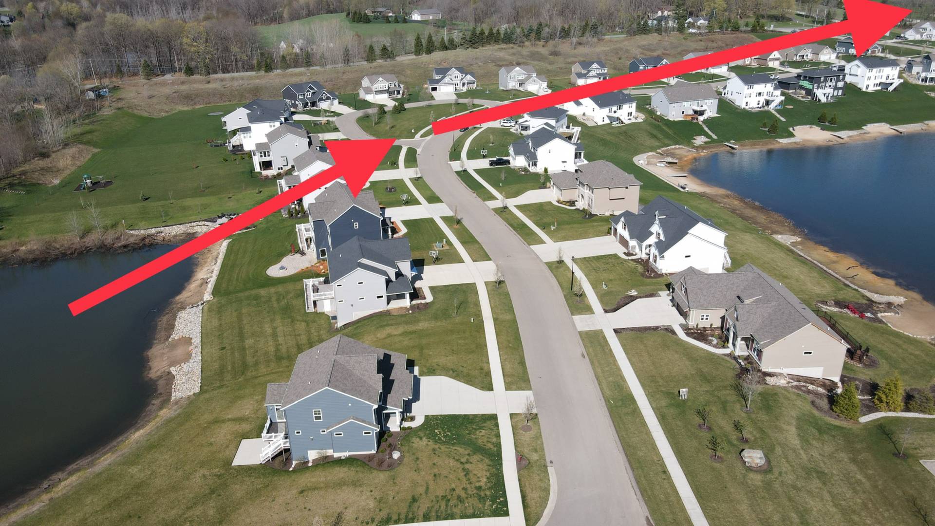
Anywhere in the square mile of 100th, Kalamazoo Ave. 84th, and Division Ave – Joel
5:10 PM.
I arrived at location of possible tornado damage.
April 11th, 2021
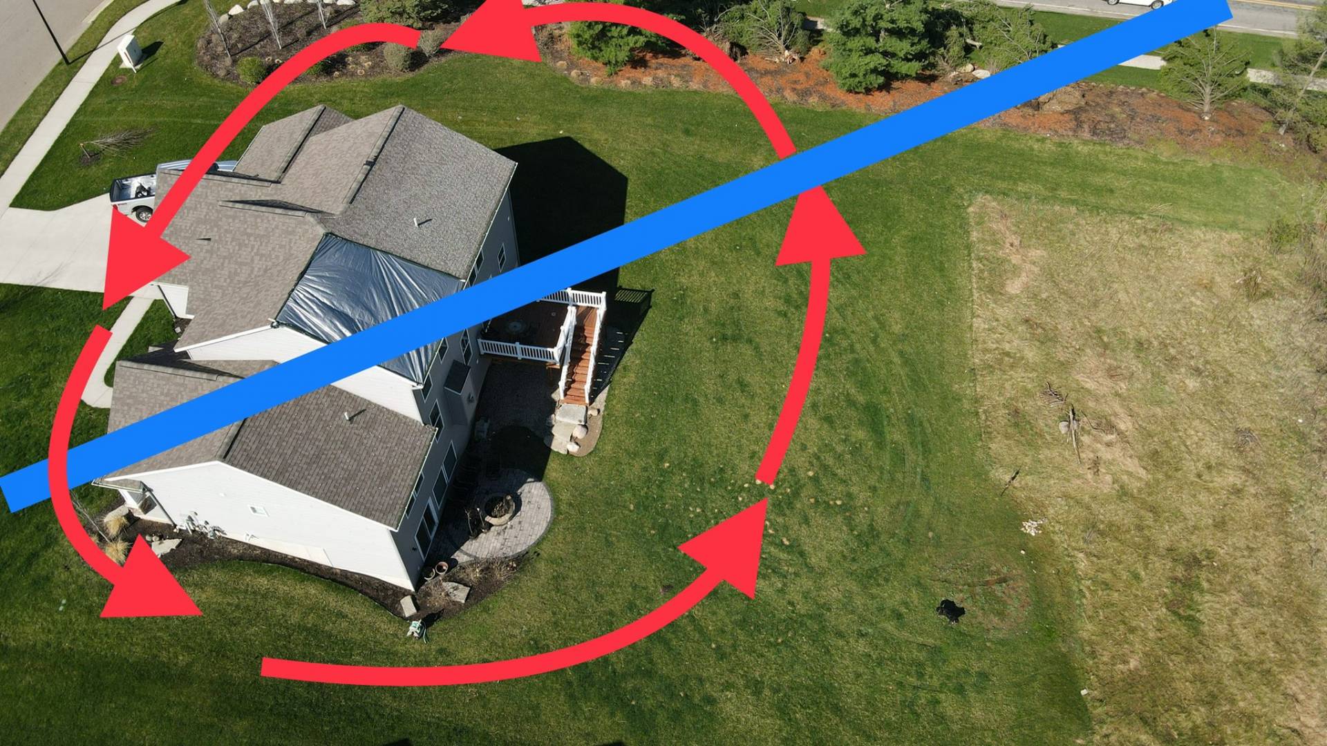
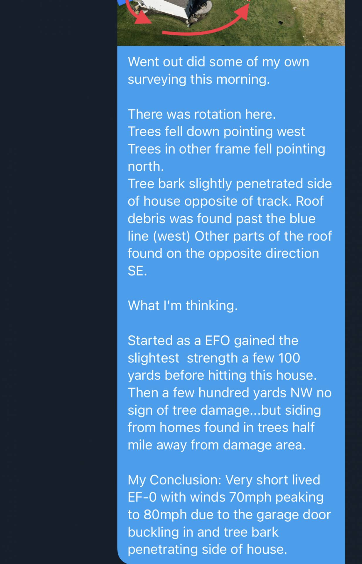
Went back out to location with my drone to independent surveying of the area.
Sources:
Joel Fritsma Twitter – Storm Chaser (Goon Chasers Group)
Community Comments
There are no comments on this post
Want to leave a comment? Join our community → OR Login →