

Published on
April 17, 2026 looked like a fairly volatile day on paper – a Moderate Risk issued by SPC covered portions of Southern Kansas into Northern Oklahoma.
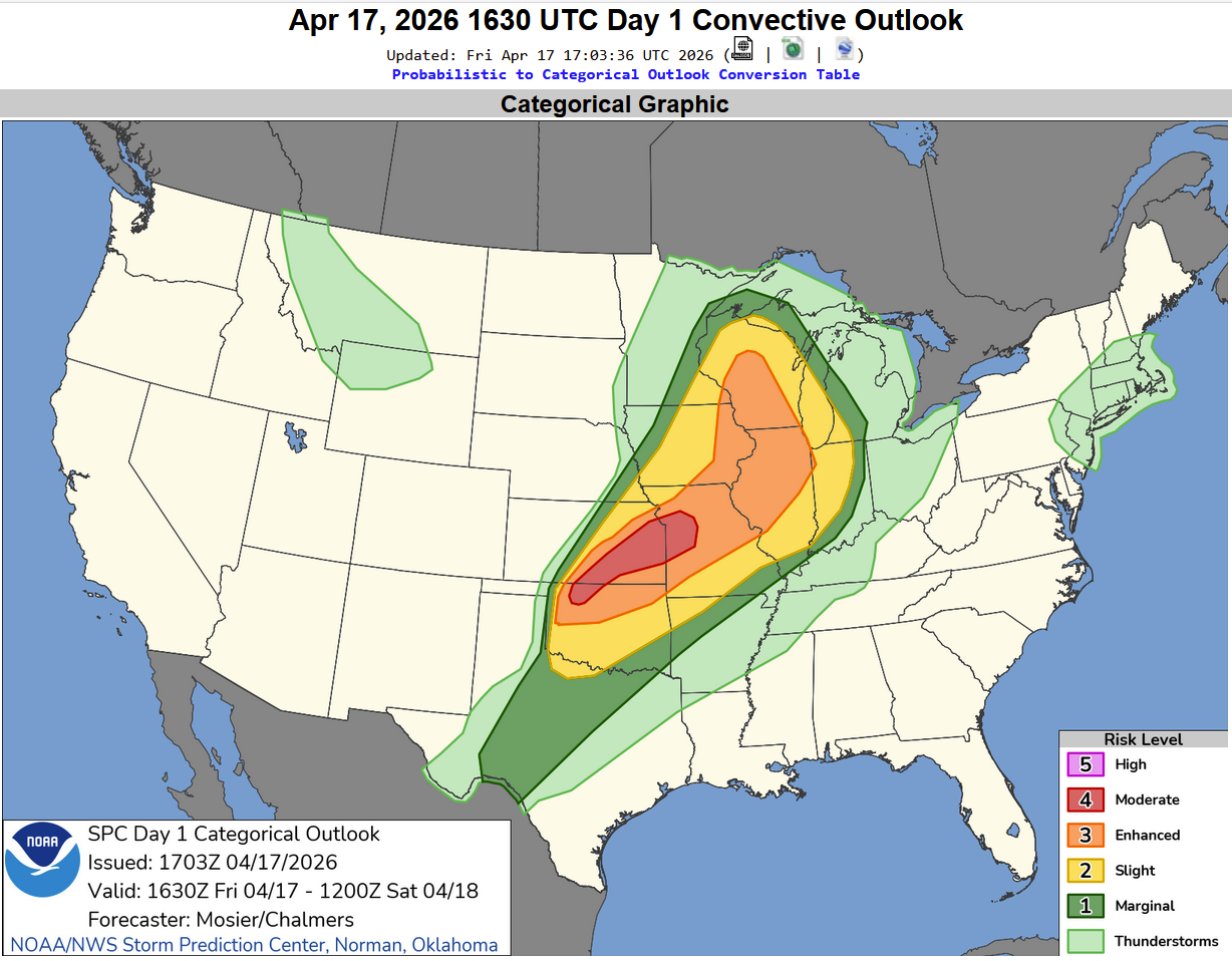
The Moderate Risk was mainly for the enhanced hail risk – some storms with huge hail. The area did have a 5% tornado risk with a 45% area for damaging winds as well.
We tracked the first storms near Conway Springs, Kansas, but everything became linear on the Kansas side fairly quickly. After some time, we tracked down I-35 into the Tonkawa, Oklahoma area.
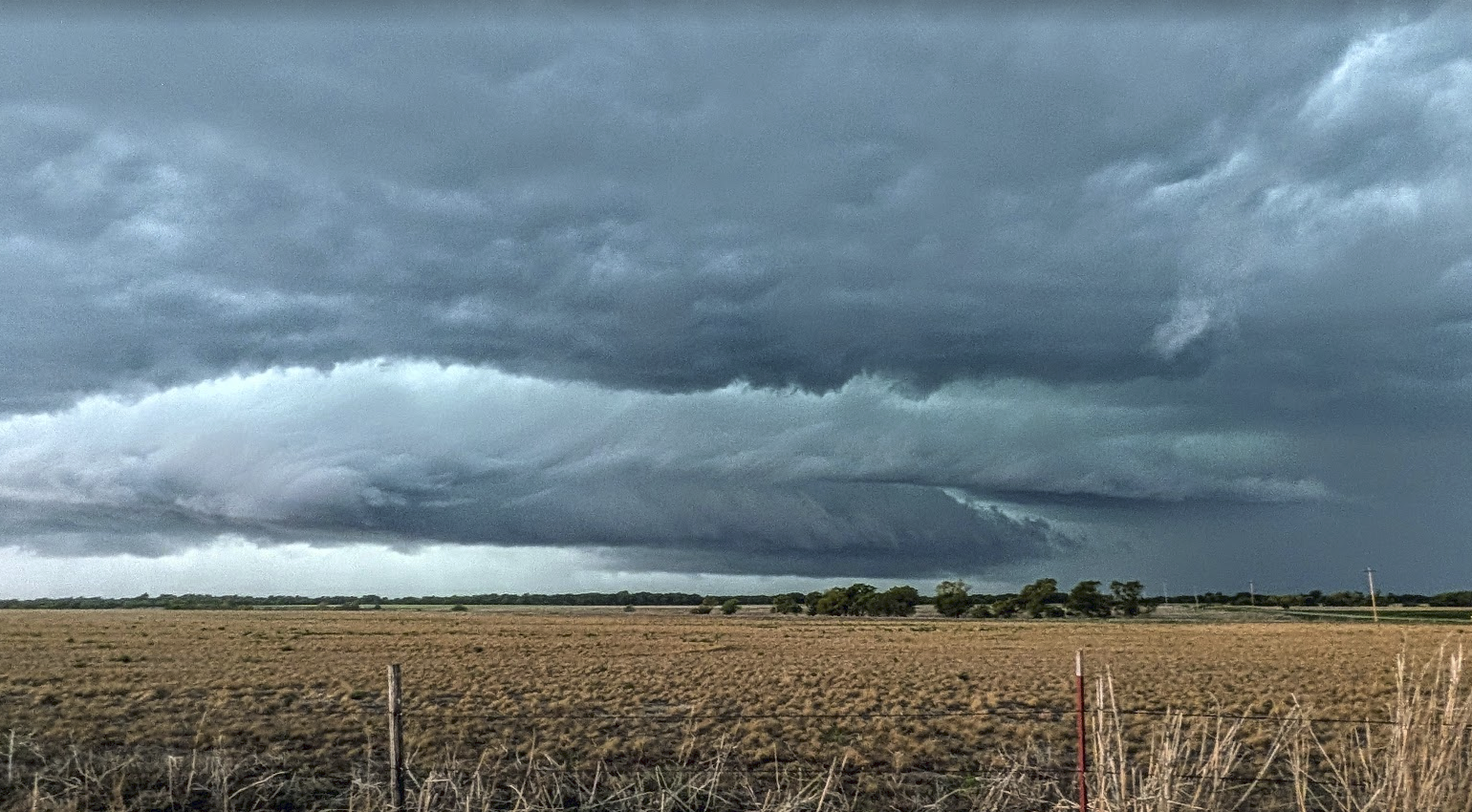
Venturing just west of Tonkawa, we found the first storm structure of the day. The storm was producing 2.5-3″ hail, but we stayed out of the way of the hail. The photo above was taken 5 miles west of I-35, west of Tonkawa.
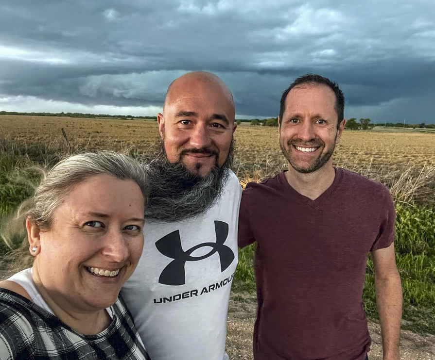
Given the opportunity for a storm selfie with the crew – we took it. Beth Bowdoin is on the left, Brandon Healy in the middle, myself (Bryce Kintigh) on the right.
We stayed ahead of the storm and found a safe hangout in Tonkawa to let the storm pass over.
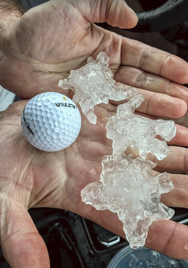
The storm produced 2″ hail just north of Tonkawa, and did produce a tornado just after passing our location, doing some damage in Ponca City. We didn’t see the tornado, but the storm was strengthening as it pushed overhead.
Overall – a pretty fun day, especially when we found some storm structure worthy of photos!
— Bryce
Community Comments
There are no comments on this post
Want to leave a comment? Join our community → OR Login →