

Published on
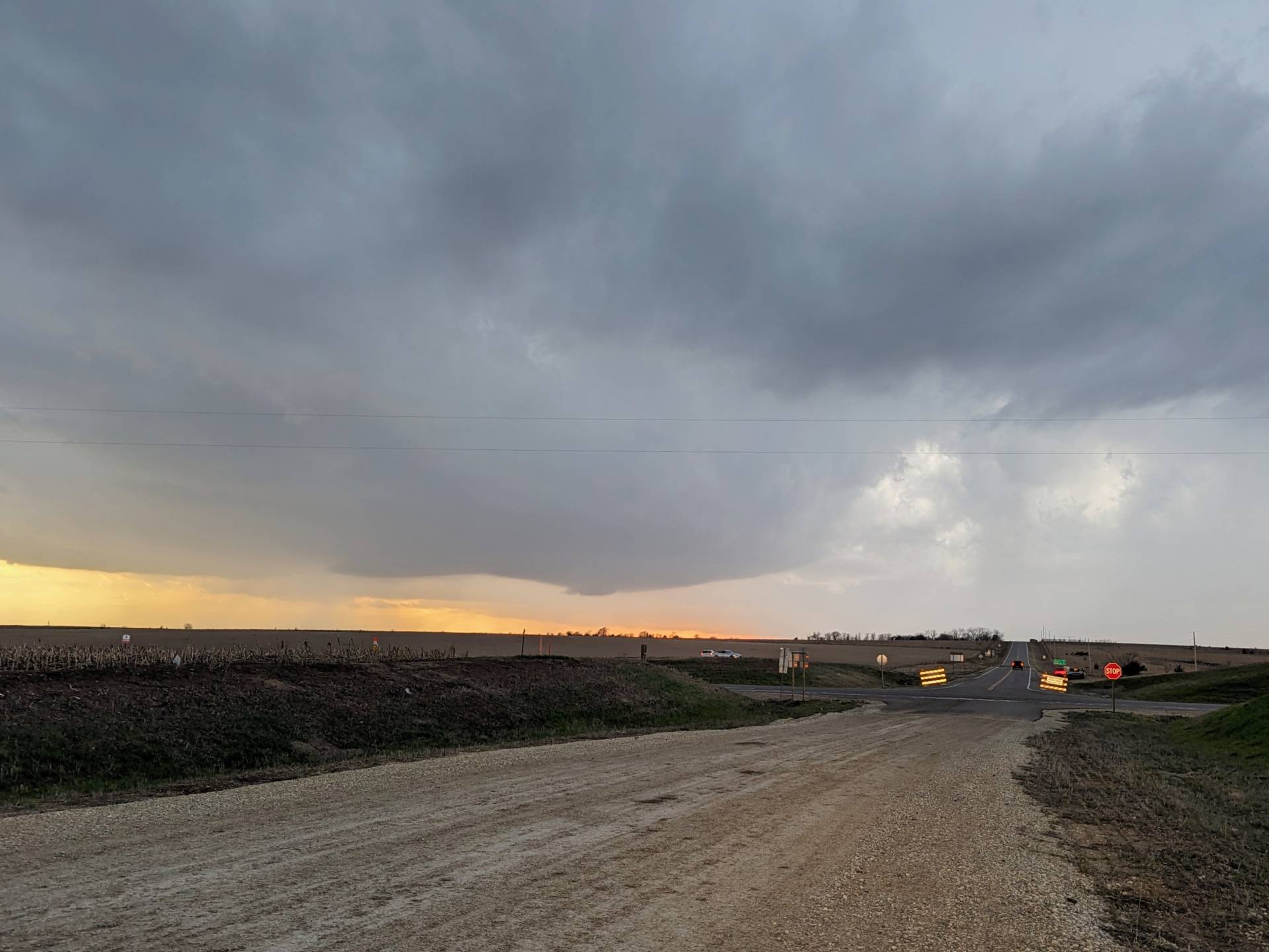
It seemed like a clear-cut chase day. The warm front, draped near I-70 in Central/Northeast Kansas would be the focal point for severe storms. Sure enough – by about 7:30, we had our first severe storm warnings for Morris County.
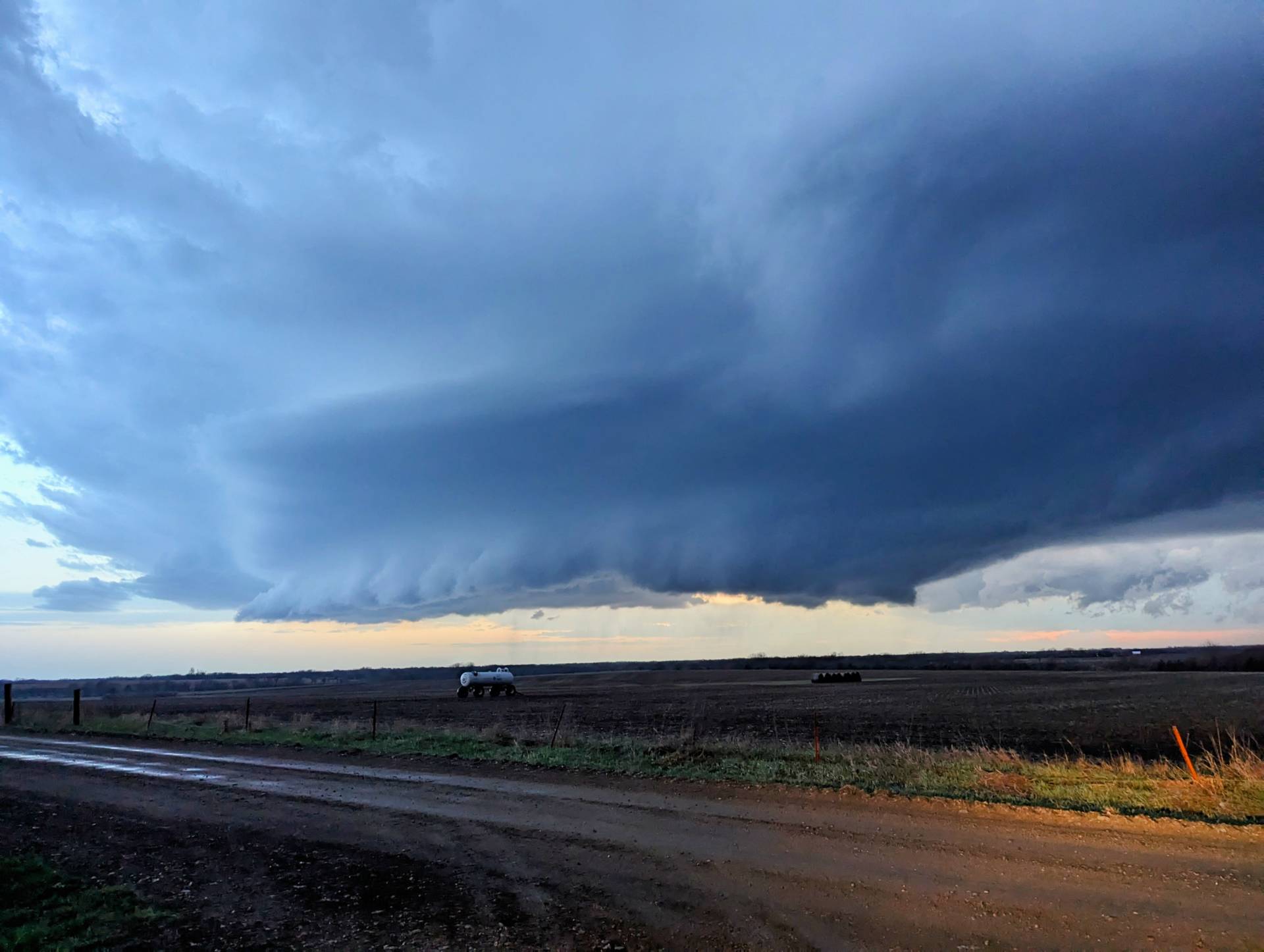
As the storm moved north-northeast, it gained strength as the low-level jet maximized right after sunset.
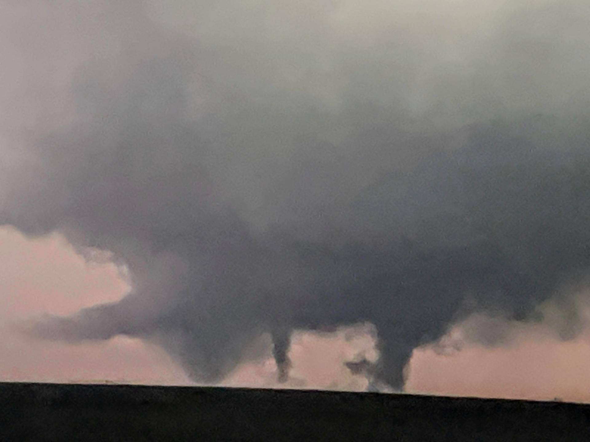
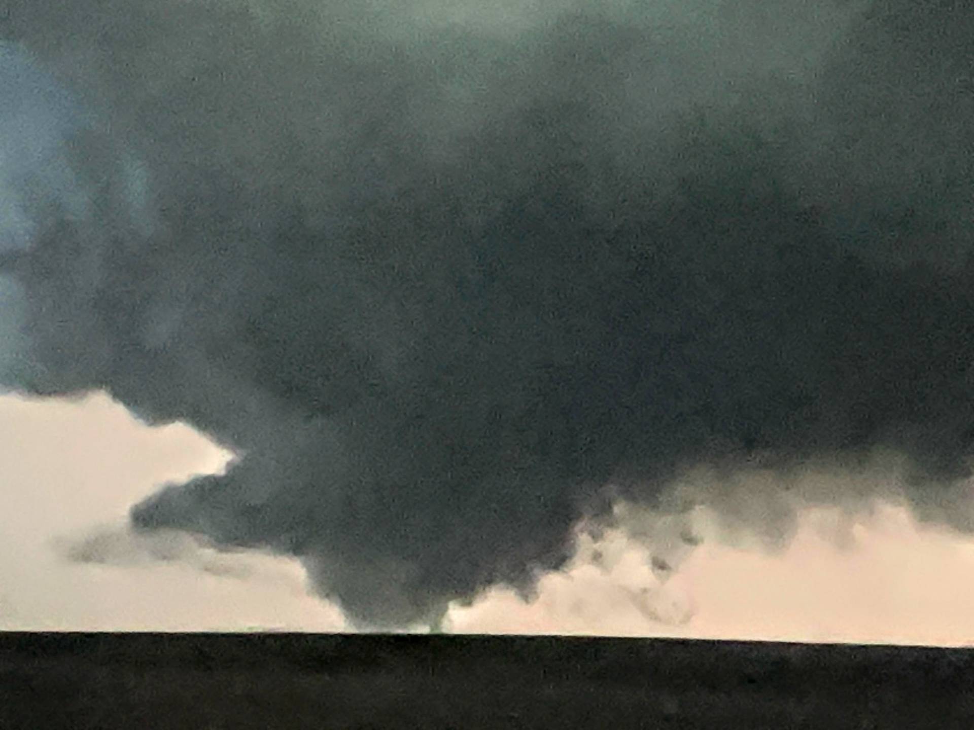
At one point, we had seemingly three tornadoes simultaneously near Volland, Kansas.
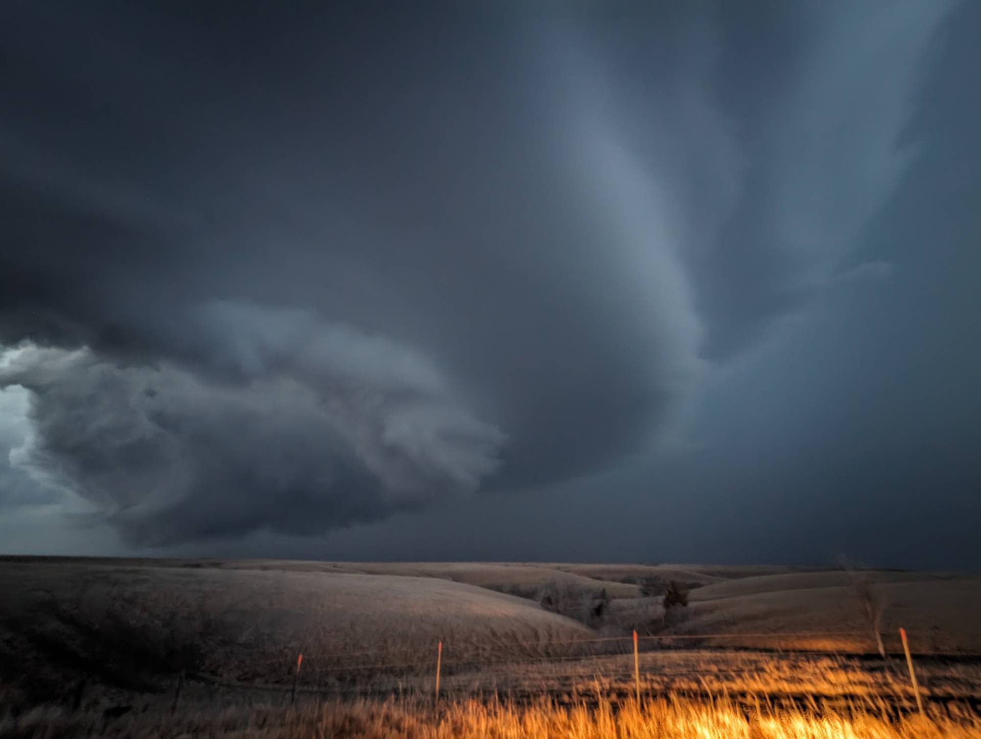
Structure on this storm was magnificent – it was so massive that it was hard to get good pictures from a distance. Road options were also problematic, so without a wide angle lens, the whole scene was hard to capture.
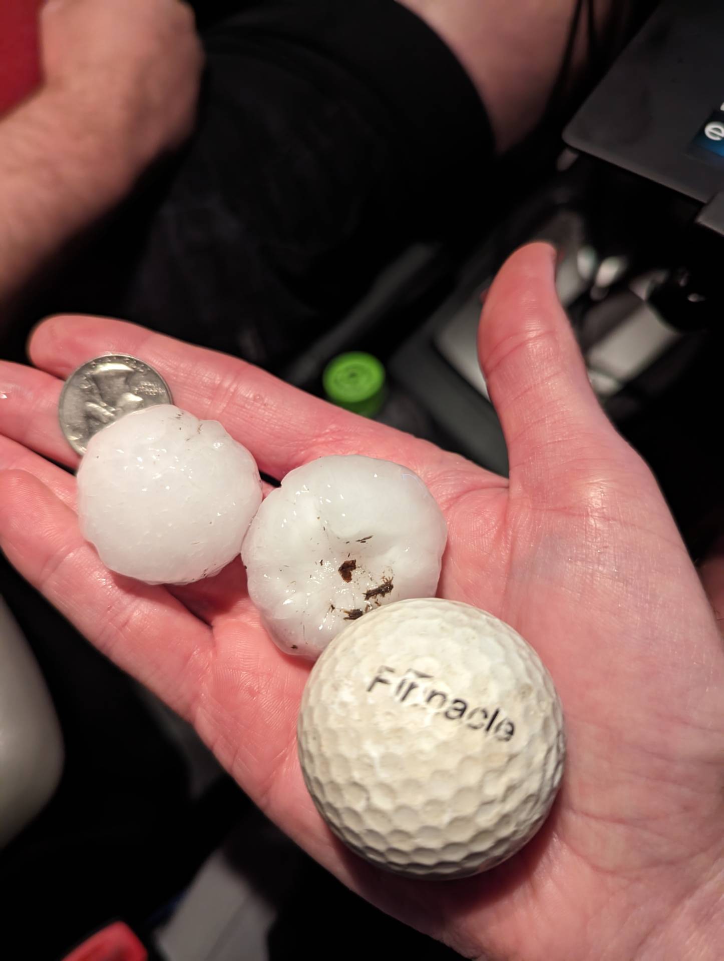
This storm was also a prolific hail producer. We got into several rounds of golfball sized hail, but there were many reports of 3-4″ in diameter hail just up the road from our location near Alma, Kansas.
Community Comments
There are no comments on this post
Want to leave a comment? Join our community → OR Login →