

Published on
Welcome to my page!
Hello everyone, I would like to welcome you to my page. I have done virtually no blogs before, but I figured I would give it a go! Be sure to stay updated to see live storm chases, a variety of storm pictures, and other weather related posts!
Today’s Chase: Northern Kansas
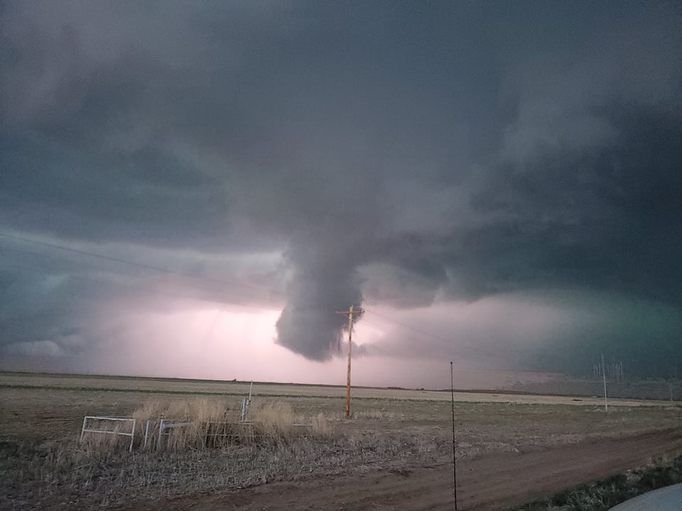
For today, I will be targeting North Central Kansas for a higher tornado risk. After watching models most of the morning, it looks like SW KS will feature discreet storm modes and large hail. Some excellent mothership pictures will be posted displaying the beauty of the supercells. Further into the evening around 22/23z, I believe the storms will move further into North Central Kansas where there is better low level shear and hopefully better moisture. The tornado threat should increase just before sunset and continue to increase until dark. Hopefully storms are still semi-discrete and can provide some good viewing angles for any tornado that may form. I will put out and updated post tomorrow on how well today goes. Be safe if you go out, and happy chasing!
(Hopefully we see this tonight, or I can take some sprite pics!!)
Community Comments
There are no comments on this post
Want to leave a comment? Join our community → OR Login →