

Published on
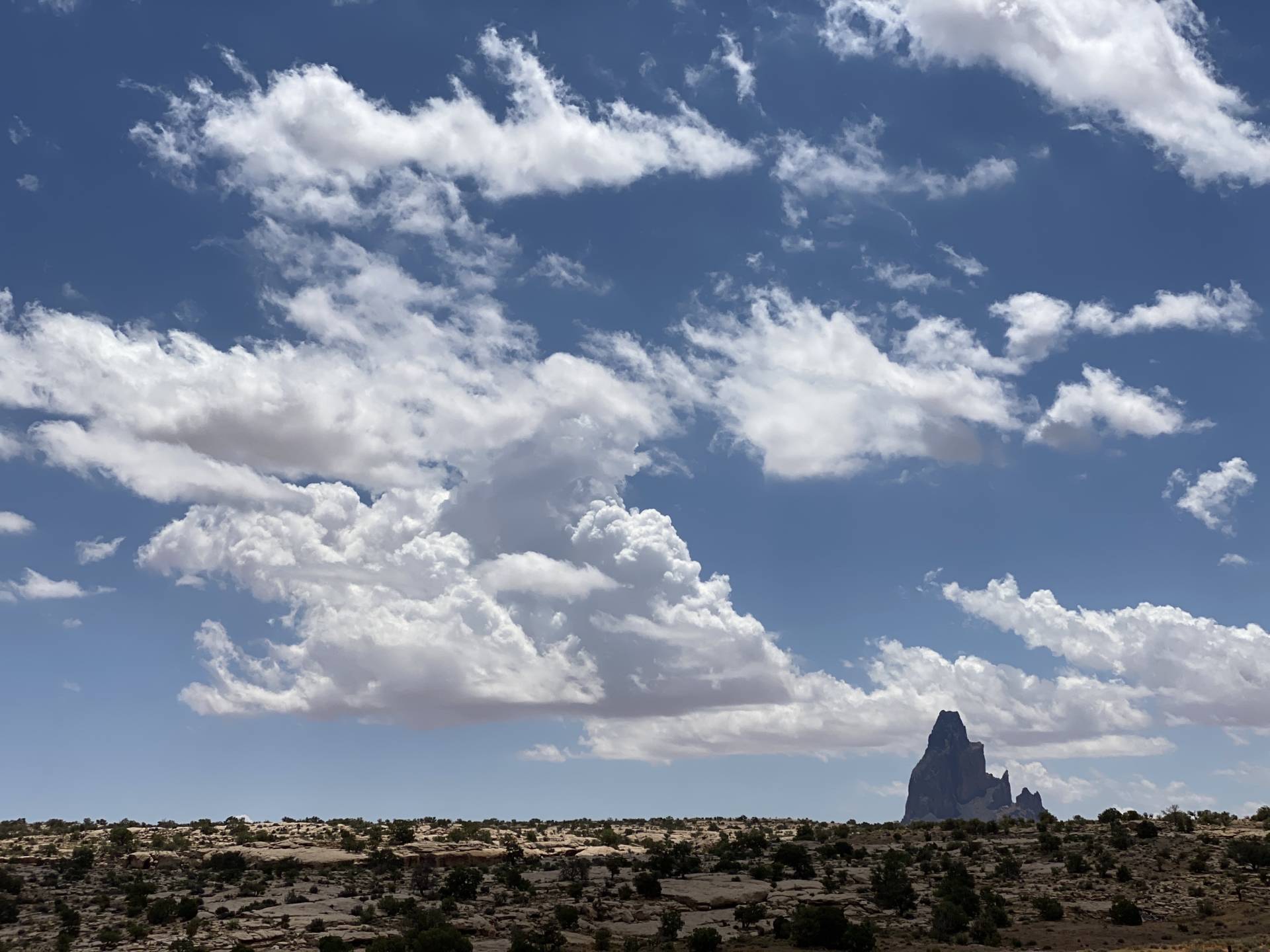
June 21st was an interesting setup in the Four Corners area. Tropical moisture had surged across the southwest while an ejecting trough and associated jet streak provided support for elevated shear across the Arizona-Utah border and on into New Mexico-Colorado. Forecast models varied on initiation and continuation of storms from Lake Powell eastward. But were pretty insistent on a strong cell forming north of the Kaibab Plateau west of Lake Powell and cruising slowly east-northeastward. That consistency was tempting, but road options, especially approaching and getting around the Lake are terrible. So I stuck with the varied option further east and cruised up to Monument Valley.
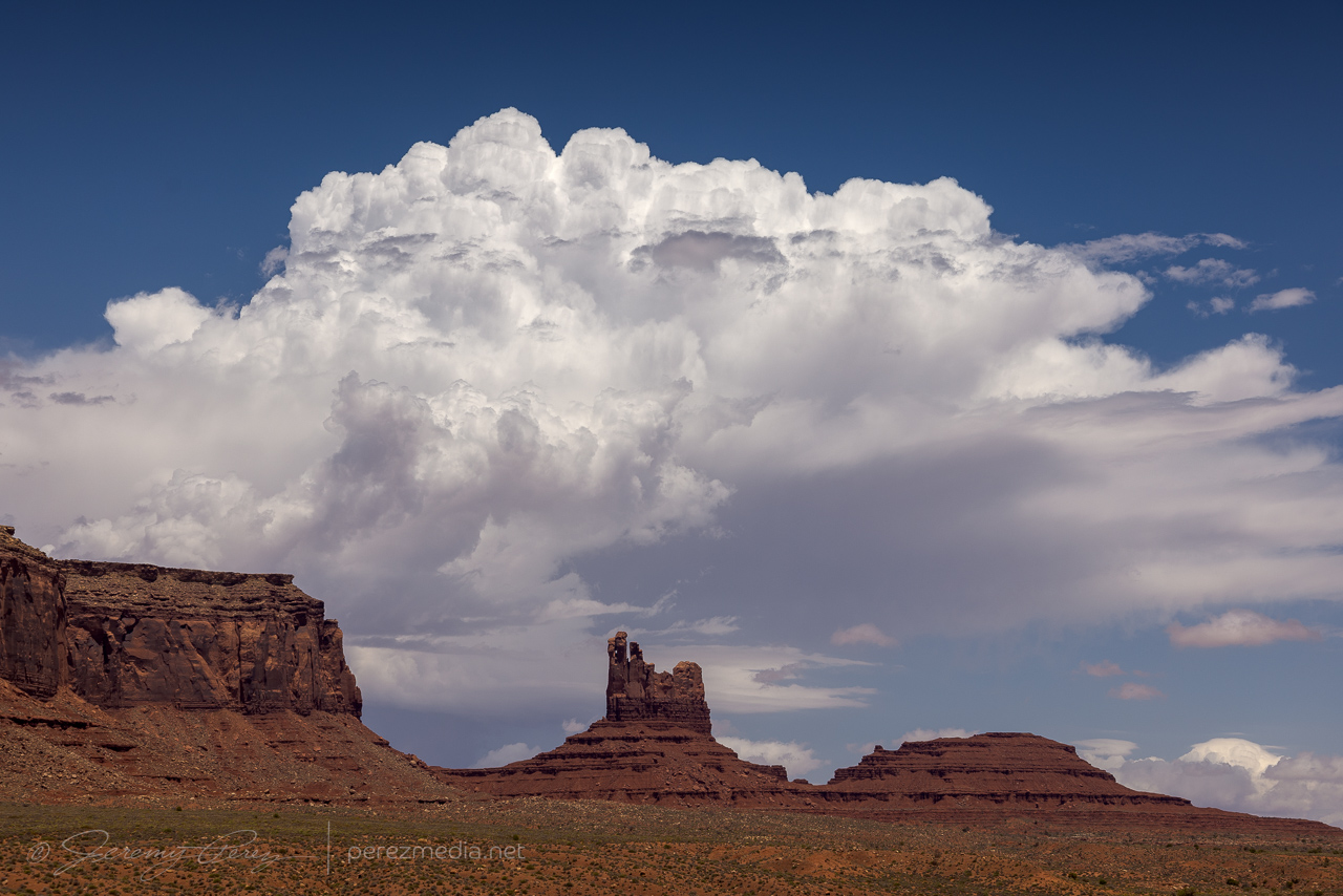
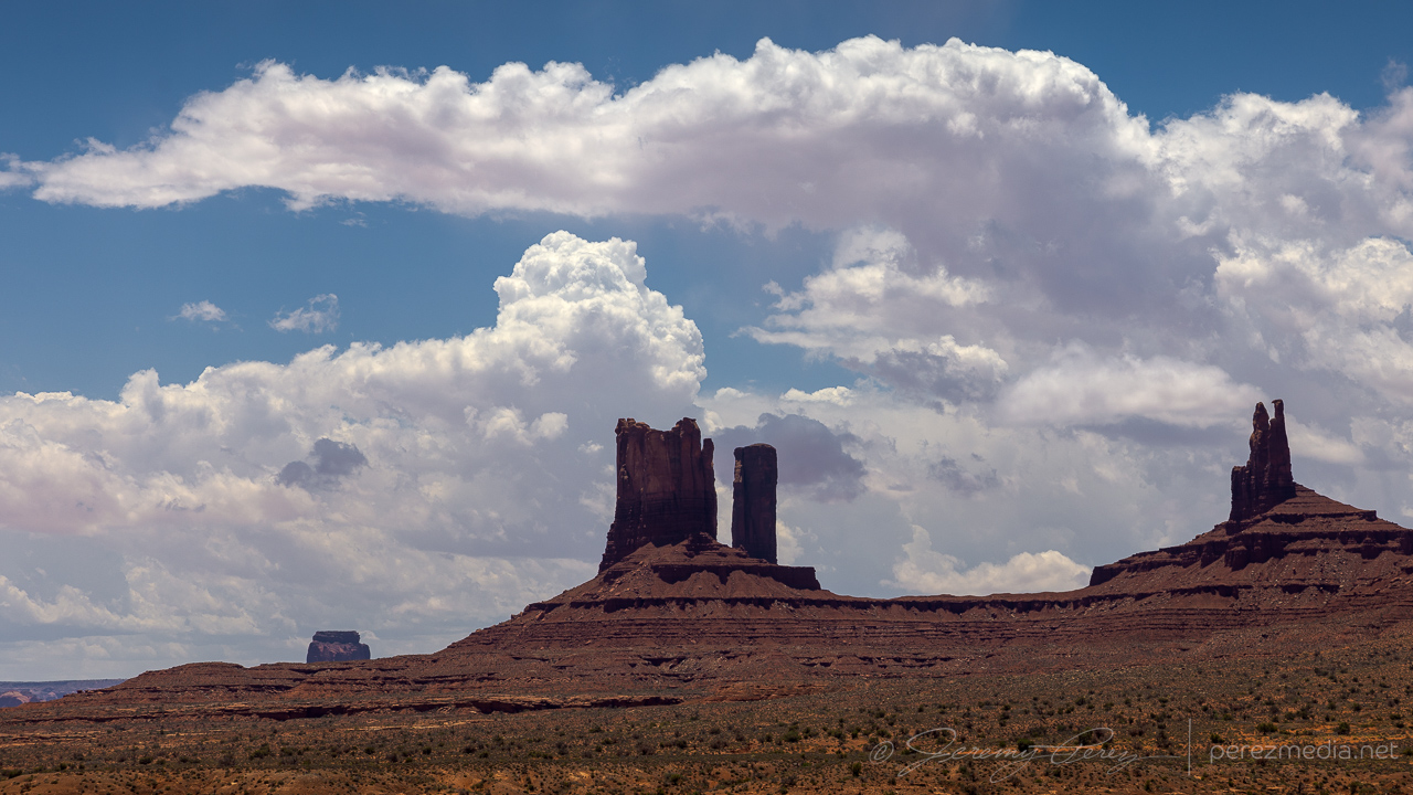
As expected, an early storm fired over the Arizona Strip and drifted over Page — reasonably further south than models had anticipated but otherwise following the pattern. Further south like that, the road network was slightly better, and an intercept near Glen Canyon Dam could have actually been really rewarding. But I was too far east at that point, hanging out in prolonged one-lane pilot-car construction, to rearrange plans. And a cell had gone up north of Monument Valley. I paced eastward with it, mindful of road commitments vs. other convective attempts nearby since the storm really seemed to be struggling. I finally decided to abandon ideas on that one and worked on some landscape shots, waiting for something more promising to fire.
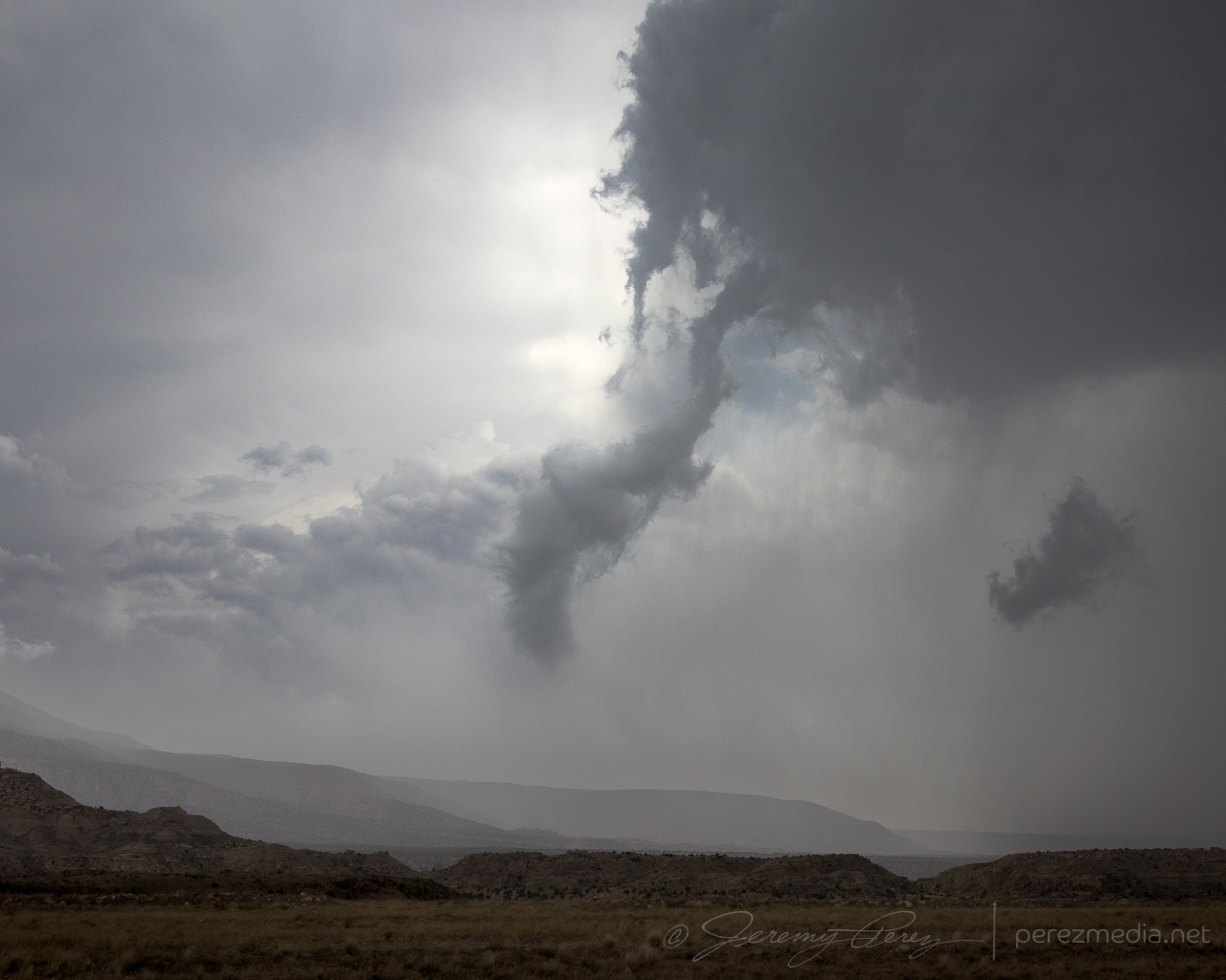
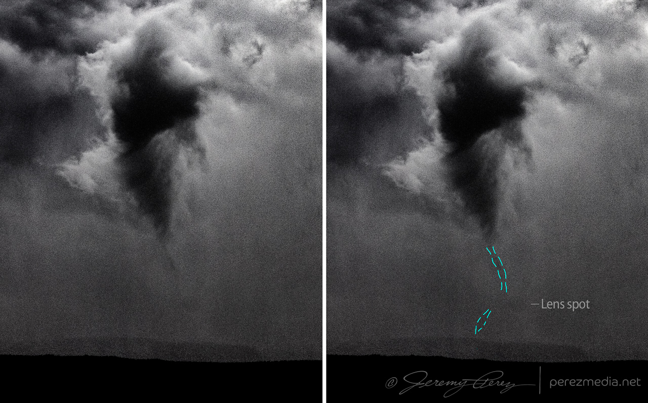
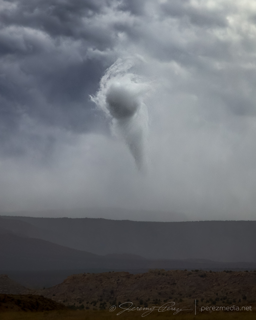
Cruising further east, about 6 miles west of Bluff, Utah, convection to the south was finally starting to take hold. A couple updrafts were visible with the near one catching my eye, displaying a low contrast ribbon from cloud base to the ground. It looked like a landspout to me. The more distant storm however, was the one to keep an eye on as it was strengthening more rapidly.

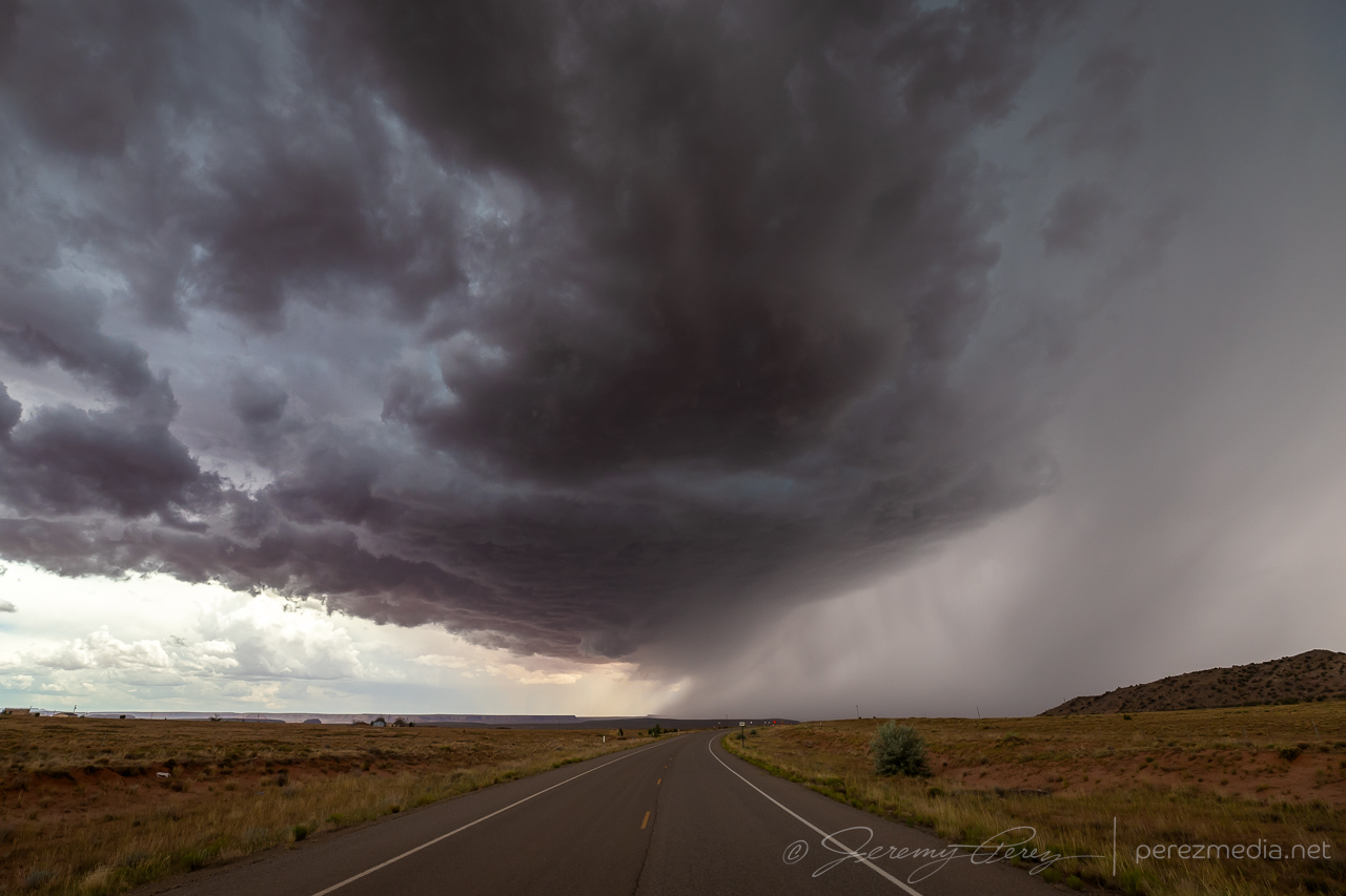
The cell further south, approaching Rock Point, AZ, did look promising, so I headed south to give it a shot. The terrain was both beautiful and frustrating, as I then cruised back east on Highway 160 trying to get ahead of it and get a look at the base between ridges and mesas. For brief glimpses, I was astounded by the beautiful color. The turquoise core contrasted against a reddish purple counterglow as the desert floor reflected into the rugged, evolving structure of the storm’s base. At one point, an RFD push was enveloped in this light as it came into view between a couple hills. But I wasn’t able to find a good pull off to capture it and hoped for a better chance at an upcoming south highway.
Just past Red Mesa, IR35 dives south again and I took that for an intercept. The road was clearly leading to a rise on the plateau that was hiding things from view, but it felt like one of those dreams where you never get to the end of the hallway. By the time I crested to a view, the cupped structure from earlier was gone, but that reflected color was still good. I couldn’t stay long as hail was starting to fall and visibility was plummeting, so I jogged back north to 160 and east again for another view.
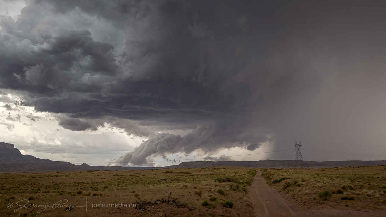
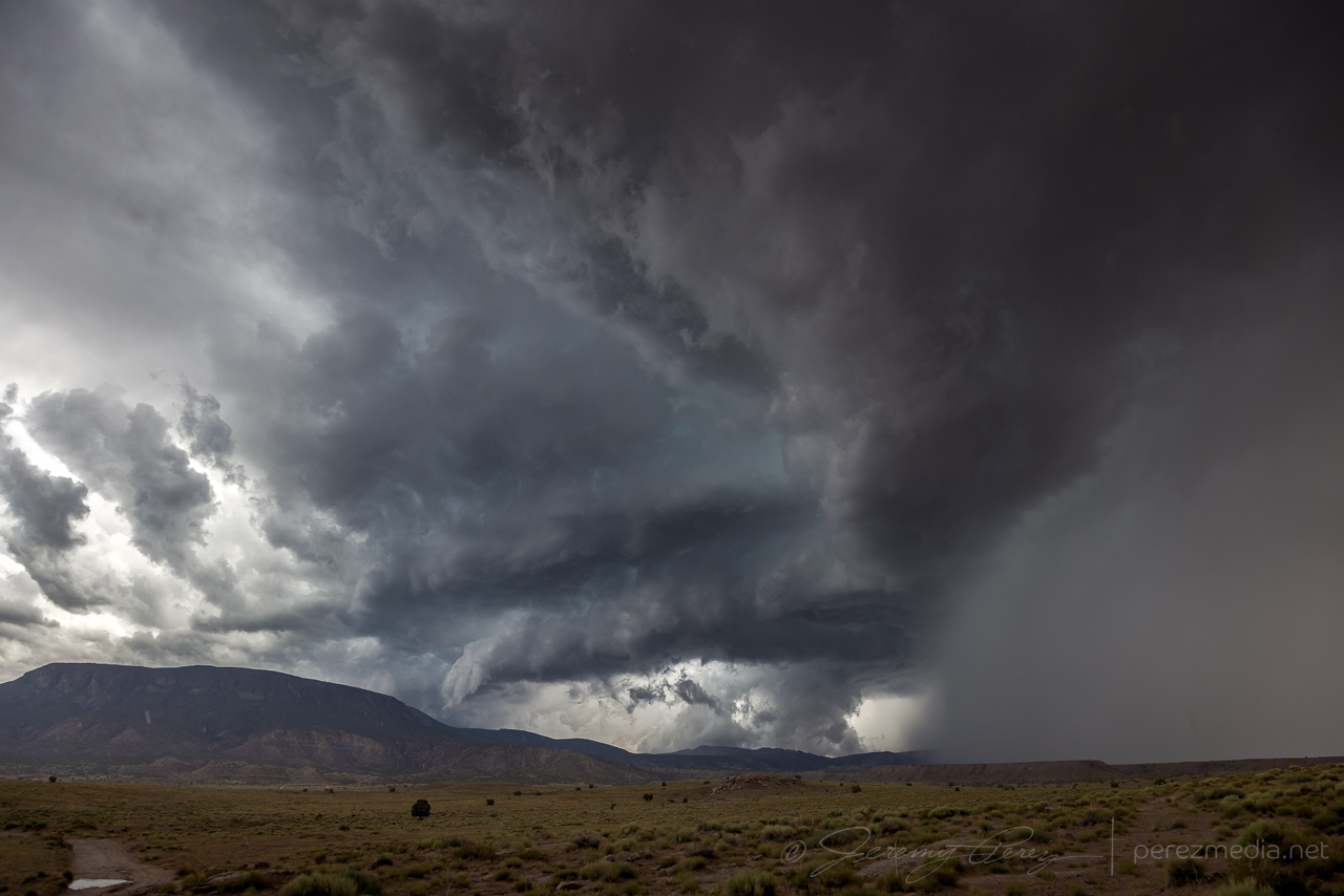
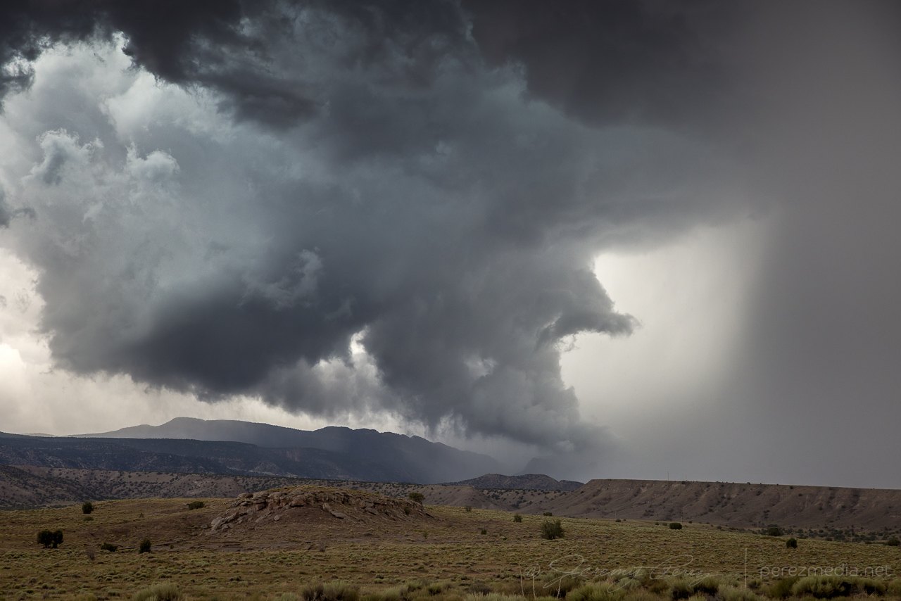
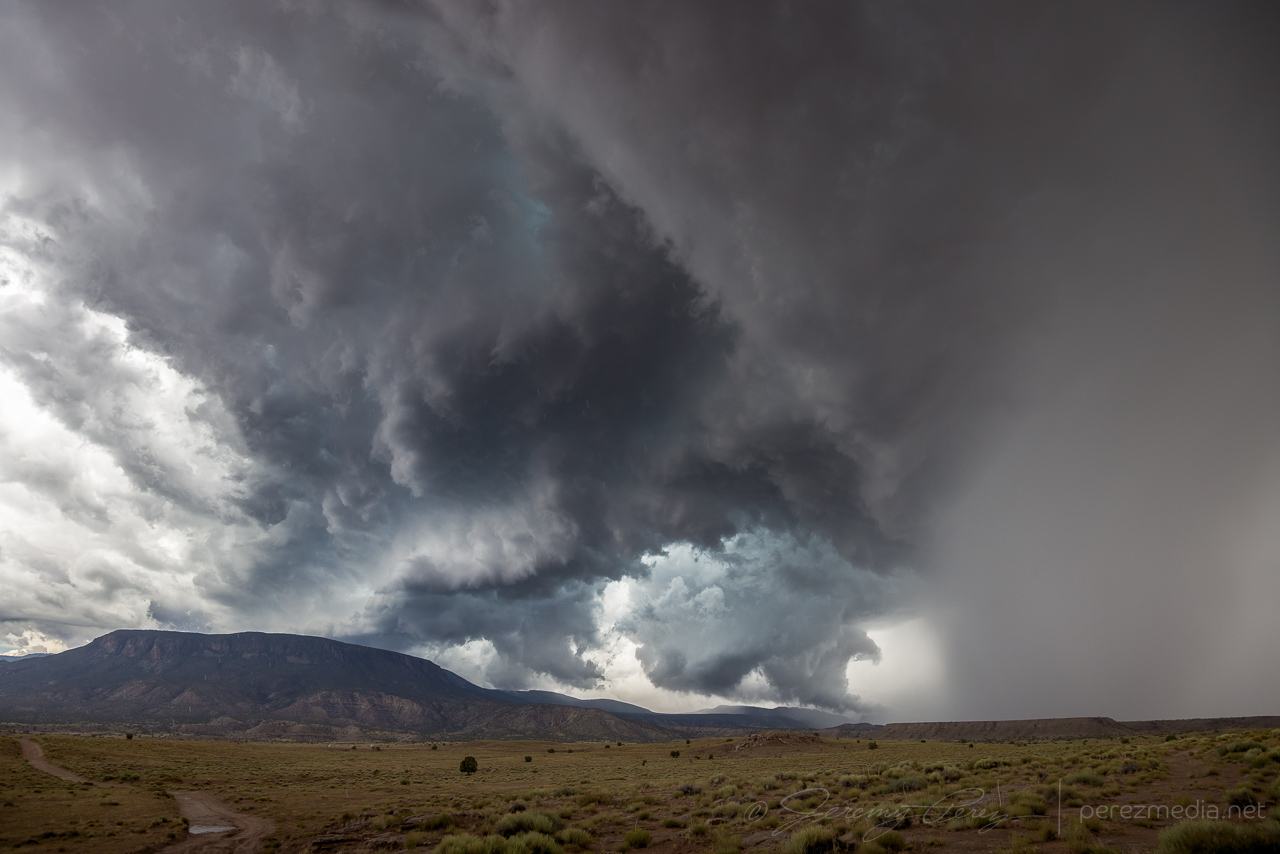
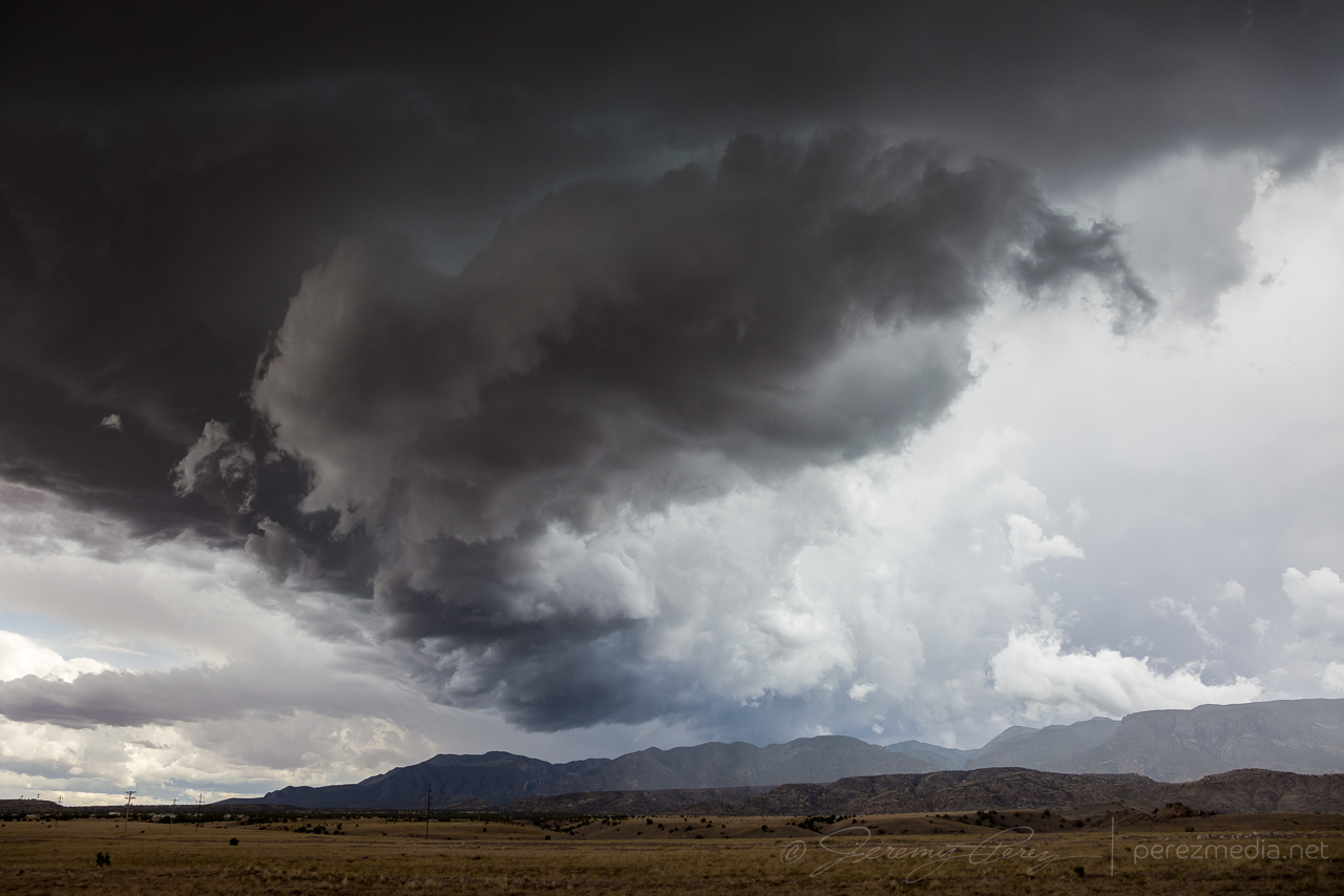
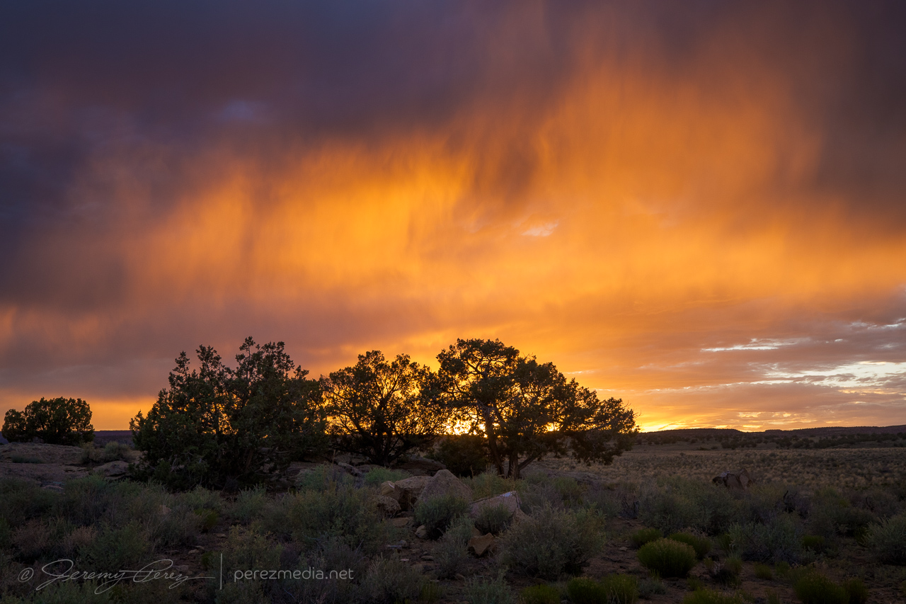
About eight miles further east, the terrain was far enough back to get a good view of the base. It felt like it was really taking cues from the buttes and foothills leading into the Carrizo Mountains. There were several good spots in this area to watch as it developed a rugged, rotating wall cloud with tail cloud feeding in off the forward flank while it scraped up the hillsides. The landscape was fantastic for this storm and way overfulfilled what I hoped would set up for this chase.
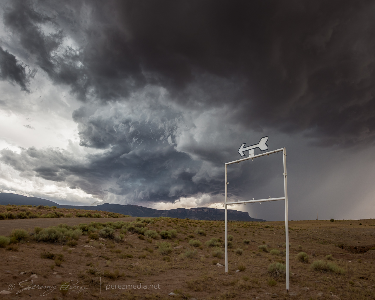
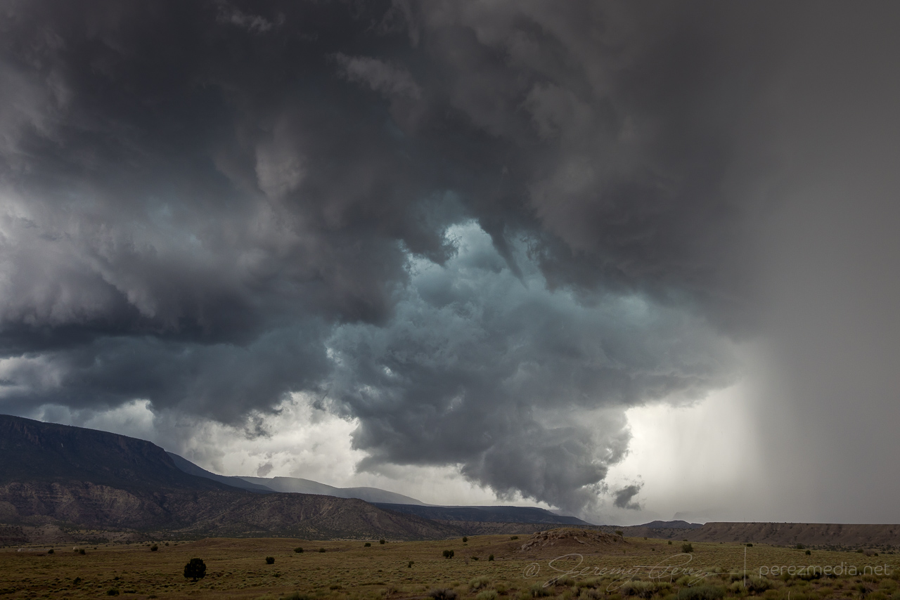
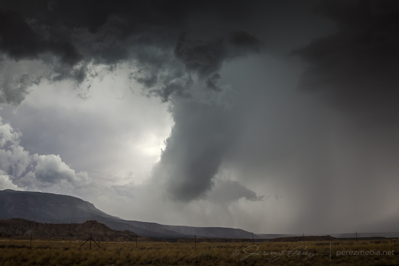
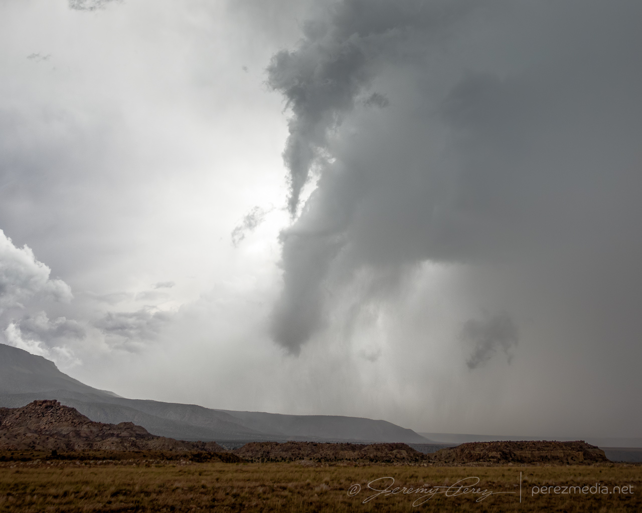
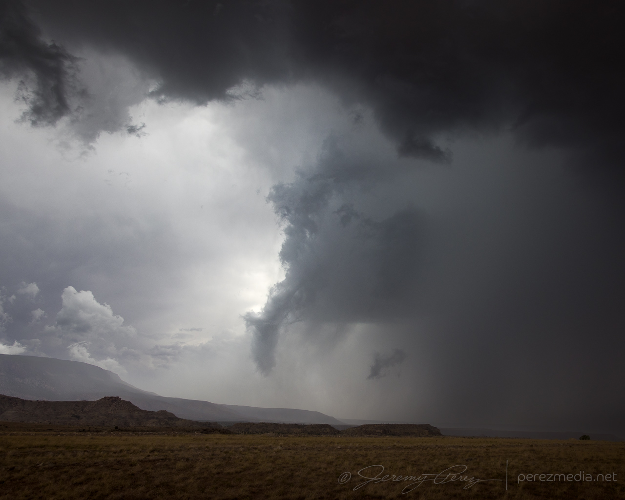
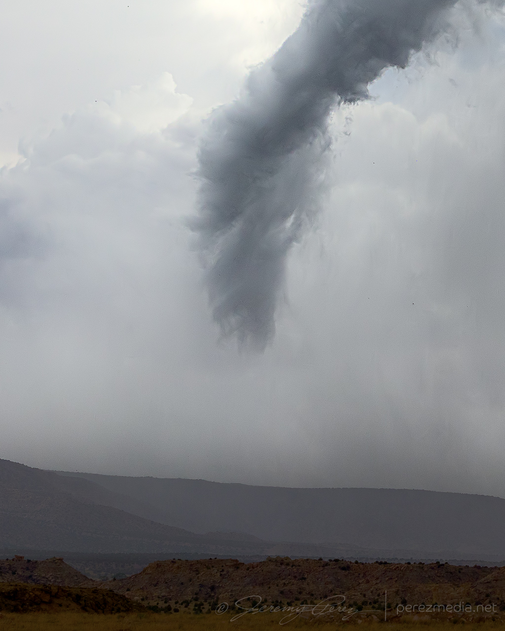
With the forward flank continually encroaching, I had to keep nudging east. My next stop, about a mile southeast of Teec Nos Pos gave a view of the occlusion sculpting a broad funnel that gradually tightened up and roped out in beautiful fashion over flat-topped terrain.
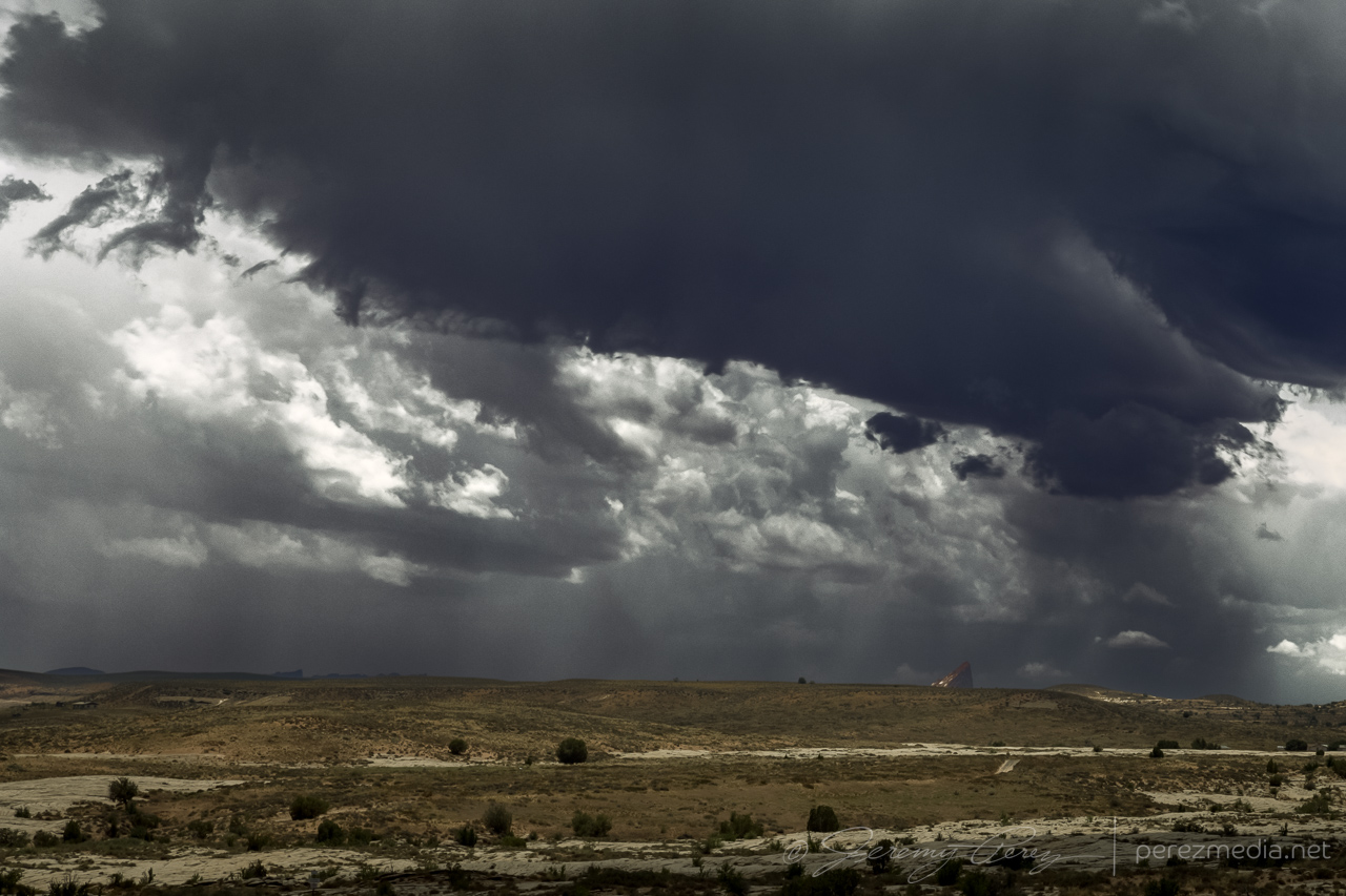
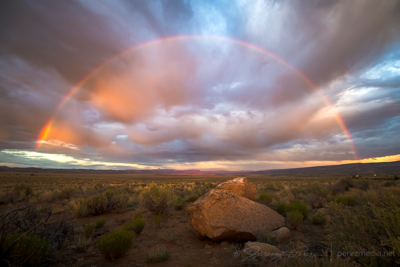
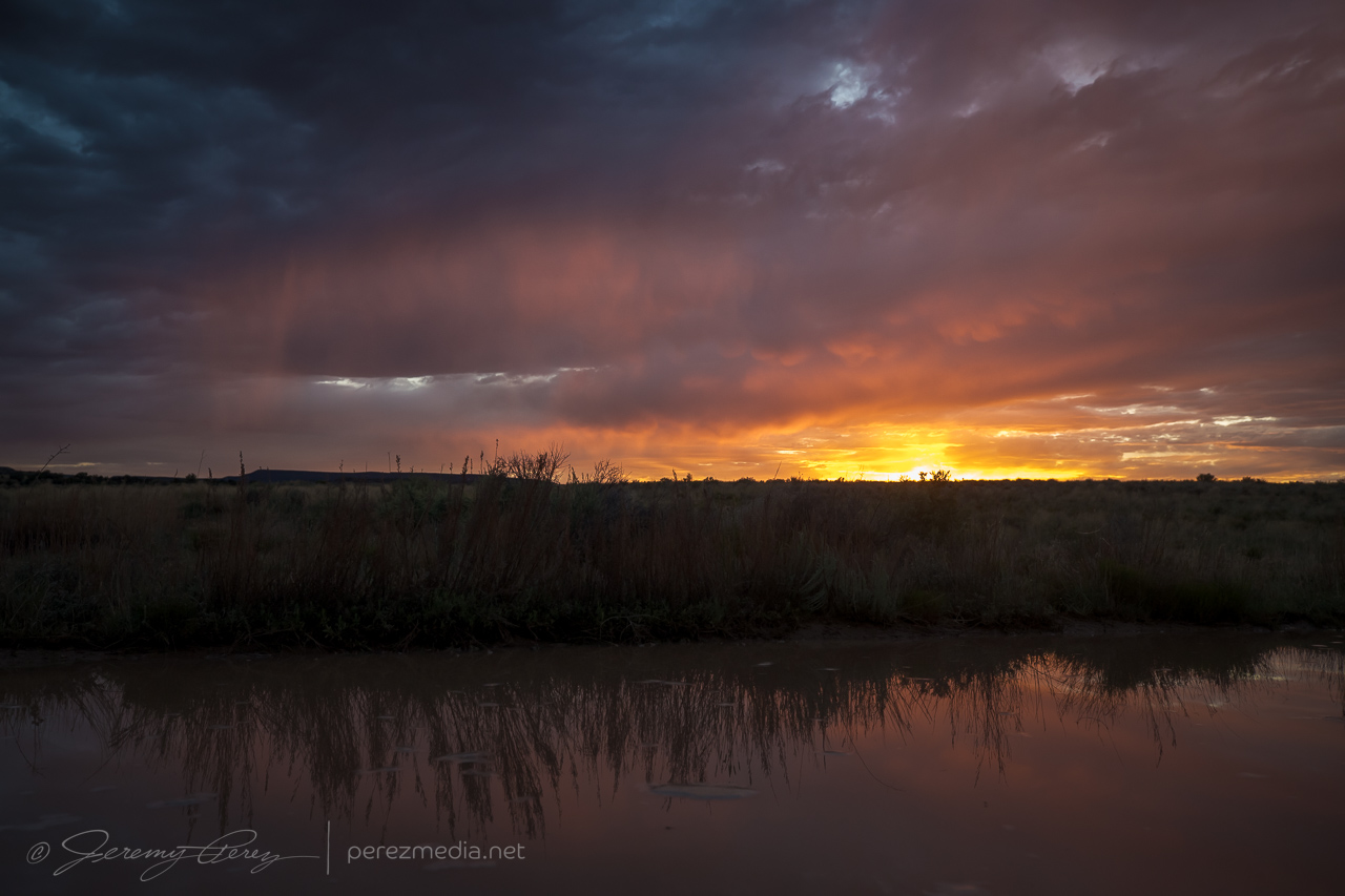
After this, the storm encountered overturned air from earlier storms in the area and it dwindled away. I took way to long deciding whether the cell that had pounded Page earlier would be worth an intercept. By the time I got going north, I was playing catchup amid a mess of other developing convection. I did finally take a pause on a forest road near Slick Rock in western Colorado and take stock of the day. The sun finally snuck under the clouds and threw out a rainbow to seal up the day.
Community Comments
طقس طقس طقس طقس طقس طقس طقس طقس طقس طقس طقس طقس عمل عمل
Reply to Public User
طقس طقس طقس طقس طقس طقس طقس طقس طقس عمل عمل عمل عمل عمل عمل عمل عمل عمل عمل عمل عمل عمل
Reply to Public User
Want to leave a comment? Join our community → OR Login →