

Published on
Chase Overview
May 23rd, 2023, is a day that will remain etched in my memory as one of the most exhilarating and intense chases I have ever experienced. The chase led us to the heart of Tornado Alley, where the small town of Eldorado, Oklahoma, became the focal point of a severe weather outbreak.
Meteorological Setup
The setup for this chase was textbook for late spring tornadoes in the Southern Plains. A deep trough was digging into the western United States, providing ample lift and wind shear. A dryline had set up across western Oklahoma, serving as the primary boundary for storm initiation. The atmosphere was primed with high instability, with CAPE values soaring above 3000 J/kg, and strong low-level shear, creating a perfect environment for supercell development.
The Chase Begins
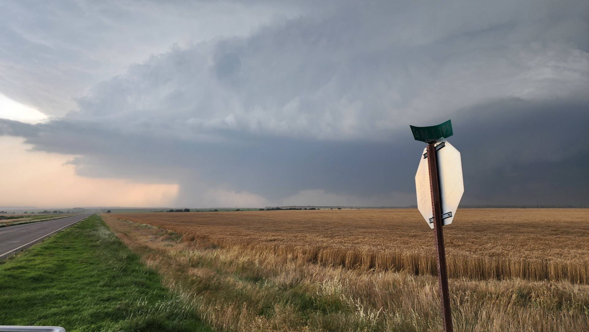
We set out early in the morning, targeting the area around Eldorado based on the latest model runs and SPC outlooks. As we approached our target area, we could see towering cumulus clouds beginning to build along the dryline. The anticipation grew as the first severe thunderstorm warning was issued for our target area.
Tornado Development
By mid-afternoon, the first supercell of the day had developed just southwest of Eldorado. We positioned ourselves to the east of the storm, giving us a clear view of its structure. The storm quickly became tornadic, producing a stunning cone tornado that touched down in an open field. The sight was both awe-inspiring and humbling as the tornado grew in size and intensity.
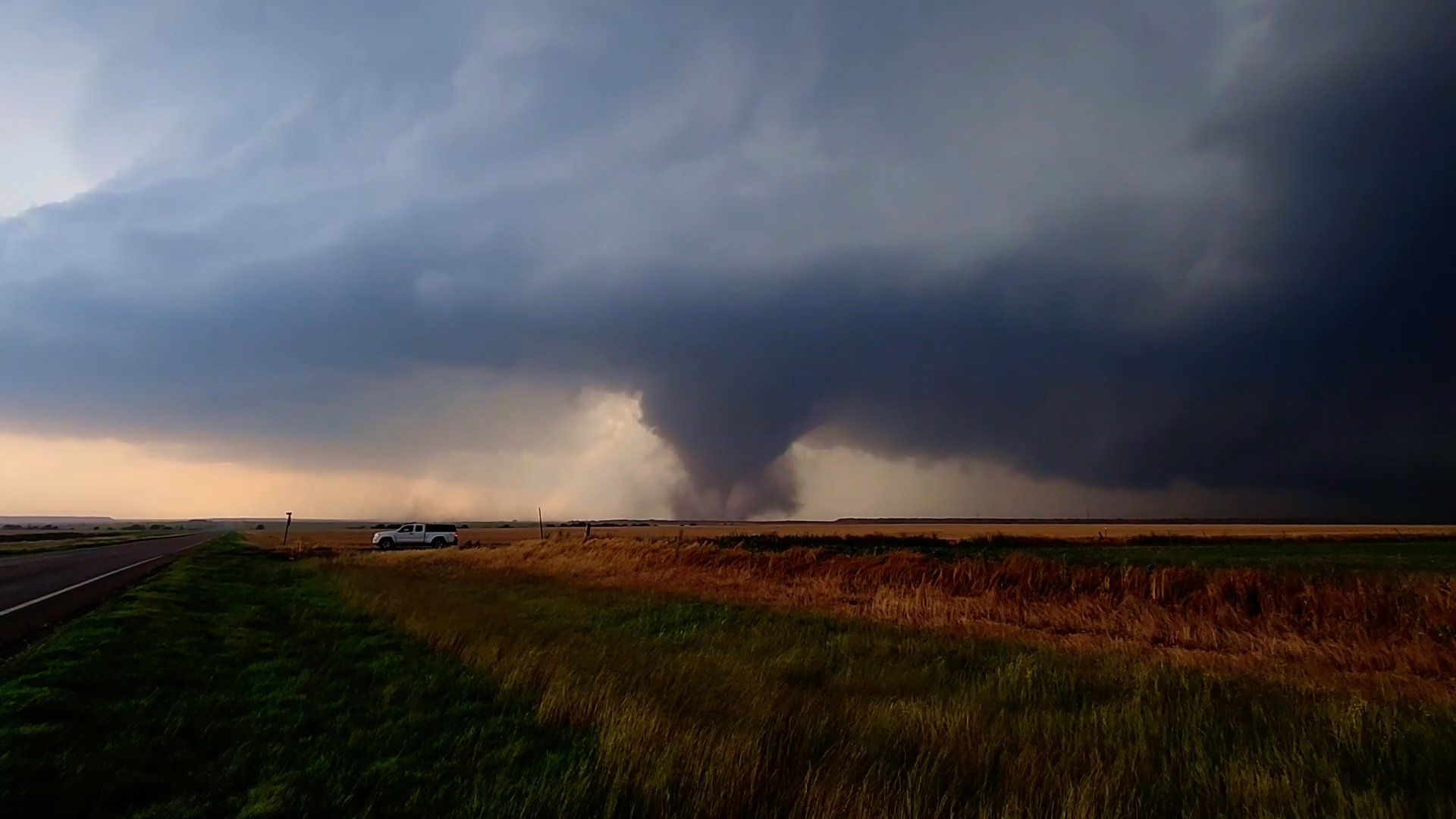
Over the next couple of hours, the storm cycled multiple times, producing several tornadoes. One of the most notable tornadoes of the day was a large, wedge-shaped tornado that tracked just south of Eldorado. This tornado caused significant damage to rural properties but fortunately missed the town itself.
Up Close and Personal
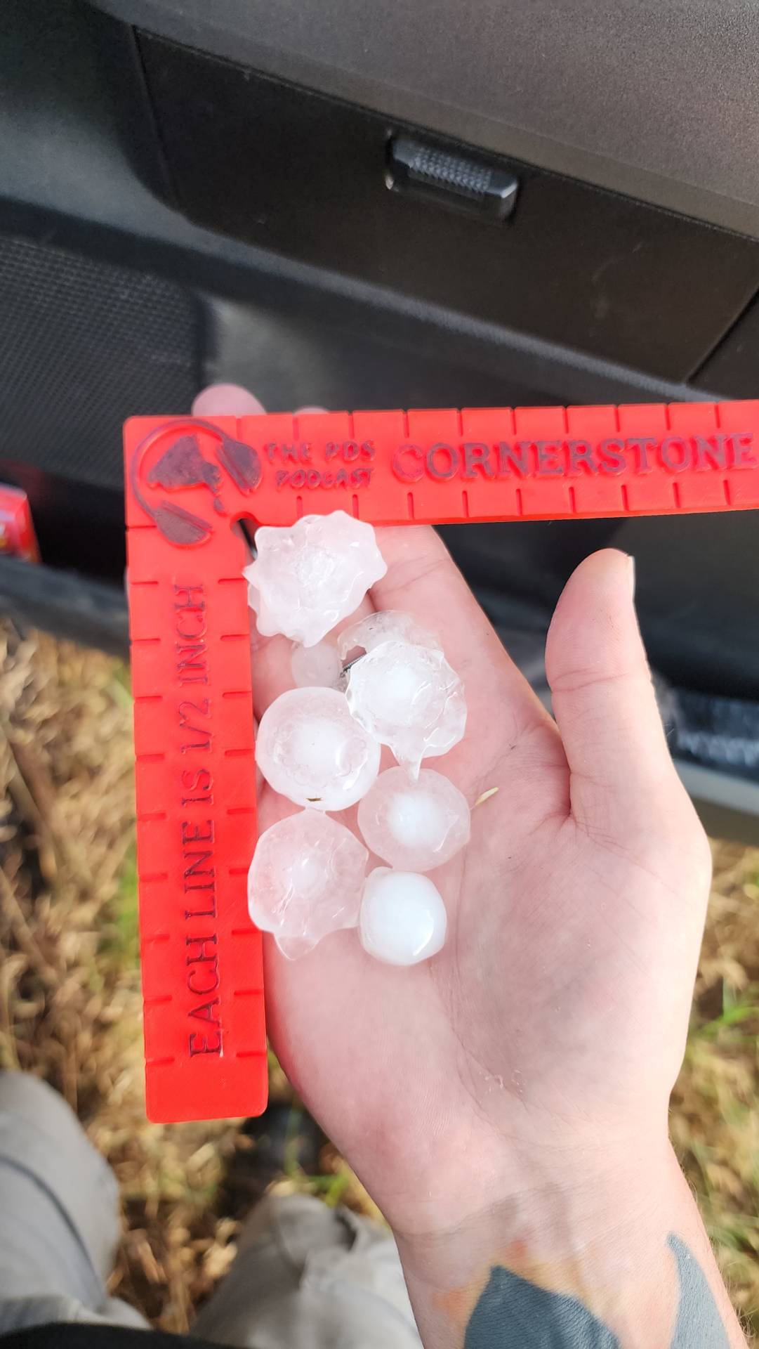
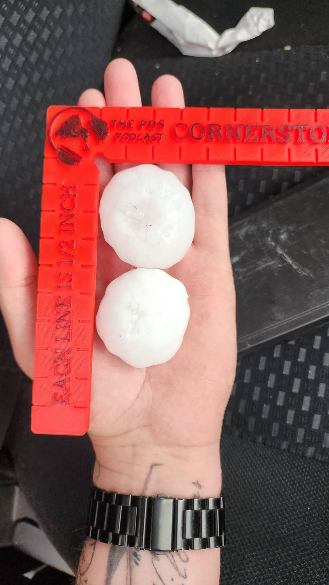
We were able to get remarkably close to the tornadoes while maintaining a safe distance, thanks to the excellent road network in the area. The sound of the roaring wind and the sight of debris being lofted into the air were reminders of the sheer power of these natural phenomena. Despite the danger, the experience of witnessing these tornadoes up close was unparalleled.
Aftermath and Reflection
As the sun began to set, the storms gradually weakened, and we made our way back to our base. The chase was a success, with multiple tornadoes documented and valuable data collected. Reflecting on the day’s events, I am reminded of the importance of respecting the power of nature and the need for continued research and preparedness in tornado-prone areas.
The May 23rd, 2023, chase in Eldorado, Oklahoma, was a stark reminder of the unpredictability and intensity of severe weather. It was a day filled with adrenaline, awe, and respect for the forces of nature. This chase log serves as a testament to the incredible experiences and observations made while chasing the Eldorado tornadoes.
Conclusion
Chasing storms is not just about the thrill; it’s about understanding and documenting the powerful forces of nature. The data collected from this chase will contribute to the broader scientific understanding of tornado formation and behavior. As we move forward, we remain committed to advancing our knowledge and preparedness for these incredible natural events.
Sorry everyone, stream is down due to network issues 07:59 PM
Community Comments
Nice captured picture of the tornado
Reply to Eric McGrath
Want to leave a comment? Join our community → OR Login →