

Published on
Unpacking the process as our storm got ready to tornado…
After watching the birth and development of an updraft near our target at the apex of intersecting boundaries west of Rosetown, our storm became a tornado-producing machine as it approached D’Arcy. This article exclusively considers observations of visual storm characteristics at around the time the first of three tornadoes developed.
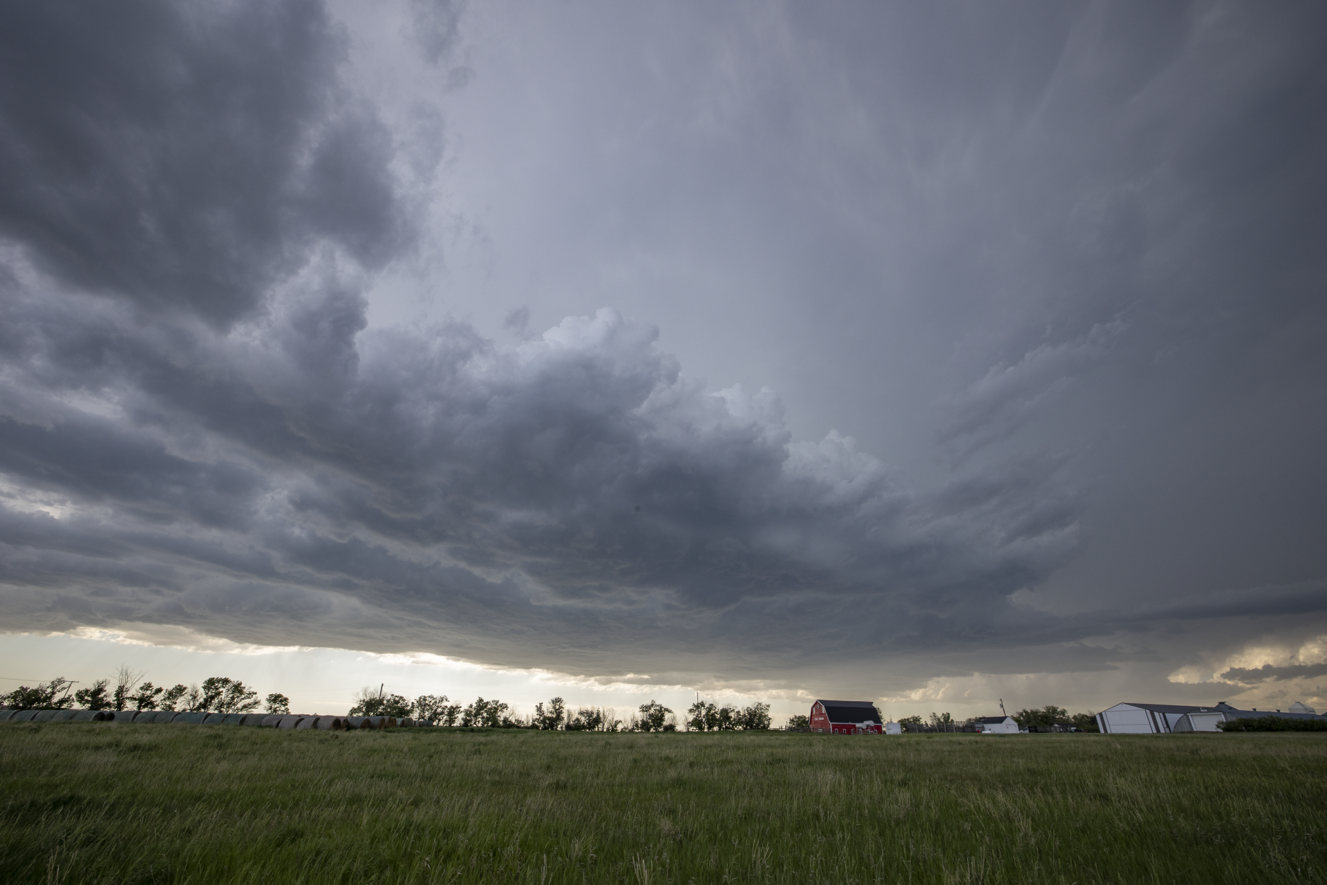
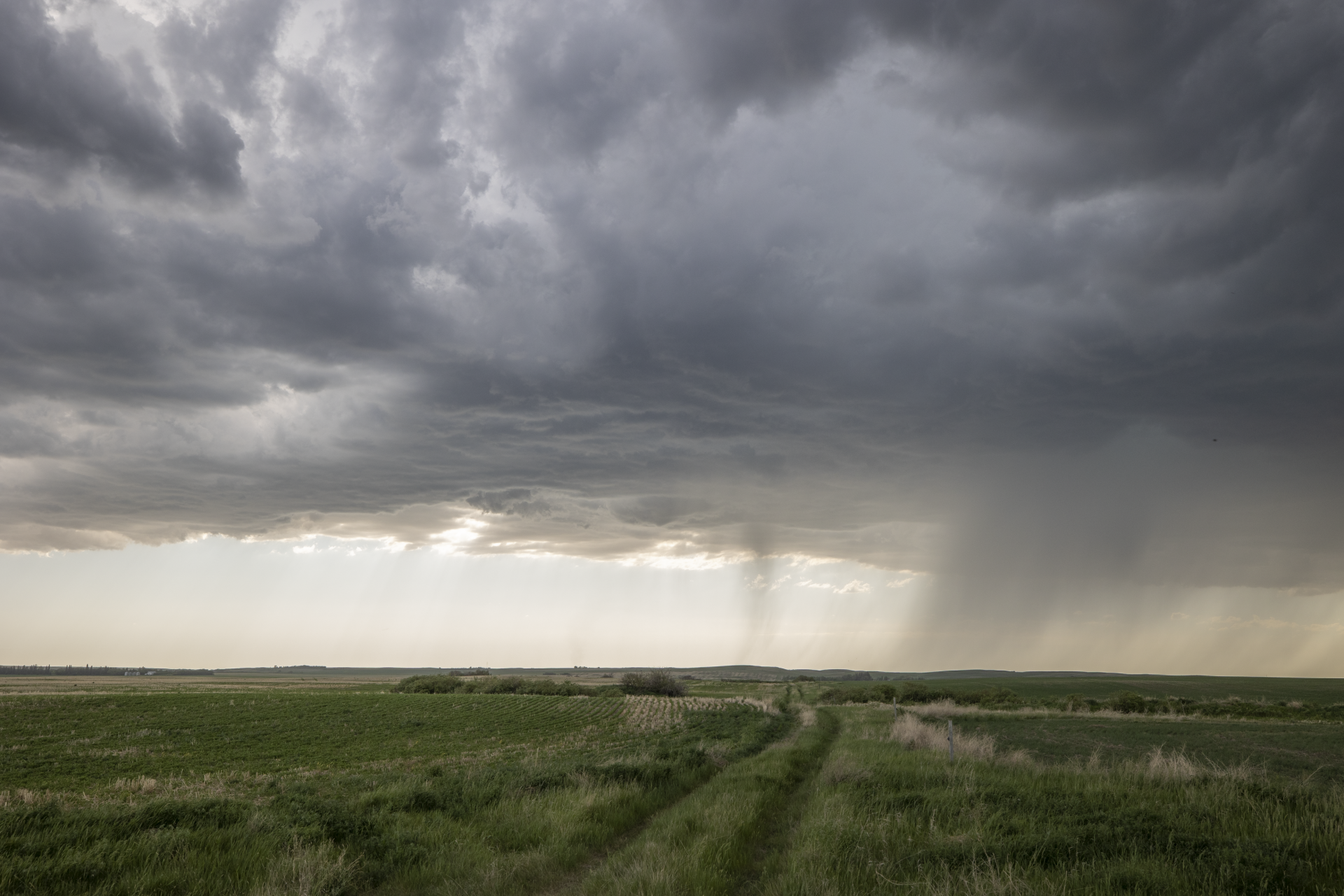
At around 5:30pm, we stopped at a picturesque farm near the community of D’Arcy. At that time, a beaver tail was feeding in just north of where the storm’s original core would soon develop. At the southern extent of the storm’s updraft, the base took on a horseshoe shape around a small clear slot. It was at this location, at the tip of the red arrow below, that the tornado soon developed.
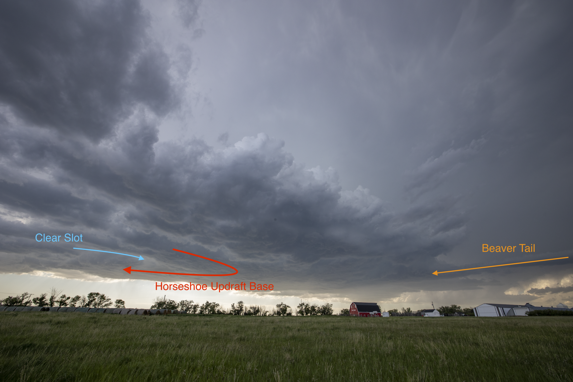
Storm structure & visual cues, looking west toward D’Arcy at 5:35pm, around the time of tornadogenesis
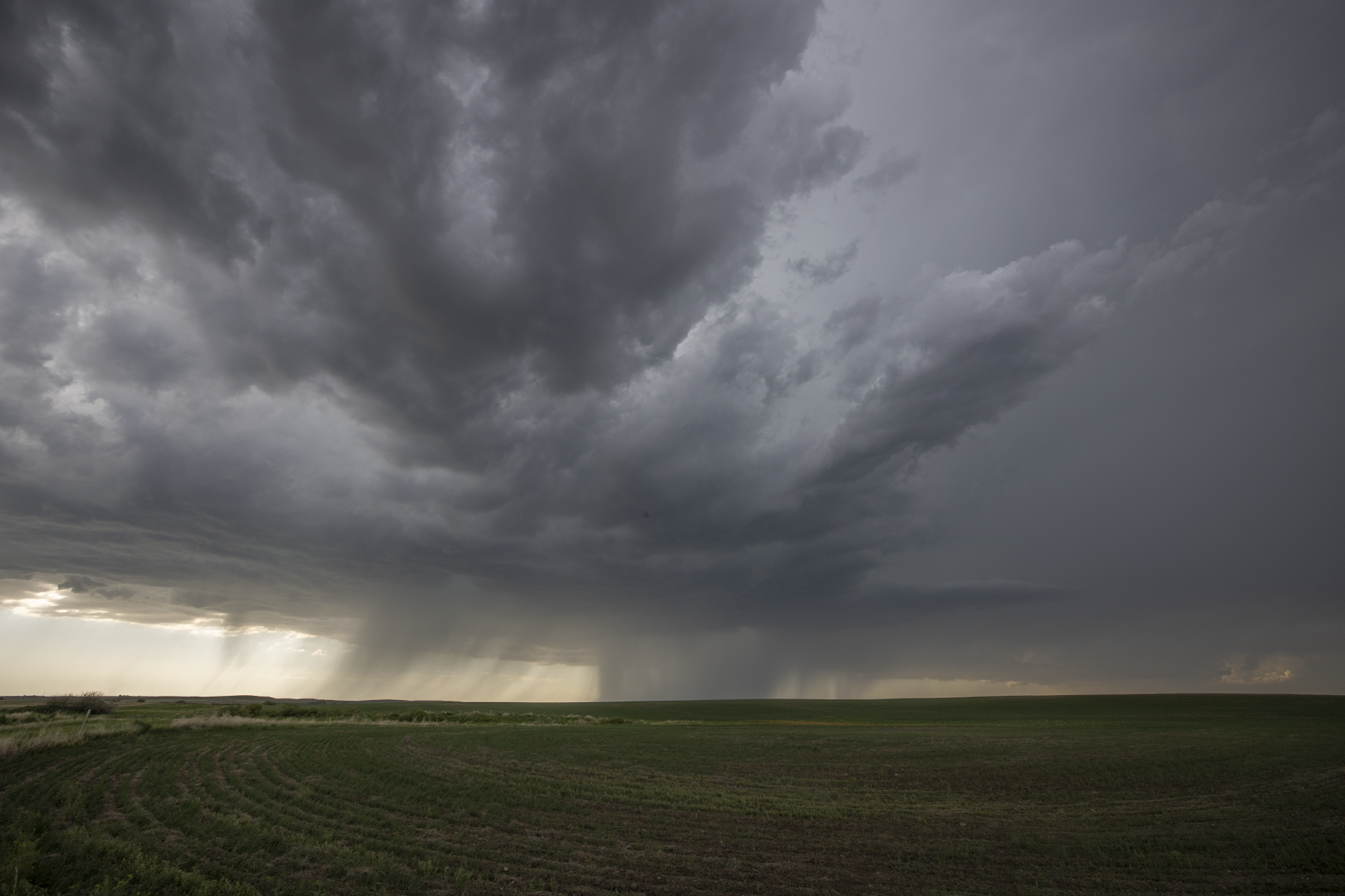
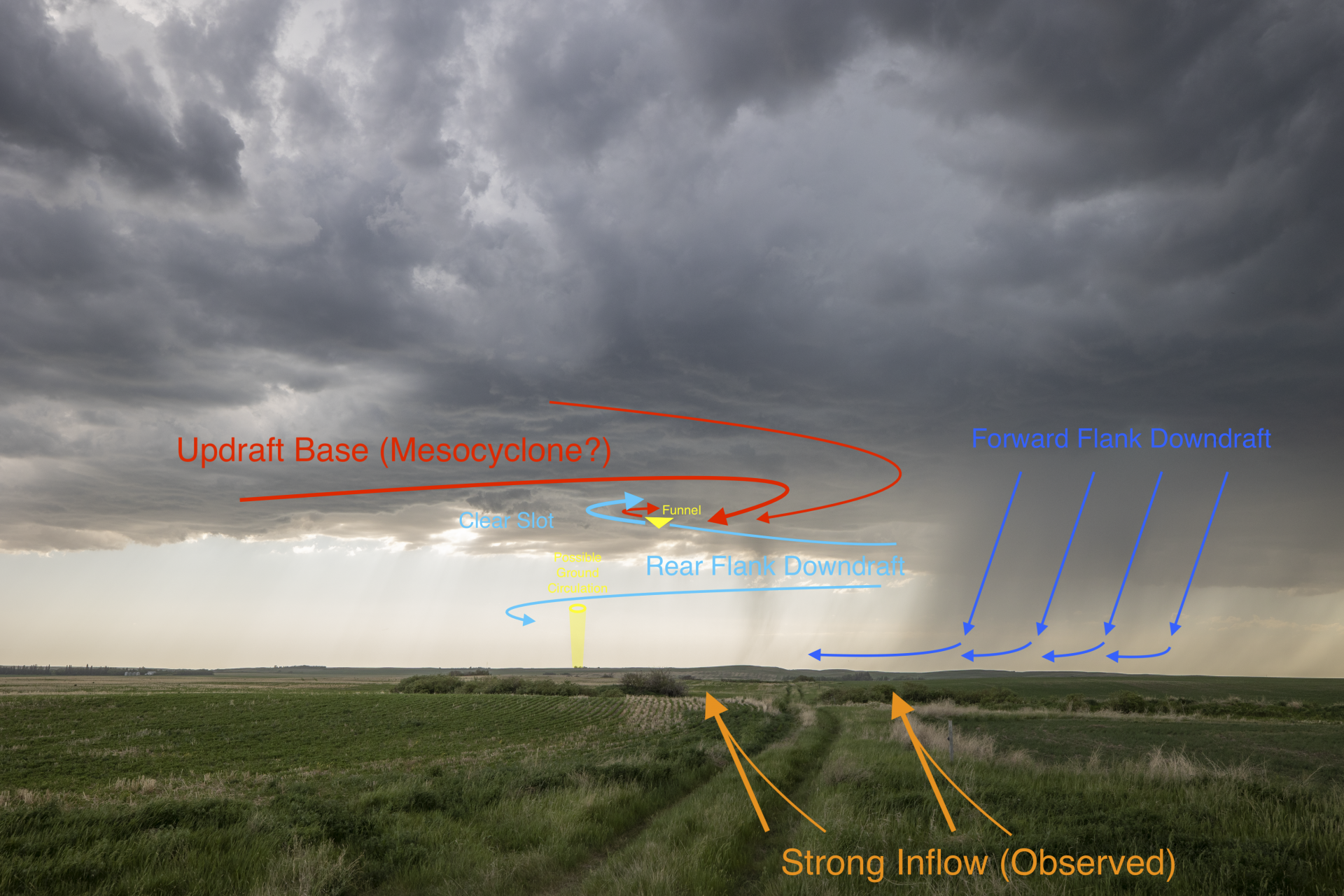
At around the time the funnel cloud was spotted, features often associated with supercell thunderstorms were observed. A new downdraft opened up to the south of the original core, and this tilted down beneath the updraft. North of the original core, an inflow feeder band streamed into the base. Faint rain bands appeared to move right-to left behind the funnel cloud and resembled a wrapping rear flank downdraft. As this occurred, the updraft base continued its arc into a ‘classic’ horseshoe shape around the clear slot. Powerful inflow was ongoing at the time. Characteristically, the process resembled typical supercell-driven tornadogenesis.
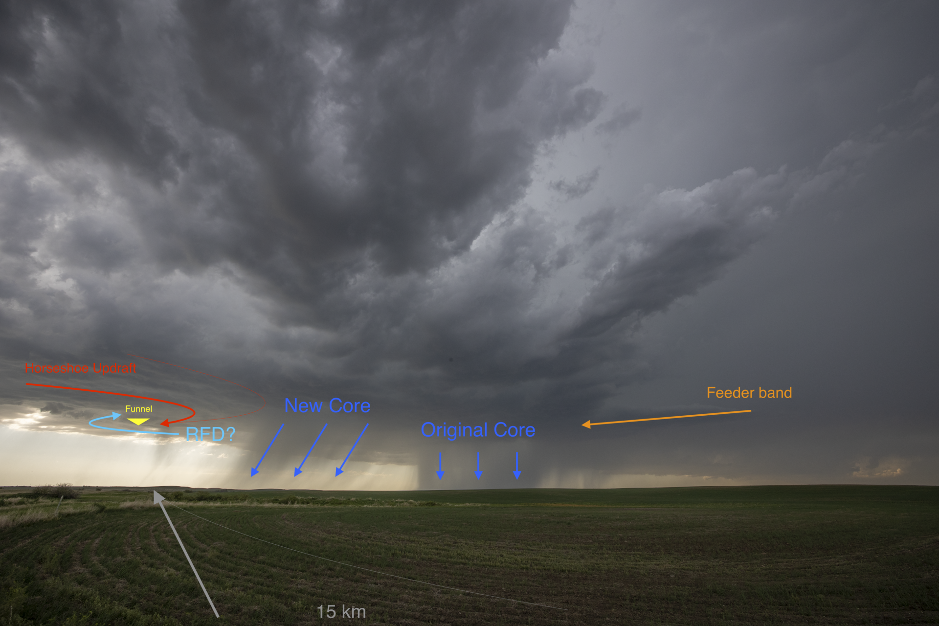
Observations as the tornado developed & analysis of storm features
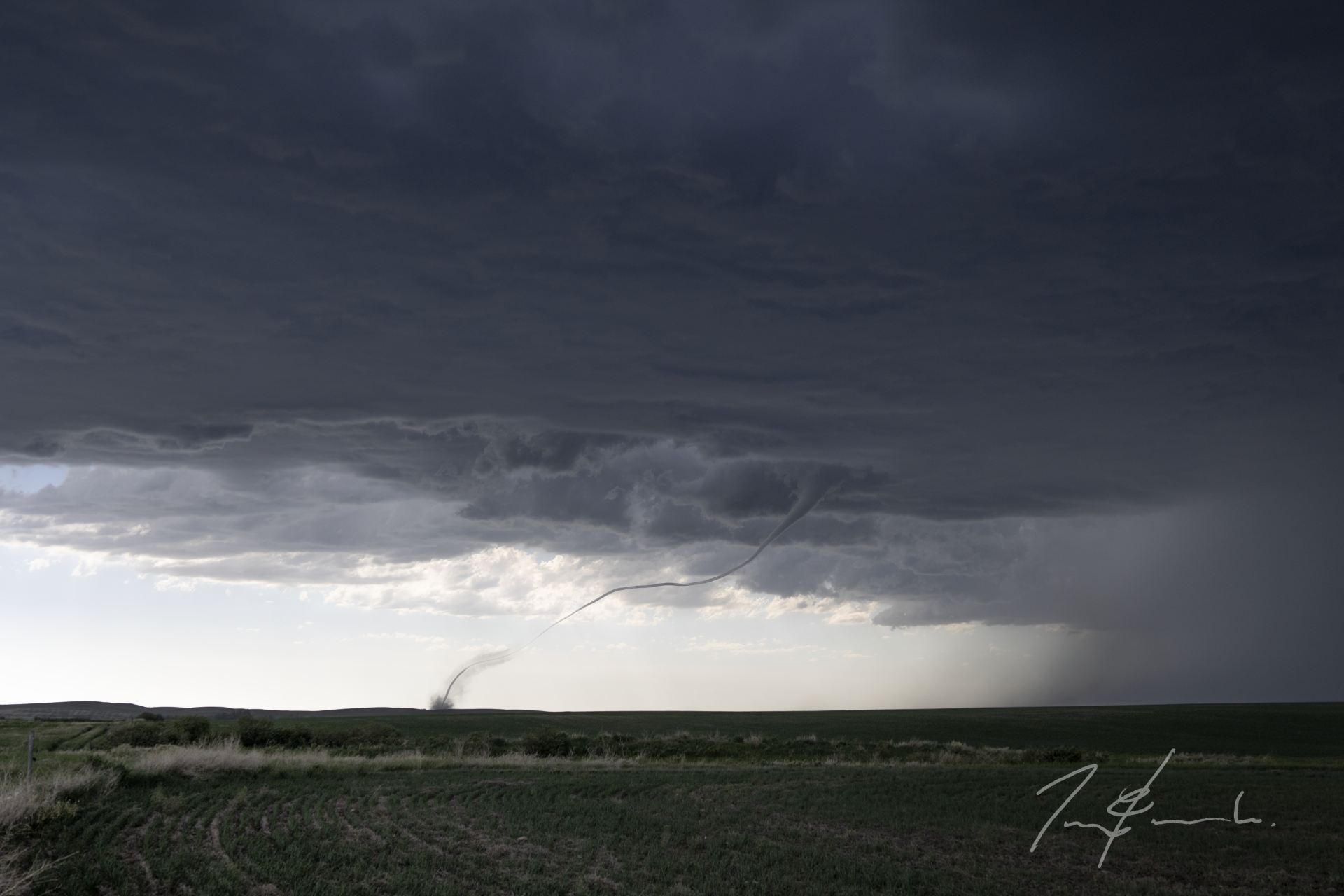
Soon the entire base of the storm’s updraft was rotating. This was evident in both cloud motion, and in structural characteristics and storm features. Mid-level structure was obscured by lower-level clouds, but the entire base of the storm presented with classic supercell features. And, although it was not yet observed in the field, analysis of photos indicates a faint dust whirl at this time; the tornado was now in progress.
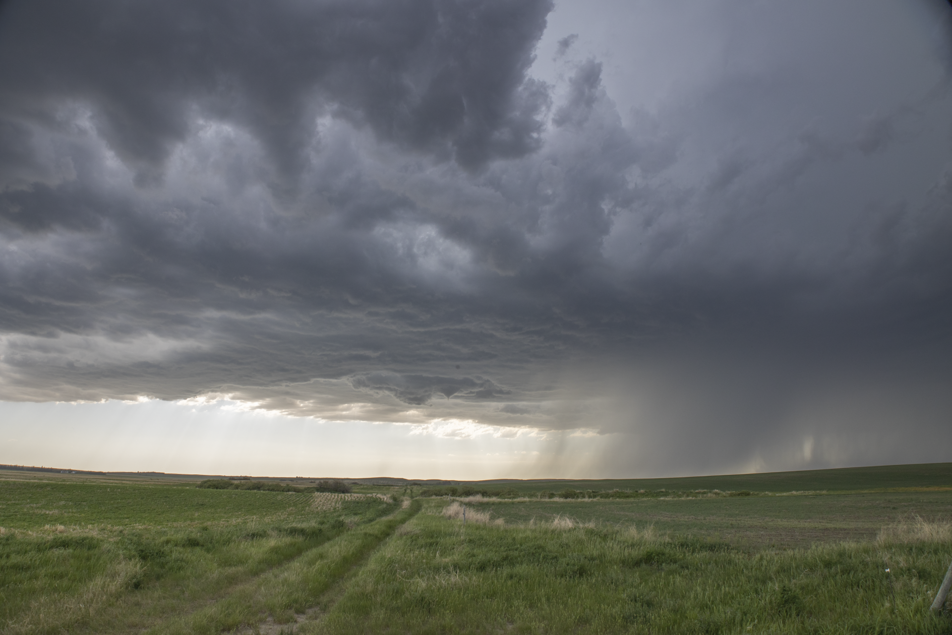
More features present themselves
As the storm approached, features associated with the funnel cloud and tornado became more apparent as they came better into view. In particular, we saw that the funnel was connected to a short-but-obvious wall cloud around the top of the occluded updraft.
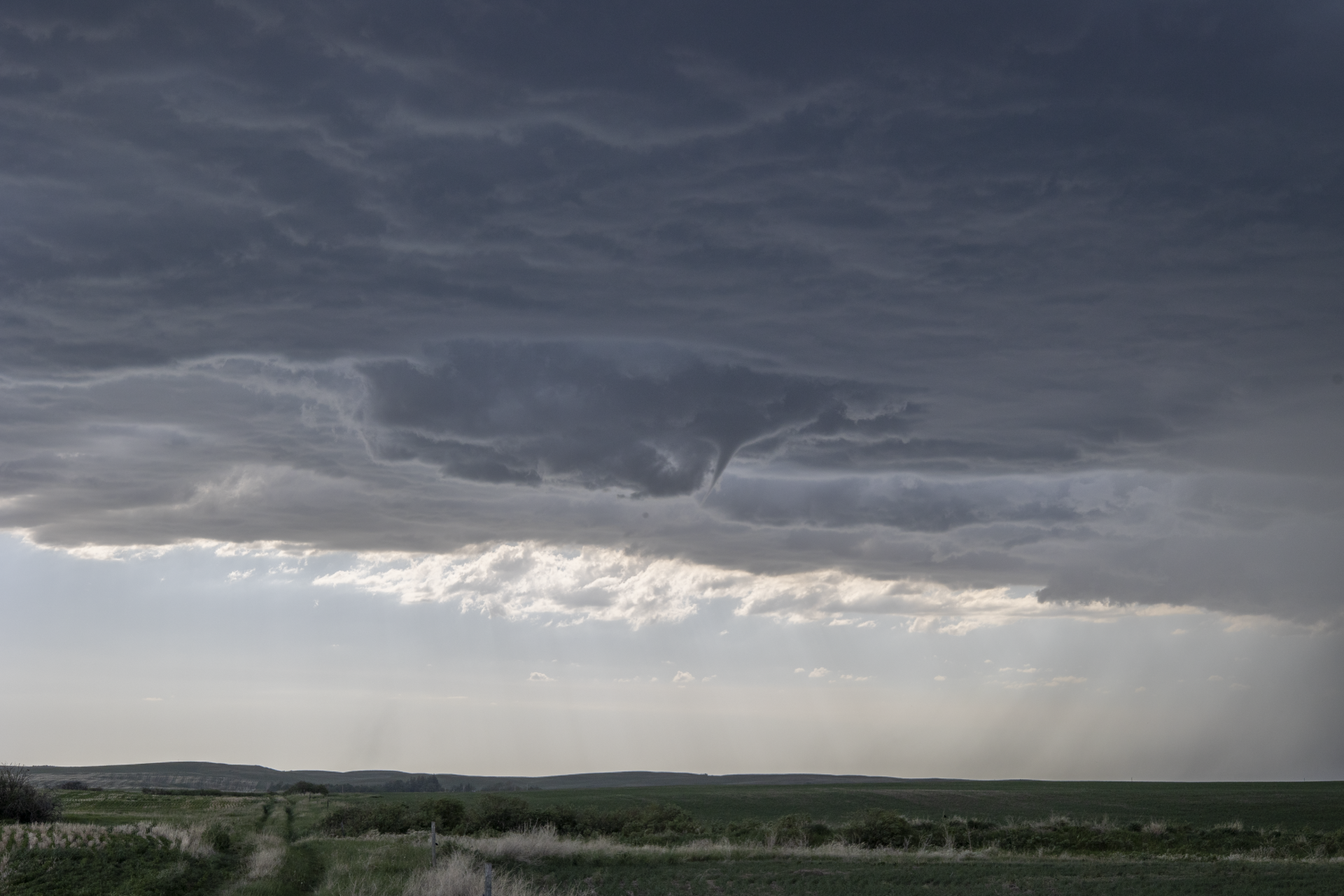
Regardless of the processes at play…
… Landspout, hybrid or supercell tornado, the outcome was a sight to be hold and we were lucky to be there for it!
Community Comments
There are no comments on this post
Want to leave a comment? Join our community → OR Login →