This rain-wrapped tornado tracked through rural properties to the north of Whitby, tearing a path in a northeasterly direction. Early in the track, its damage path was narrow, perhaps around 50m in width, and consisted of light damage to tree branches. As the tornado moved toward Lake Ridge Road, it increased steadily in strength and size; it crossed Sideline 2 leaving a 200m-wide swath of large tree limbs snapped and thrown. It seemed to weaken some as it passed through a farm near the intersection of Myrtil Road West and Lake Ridge Road, causing light tree damage and shingle damage to the home. However, the most significant damage occurred near the very end of the tornado’s path, at a farm on Dagmar Road.
The tornado tore into the property, snapping trees along the north side of Myrtil Road and throwing them several meters into a corn field. It then ripped through the field, levelling a 50m-wide swath and leaving swirling patterns through the flattened field. The tornado narrowly missed the farm home, sideswiping the house while snapping nearby trees and leaving others with their tops shorn off. Limbs from the shredded trees were tossed inward toward the centre of the damage path and lay scattered in an arcing pattern amidst a whirl of flatted corn. As the tornado exited the property across Dagmar Road, it left stalks of corn dangling from the telephone wires. From there it moved into an adjacent woodlot, snapping trees before dissipating.
This was one of two tornadoes that occurred on this day, the other:

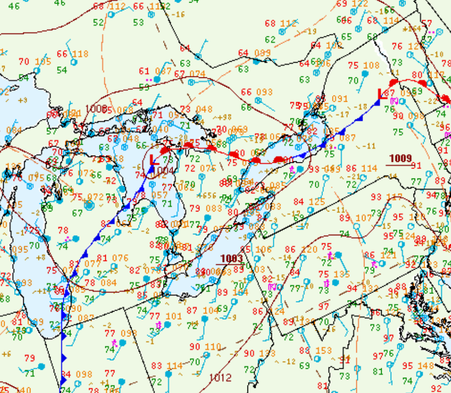
Figure 1 depicts the surface observations at 2:00 pm EDT at the time of the tornado, which shows a low pressure over Lake Huron with a cold front extending into Michigan and a warm front across southern Ontario. The warm front became the focus for thunderstorm activity, which ultimately led to this tornado.
Sources
NWS Weather Prediction Center Surface Analysis Archive. (2017). Surface analysis 18Z Sat Aug 13 2016. Retrieved from: https://www.wpc.ncep.noaa.gov/archives/web_pages/sfc/sfc_archive.php

