

This tornado occurred at around 12:50 pm and tore a 5-6 km path across the eastern shoreline of Lake Simcoe. Local residents witnessed the tornado at Sunset Beach shortly after its initial touchdown, and their reports prompted Environment Canada to issue a tornado warning. In addition, radar showed a supercell with a clear hook and a strong velocity couplet moving over the area. The warning was issued at 12:56 pm, indicating a tornado on the ground at Sunset Beach, headed toward the town of Beaverton.
The tornado passed from Sunset Beach to Riverview Beach where it left a path of damaged trees and an expansive boat shed demolished at Flying Bridge Marina. From there the tornado moved on to the northeast, causing heavy tree damage in Corner Park and along Clovelly Cove on the west side of Port Bolster. It then moved across the north edge of the small town, twisting, snapping and uprooting trees, leaving roof damage to cottages and outbuildings, and destroying a large garage. The garage, located on lake Ridge Road, was blown apart with debris scattered for dozens of metres across neighbouring properties.
This was one of two tornadoes that occurred on this day, the other:
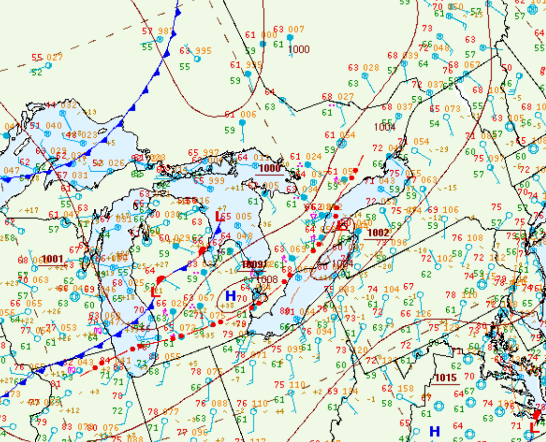
Figure 1 depicts the surface observations at 2:00 pm EDT at the time of the tornado, which shows a low pressure over Lake Huron with a cold front extending into Michigan and a warm front across southern Ontario. The warm front became the focus for thunderstorm activity, which ultimately led to this tornado.
Sources
NWS Weather Prediction Center Surface Analysis Archive. (2017). Surface analysis 18Z Sat Aug 13 2016. Retrieved from: https://www.wpc.ncep.noaa.gov/archives/web_pages/sfc/sfc_archive.php