
National Centers for Environmental Information reports:
![]()
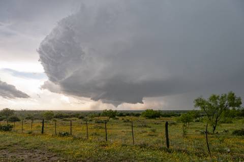
A NWS Storm Survey was conducted for this tornado that was videotaped by many storm chasers throughout it's track across northern Sterling County. We found many snapped Mesquite tree trunks and plenty of tree limb damage. The tornado moved large wind turbine propellers at two different locations, and it snapped 16 power poles across two ranches. The tornado caused a wind mill stand to bend over. A nearby crane located about a mile south of the tornado track or in the rear flank downdraft, measured a wind speed of 109 mph. The twister destroyed a camper.
The collective videotapes on social media from the many storm chasers, showed the tornado starting out as a multi-vortex tornado in the northwest part of Sterling County around 711 PM CDT, transitioning to a large cone near the wind farms, and then becoming rain wrapped as it struck the gas plant at around 747 PM CDT. As the tornado struck a gas plant on State Highway 163, it slung a large dumpster about 300 yards into a nearby pasture, snapped a telephone pole and threw a large Conix container about 50 feet. It also bent one of the towers on the plant.
Many thanks to the Sterling County Sheriff's Department, the Stewart Ranch, National Weather Service Midland, other ranchers and all of the storm chasers for their excellent assistance.