

The tornado touched down at 8:45 pm and had a path that was 7 kilometres long and 150 metres wide. Trees were snapped and uprooted, falling on and causing damage to houses and vehicles, and the copula was torn off of a church. The tornado passed just north of Amherstburg. Damage from this tornado, and another at Malden Centre, was estimated by Environment Canada surveyors to be around $60,000.
This was one of two tornadoes that struck Southwestern Ontario, near Windsor on this day; the other, an F1 at Malden Centre, caused tree and property damage.
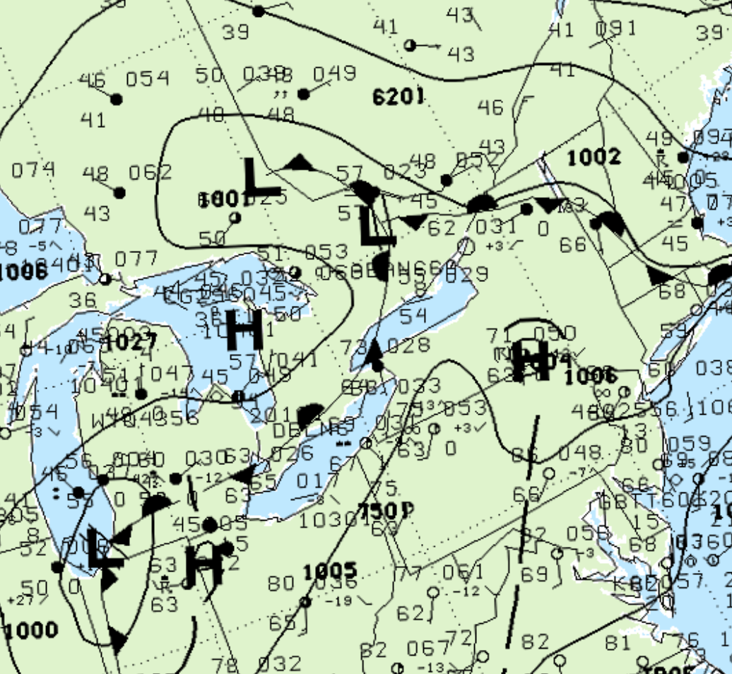
Figure 1 depicts the surface observations at 8:00 pm, which shows a low pressure system in eastern Ontario with a stationary front across southwestern Ontario. This boundary became the focus for intense thunderstorms in the afternoon/evening hours of May 9th and ultimately led to this F0 tornado.
According to Environment and Climate Change Canada (2018), an F0 tornado touched down at 8:45 pm EDT near Amherstburg, ON. The tornado travelled for 7 km with a maximum width of 150 metres. The tornado caused no fatalities or injuries, but caused $10 thousand dollars in property damage.
Sources
NWS Weather Prediction Center Surface Analysis Archive. (2017). Surface analysis 00Z Wed May 10 2000. Retrieved from: https://www.wpc.ncep.noaa.gov/archives/web_pages/sfc/sfc_archive.php
Environment and Climate Change Canada Data. (2018). Canadian National Tornado Database: Verified Events (1980-2009) – Public. Retrieved from: http://donnees.ec.gc.ca/data/weather/products/canadian-national-tornado-database-verified-events-1980-2009-public/