

Figure 1 shows the surface observations at 7:00 am CDT, which shows no dominant features across Manitoba. The only thing of note is weak troughing across Manitoba, which is better observed in upper-air charts (Figure 2).
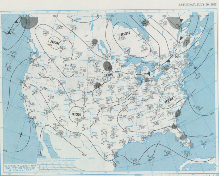
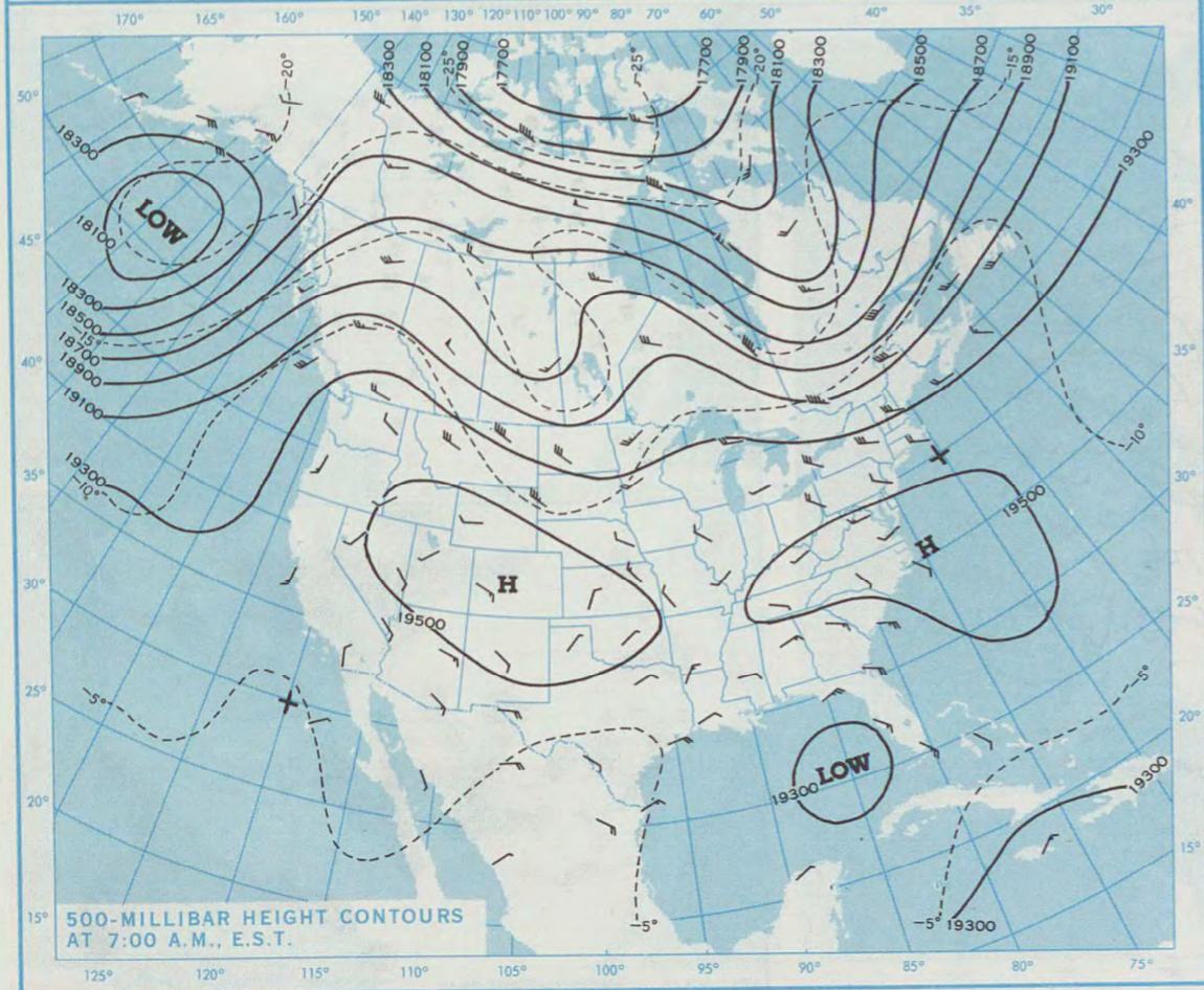
Figure 2 shows said weak negatively-tilted upper-level trough. This trough, possibly aided by some lake-breeze interactions, triggered thunderstorms across southern Manitoba and ultimately led to three tornadoes across the province on this day.
According to Environment and Climate Change Canada (2018), an F0 tornado touched down at 3:30 pm CDT near Arden, MB. The track and width of this tornado was not documented by ECCC. The tornado caused no injuries, fatalities or property damage.
Sources
NOAA Central Library. (2020). U.S. Daily Weather Maps. Saturday July 30, 1983 [PDF]. Retrieved from https://library.noaa.gov/Collections/Digital-Collections/US-Daily-Weather-Maps
Environment and Climate Change Canada Data. (2018). Canadian National Tornado Database: Verified Events (1980-2009) – Public. Retrieved from: http://donnees.ec.gc.ca/data/weather/products/canadian-national-tornado-database-verified-events-1980-2009-public/