

Figure 1 shows the surface observations at 7:00 am CDT, which shows a low pressure system in the Interlakes region of Manitoba with a cold front extending south across southern Manitoba and North Dakota. A warm front is also observed extending south from the low across southeastern Manitoba and Minnesota.
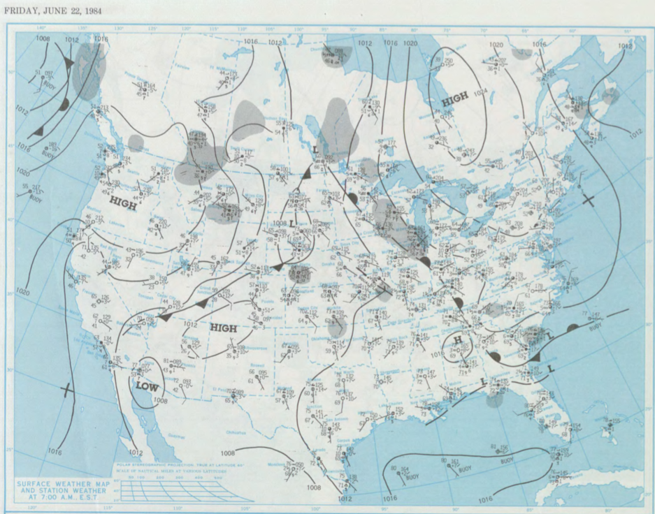
The warm front likely triggered thunderstorms across the Interlakes region and southeastern Manitoba in the afternoon/evening hours of June 22nd, which ultimately led to four tornadoes on this day.
According to Environment and Climate Change Canada (2018), an F0 tornado touched down at 5:00 pm CDT near Ashern, MB. The track and width of this tornado was not documented by ECCC. The tornado caused no injuries, fatalities or property damage.
Sources
NOAA Central Library. (2020). U.S. Daily Weather Maps. Friday June 22, 1984 [PDF]. Retrieved from https://library.noaa.gov/Collections/Digital-Collections/US-Daily-Weather-Maps
Environment and Climate Change Canada Data. (2018). Canadian National Tornado Database: Verified Events (1980-2009) – Public. Retrieved from: http://donnees.ec.gc.ca/data/weather/products/canadian-national-tornado-database-verified-events-1980-2009-public/