

The tornado was on the ground for a half kilometre and had a width of 20 metres. It was filmed by CANWARN spotter Dave Patrick as it narrowly missed a passing train. Although it did not produce any damage, the tornado left swirling patterns through the crops and fields over which it passed.
This was one of four tornadoes to touch down during a small tornado outbreak in Southern Ontario. The others were an F0 at Campbellville, an F1 near Highland Grove, and an F1 near Fenlon Falls.
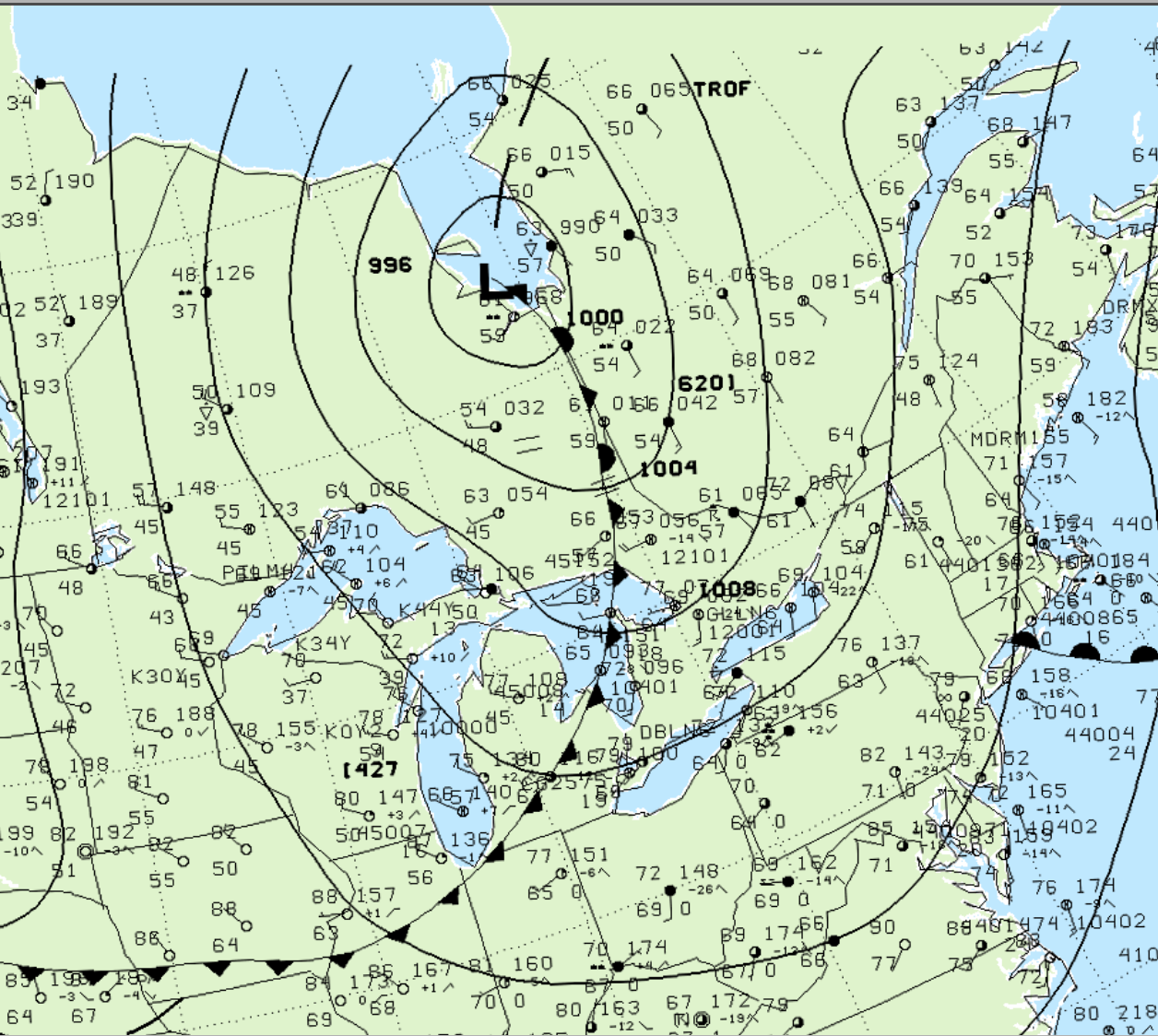
Figure 1 depicts the surface observations at 2:00 pm EDT, which shows a significant low pressure over James Bay with a cold front extending into Ontario and Michigan. This front became the focus for intense thunderstorms in the afternoon hours of July 4th, which ultimately led to this F0 tornado.
According to Environment and Climate Change Canada (2018), an F0 tornado touched down at 5:05 pm EDT near Ayr, ON. The path and width of the tornado was not documented by ECCC. The tornado caused no fatalities, injuries or property damage.
Sources
NWS Weather Prediction Center Surface Analysis Archive. (2017). Surface analysis 18Z Wed Jul 4 2001. Retrieved from: https://www.wpc.ncep.noaa.gov/archives/web_pages/sfc/sfc_archive.php
Environment and Climate Change Canada Data. (2018). Canadian National Tornado Database: Verified Events (1980-2009) – Public. Retrieved from: http://donnees.ec.gc.ca/data/weather/products/canadian-national-tornado-database-verified-events-1980-2009-public/