

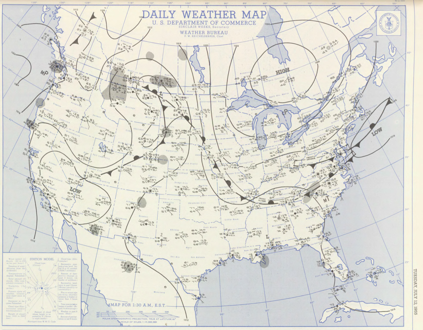
Figure 1 depicts the surface observations at 2:30 am EDT, which shows a cold front off the northeast coast of the United States and a large area of high pressure across Canada. An area of developing low pressure associated with a stationary front off the coast of Massachusetts is also observed to be developing at the time of Figure 1. This stationary front could have been responsible to initiate thunderstorms, possibly aided by sea-breeze interactions, which ultimately led to this F2 tornado.
The Berkshire County, MA F2 tornado of July 12, 1955 impacted Berkshire County in Massachusetts. According to NOAA (2019), the F2 tornado caused no fatalities, injuries or property damage. The tornado touched down in Berkshire County south of Salisbury Road at 7:00 pm EDT. The tornado travelled for 0.5 miles and had a maximum width of 33 yards.
Sources
NOAA Central Library. (2019). U.S. Daily Weather Maps. Tuesday July 12, 1955 [PDF]. Retrieved from https://library.noaa.gov/Collections/Digital-Collections/US-Daily-Weather-Maps
NOAA National Centers for Environmental Information (2019). Storm Events Database. Retrieved from: https://www.ncdc.noaa.gov/stormevents/