

Touching down at 6:00 pm, this tornado travelled for 5 km and had a path that was 100m wide. Witnesses described seeing a large black funnel that downed trees and tossed picnic tables.
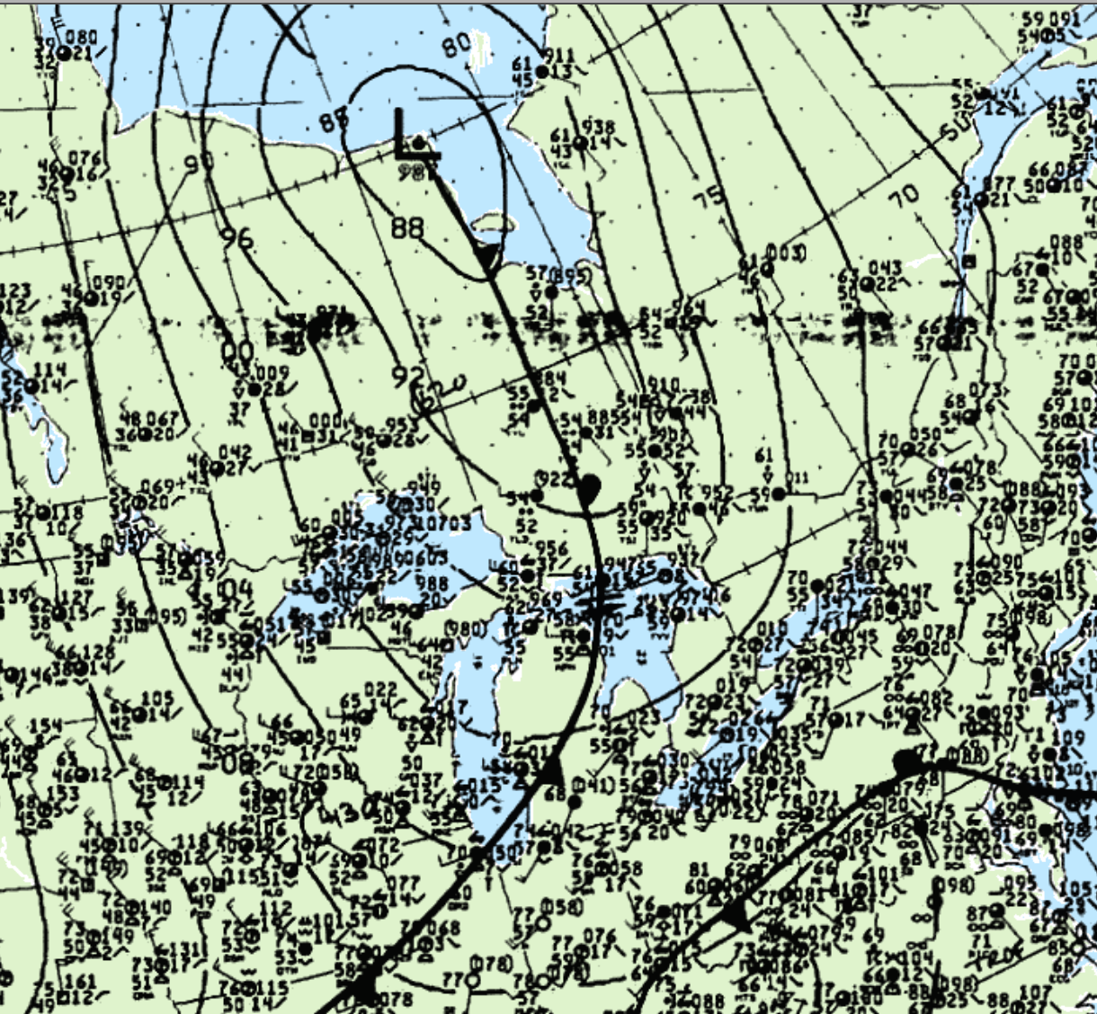
Figure 1 depicts the surface observations at 5:00 pm EDT, which depicts a low pressure sitting near James Bay, with a cold front extending across the Great Lakes. A pre-frontal trough is noted to develop around 22Z, which likely initiated storms. These pre-frontal storms resulted in this long-track F1 tornado.
According to Environment and Climate Change Canada (2018), an F1 tornado touched down at 6:00 pm EDT near Bonnie Lake, ON. The path and width of the tornado was not documented by ECCC. The tornado caused no fatalities, injuries or property damage.
Source
NWS Weather Prediction Center Surface Analysis Archive. (2017). Surface analysis 21Z Sat Sep 9 1993. Retrieved from: https://www.wpc.ncep.noaa.gov/archives/web_pages/sfc/sfc_archive.php
Environment and Climate Change Canada Data. (2018). Canadian National Tornado Database: Verified Events (1980-2009) – Public. Retrieved from: http://donnees.ec.gc.ca/data/weather/products/canadian-national-tornado-database-verified-events-1980-2009-public/