

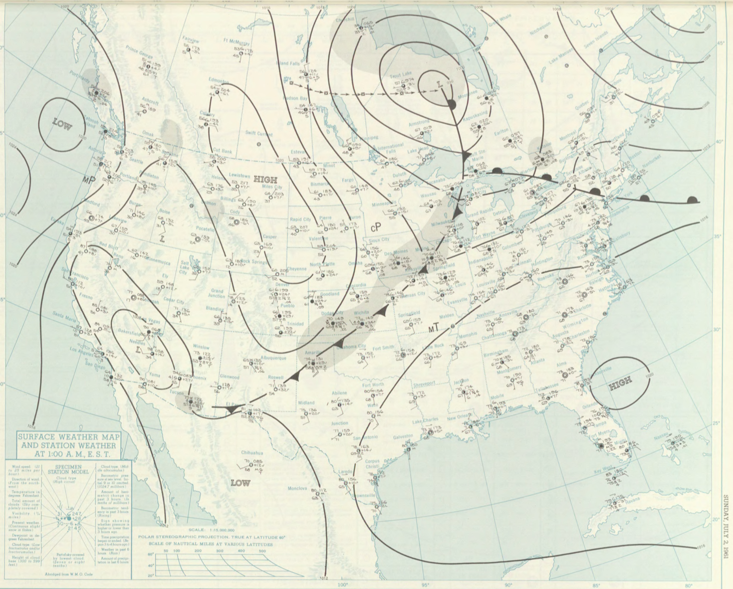
Figure 1 depicts the surface observations at 2:00 am EDT, which shows a warm front advecting north in the northeast United States and a cold front moving across the Midwest. This cold front would have moved east throughout the day, triggering thunderstorms in Massachusetts, which ultimately led to this long-track tornado.
The Bradstreet, MA F0 tornado of July 2, 1961 impacted Franklin County in Massachusetts. According to NOAA (2019), the F0 tornado caused no fatalities or injuries, but caused $25 thousand dollars in property damage. The tornado touched down in Franklin County west of Main Street at 5:30 pm EDT. The tornado travelled for 2 miles and had a maximum width of 280 yards.
Sources
NOAA Central Library. (2019). U.S. Daily Weather Maps. Friday July 2, 1961 [PDF]. Retrieved from https://library.noaa.gov/Collections/Digital-Collections/US-Daily-Weather-Maps
NOAA National Centers for Environmental Information (2019). Storm Events Database. Retrieved from: https://www.ncdc.noaa.gov/stormevents/