

The most damaging tornado of the night, this probable F2 tornado ravaged the town of Bridgenorth. It came ashore on the east side of Chemong Lake and struck Dutch Marine, where boats were either sunken or plucked from the water and thrown ashore. All of the buildings at the marina were torn apart and levelled, with debris scattered uphill for over a kilometre through the town.
Beyond the marina, the tornado struck dozens of houses, leaving them severely damaged. Windows were smashed and walls pierced and pockmarked by flying debris; a few homes had their roofs torn off. At one, a mother was injured by flying debris as she lay atop her son while attempting to shield him while windows exploded, sections of roofing and walls were torn away and boards from the marina burst in and impaled the walls around them.
One woman died of a heart attack as the tornado struck her home, and this death is often incorrectly attributed to the tornado as a direct casualty.
Continuing on to the east, the tornado ripped through a dense pine forest, reportedly leaving nothing but a field of shredded tree trunks. It then tore apart a county sand dome before passing through rural properties. At one of them, a farm on 7th Line, a barn and silo were completely destroyed with debris scattered for hundreds of metres through area fields.
Shortly after the storm, a police officer reportedly responded to an alarm going off at the south end of Bridgenorth. He drove through the area which was undamaged by the tornado, unaware of the path of destruction just to his north in town. After the call he left the area, having never encountered the damage path, and it was not until the next morning that emergency officials became aware of the devastation in town.
This was one of four tornadoes that touched down in Cottage Country as a violent derecho swept across Central Ontario. The others:
- F1 at Kennisis Lake
- F1 at Balsam Lake
- F0 at Clearwater Beach
The Forecast
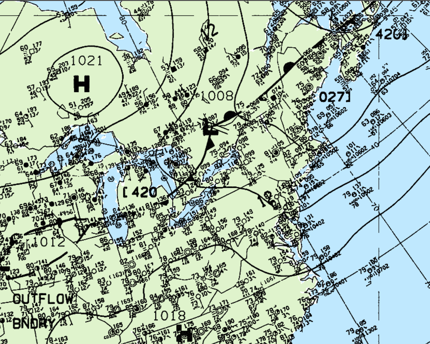
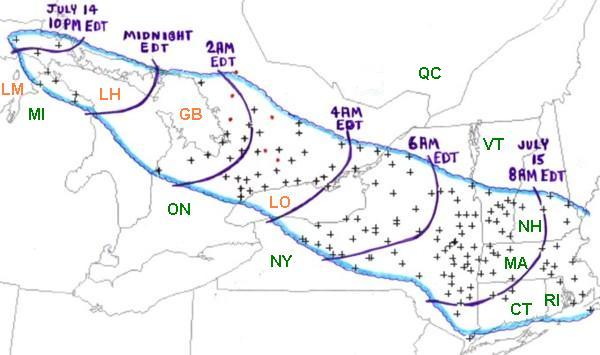
Figure 2 depicts the surface observations on the early morning hours of July 15, 1995. According to the Storm Prediction Center (2018), a bow echo was ongoing since July 14th across the Great Lakes region (Figure 1). At the time of Figure 2, storms were located along the cold front in southern Ontario, extending from the low pressure system. This derecho can be seen via the radar loop shown below.
“As the bow echo system producing the derecho crossed northern Lake Huron (LH) and Georgian Bay (GB), it grew in scale and severe winds affected a large part of southern Ontario (ON) during the pre-dawn hours of Saturday, July 15th (Figure ##). Some damage occurred in the Toronto metropolitan area near the southern edge of the derecho, and a wind gust to 136 kph (85 mph) was measured at the Buttonville Airport just north of the city. However, the most severe damage, which likely was associated with wind gusts up to 160 kph (100 mph) or more, occurred along a band from the “Cottage Country” east of Georgian Bay to the northeastern corner of Lake Ontario (LO) and adjacent parts of the St. Lawrence River Valley. This swath of damage was associated with the most rapidly moving part of the bowed line, as depicted in the above radar imagery loop from Environment Canada’s King City, Ontario radar. While most of the damage was associated with intense straight-winds, several brief tornadoes occurred in the bowed line. Most were weak, but a strong F2 intensity tornado hit the town of Bridgenorth, destroying a marina and damaging 20 homes” (Storm Prediction Center, 2018).
Recap
According to Environment and Climate Change Canada (2018), an F2 tornado touched down at 3:15 am EDT and travelled for 400 metres. The tornado caused one fatality, no injuries and $2.6 million dollars in property damage.
Sources
Storm Prediction Center. (2018). July 12-13, 1995 Derecho “The Right Turn Derecho”. Retrieved from: https://www.spc.noaa.gov/misc/AbtDerechos/casepages/jul1995derechopage.htm
NWS Weather Prediction Center. (2017). Surface analysis 06Z Sat Jul 15 1995. Retrieved from: https://www.wpc.ncep.noaa.gov/archives/web_pages/sfc/sfc_archive.php
Environment and Climate Change Canada Data. (2018). Canadian National Tornado Database: Verified Events (1980-2009) – Public. Retrieved from: http://donnees.ec.gc.ca/data/weather/products/canadian-national-tornado-database-verified-events-1980-2009-public/