

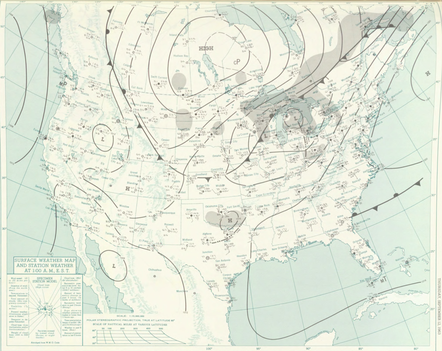
Figure 1 depicts the surface observations at 2:00 am EDT, which shows a cold front moving across Ontario and Quebec and a cold front moving across the U.S. Midwest. The cold front over ON/QC likely became near-stationary as the Midwest cold front moved east-southeast. This cold front eventually moved toward Massachusetts, which ultimately led to this tornado.
The Franklin County, MA F1 tornado of September 12, 1963 impacted Franklin County in Massachusetts. According to NOAA (2019), the F1 tornado caused no fatalities or injuries, but caused $2.5 thousand dollars in property damage. The tornado touched down in Franklin County in Warwick State Forest at 8:00 pm EDT. The tornado travelled for 1 mile and had a maximum width of 50 yards.
Sources
NOAA Central Library. (2019). U.S. Daily Weather Maps. Thursday September 12, 1963 [PDF]. Retrieved from https://library.noaa.gov/Collections/Digital-Collections/US-Daily-Weather-Maps
NOAA National Centers for Environmental Information (2019). Storm Events Database. Retrieved from: https://www.ncdc.noaa.gov/stormevents/