

Figure 1 depicts the surface observations at 12:00 pm MDT, which shoes an occluding low pressure system in Northern Alberta.
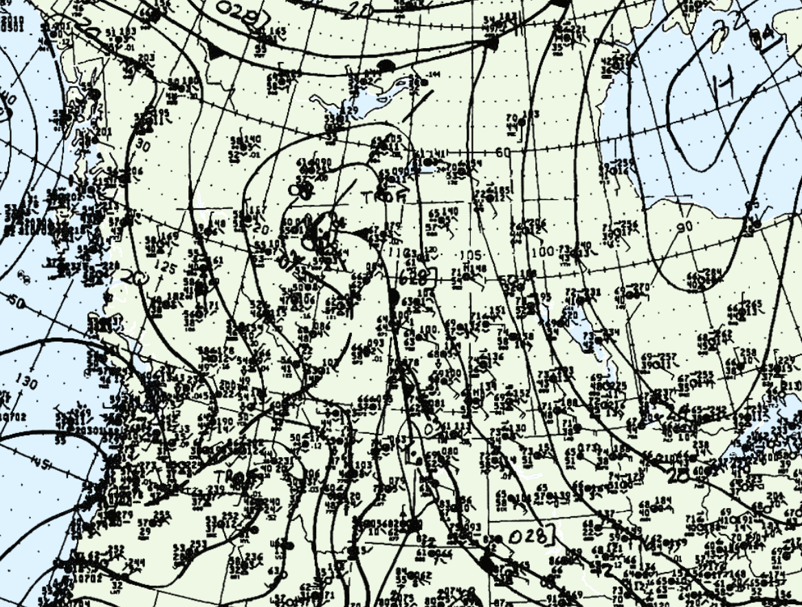
According to Environment and Climate Change Canada (2018), an F2 tornado touched down at 1:30 pm MDT near Cardston, AB. The path and width of the tornado was not documented by ECCC.
Sources
NWS Weather Prediction Center Surface Analysis Archive. (2017). Surface analysis 18Z Wed Jun 29 1988. Retrieved from: https://www.wpc.ncep.noaa.gov/archives/web_pages/sfc/sfc_archive.php
Environment and Climate Change Canada Data. (2018). Canadian National Tornado Database: Verified Events (1980-2009) – Public. Retrieved from: http://donnees.ec.gc.ca/data/weather/products/canadian-national-tornado-database-verified-events-1980-2009-public/