

This EF0 tornado touched down 4 km to the southeast of Casselman at approximately 7:00 pm. The path of light damage was 9 kilometres long. There were several witnesses to the tornado and video of it that showed a funnel cloud condensed halfway to the ground with a swirling cloud of dust and debris below.
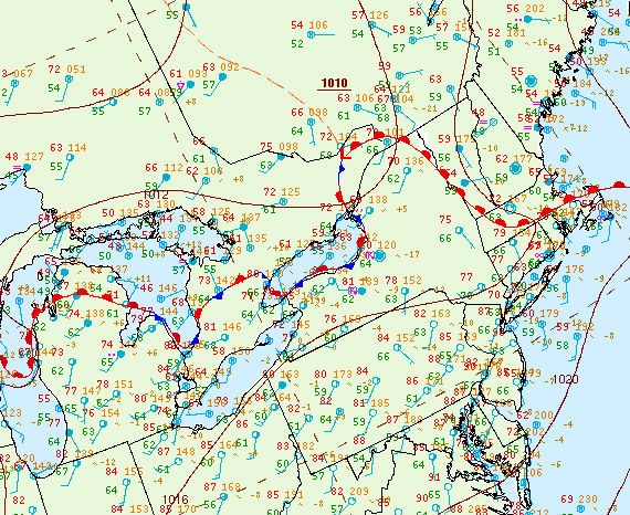
Figure 1 depicts the surface observations at 5:00 pm EDT, which shows a warm front moving northward across southeastern Ontario. This front was the focus for thunderstorms in the afternoon hours of May 29th, which ultimately led to this tornado.
Sources
NWS Weather Prediction Center Surface Analysis Archive. (2017). Surface analysis 21Z Wed May 29 2013. Retrieved from: https://www.wpc.ncep.noaa.gov/archives/web_pages/sfc/sfc_archive.php