

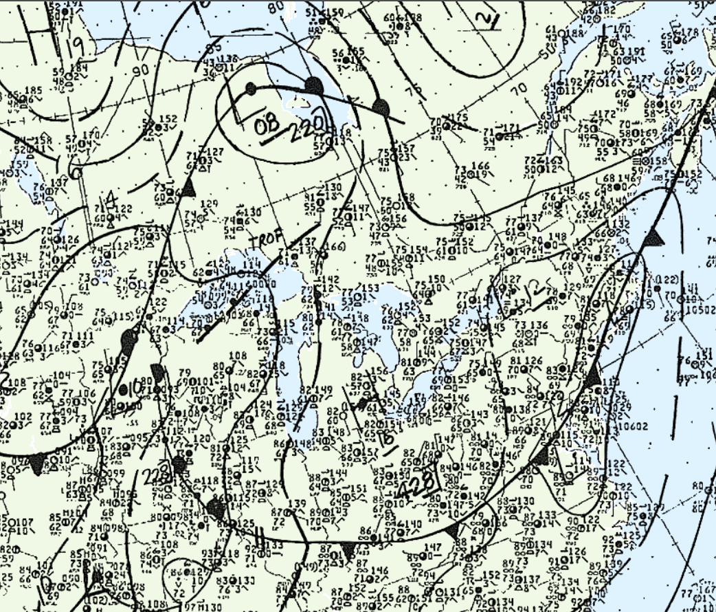
A pilot reported observing a funnel cloud touch down and lift debris into the air, however, no known damage was caused by the twister. The tornado’s southeasterly path was estimated given geostrophic vectors and surface analysis available for this day.
Figure 1 depicts the surface analysis at 2:00 pm EDT, showing the Great Lakes region under an area of high pressure. The convection that led to the formation of this tornado was therefore initiated by a lake-breeze originating from Lake Huron. The southeasterly motion of this lake-breeze (parallel to the lake shore), is where the estimated motion for this tornado came from.
According to Environment and Climate Change Canada (2018), an F0 tornado touched down at 4:45 pm EDT near Centralia, ON. The track and maximum width of this tornado was not documented by ECCC. The tornado caused no injuries, fatalities or property damage.
Sources
NWS Weather Prediction Center Surface Analysis Archive. (2017). Surface analysis 18Z Sun Jul 27 1986. Retrieved from: https://www.wpc.ncep.noaa.gov/archives/web_pages/sfc/sfc_archive.php
Environment and Climate Change Canada Data. (2018). Canadian National Tornado Database: Verified Events (1980-2009) – Public. Retrieved from: http://donnees.ec.gc.ca/data/weather/products/canadian-national-tornado-database-verified-events-1980-2009-public/