

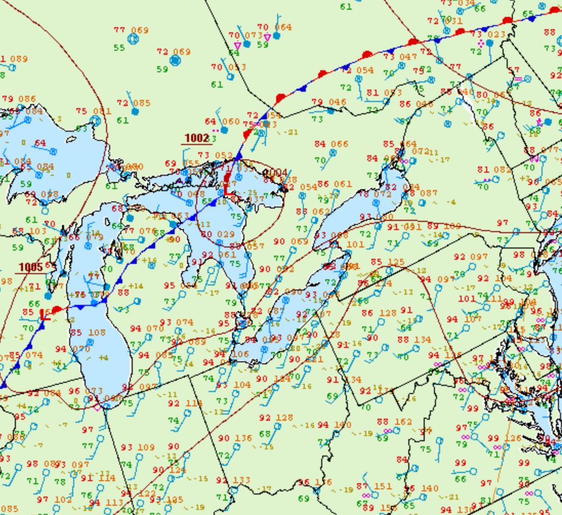
Figure 1 depicts the surface observations at 5:00 pm EDT, which shows a low pressure over Georgian Bay with a cold front stretching into Michigan. This cold front became the focus for intense thunderstorms in the evening hours of August 2nd, which ultimately led to a tornado outbreak across southern Ontario.
According to Environment and Climate Change Canada (2018), an F0 tornado touched down at 8:10 pm near Coxvale, ON. The tornado travelled for 1.22 km with a maximum width of 100 metres. The tornado caused no fatalities, injuries or property damage.
Sources
NWS Weather Prediction Center Surface Analysis Archive. (2017). Surface analysis 21Z Wed Aug 2 2006. Retrieved from: https://www.wpc.ncep.noaa.gov/archives/web_pages/sfc/sfc_archive.php
Environment and Climate Change Canada Data. (2018). Canadian National Tornado Database: Verified Events (1980-2009) – Public. Retrieved from: http://donnees.ec.gc.ca/data/weather/products/canadian-national-tornado-database-verified-events-1980-2009-public/