

Figure 1 depicts the surface analysis at 1:00 pm CDT, where an outflow boundary is observed just west of Dryden, just south of a stationary front. Figure 1 also depicts ongoing thunderstorms at the Manitoba/Ontario border.
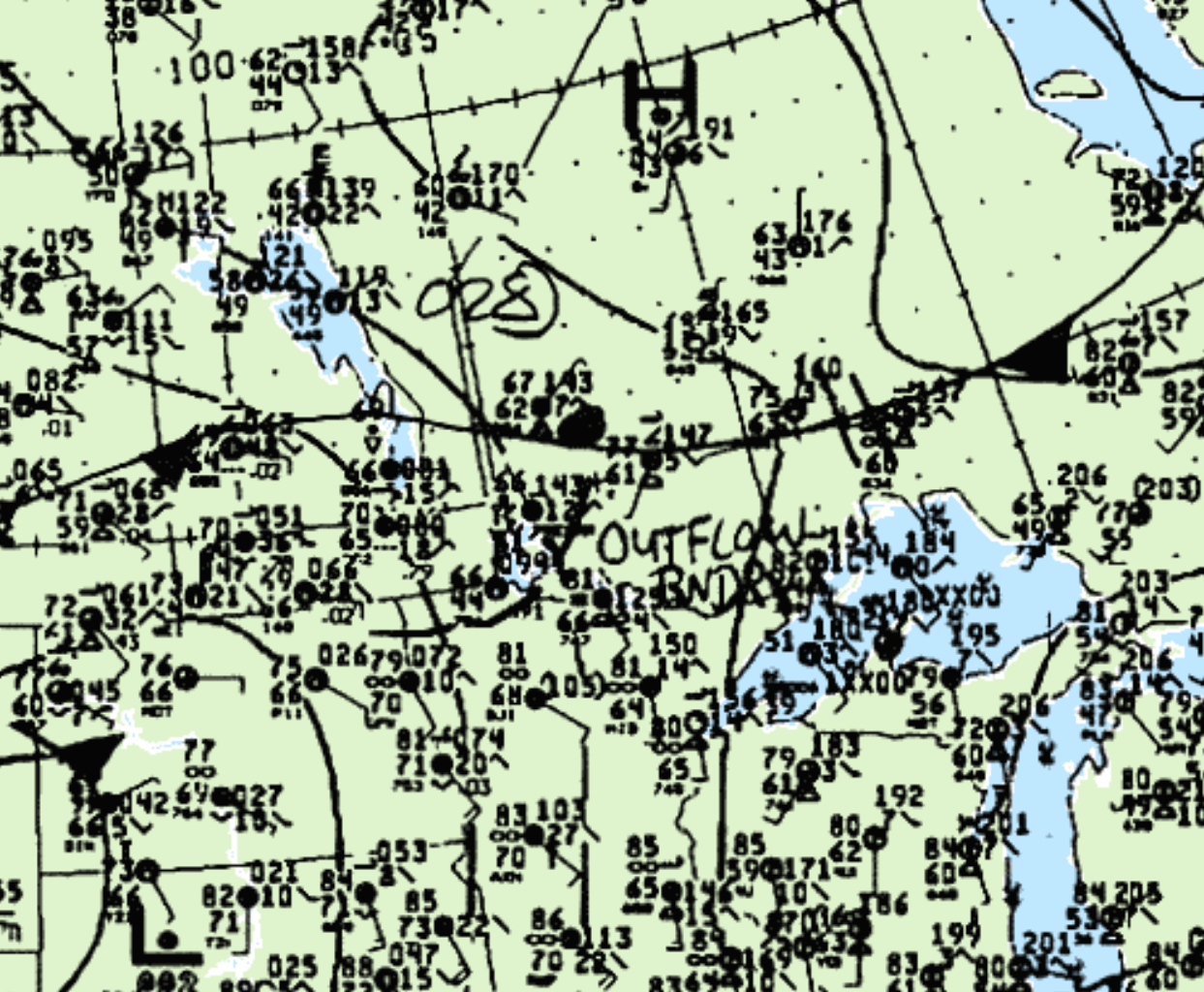
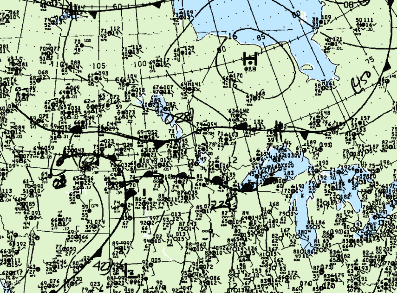
Figure 2 depicts a strong low “occluding” in southern Saskatchewan, with a warm front stretching across North Dakota into the Great Lakes. A stationary boundary stretches from Alberta to northern Quebec, separating an area of high pressure. The interaction from the warm front, stationary front and outflow boundary likely played a role in the development of this tornado.
According to Environment and Climate Change Canada (2018), an F0 tornado touched down at 8:00 pm CDT near Dryden, ON. The track and width of the tornado was not documented by ECCC. The tornado caused no injuries, fatality or property damage.
Sources
NWS Weather Prediction Center Surface Analysis Archive. (2017). Surface analysis 18-00Z Wed Jun 26 1991. Retrieved from: https://www.wpc.ncep.noaa.gov/archives/web_pages/sfc/sfc_archive.php
Environment and Climate Change Canada Data. (2018). Canadian National Tornado Database: Verified Events (1980-2009) – Public. Retrieved from: http://donnees.ec.gc.ca/data/weather/products/canadian-national-tornado-database-verified-events-1980-2009-public/