

The F2 tornado at Durham, Ontario. In the mid afternoon, the first supercell of the day formed over southeast Lower Michigan. It tracked across the southern tip of Lake Huron into Ontario and, at approximately 4:00pm, produced the first tornado of what would become Canada’s largest outbreak on record. It touched down to the southwest of Ayton and tracked for 48km to the northeast of Markdale, destroying barns, knocking down power poles and levelling swaths of forest along its path which was up to 400m wide.
About halfway through its track, the tornado passed through and devastated the south side of Durham. There, several large offices, supply stores and warehouses in an industrial park were torn apart with debris scattered hundreds of metres away. Houses in and around town had windows smashed and their roofs torn off. Tragically, at a day camp that was taking place at the conservation area on the east side of Durham, children were unable to find shelter as trees were snapped and tents and concession stands were thrown by the twister. Several children were injured and an eleven year old boy was killed by flying debris.
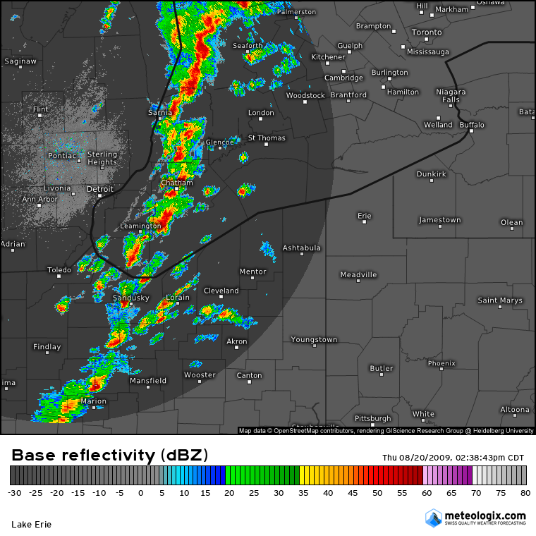
Figure 1 depicts a line of severe thunderstorms entering southwestern Ontario from Michigan. These thunderstorms were responsible for the tornado outbreak on this day.
The tornado was witnessed by residents of Durham who watched in horror as the it swept through their town. It was large and bowl-shaped, an ominous grey mass that at times exhibited a multiple vortex structure. They captured photos and video of the tornado as it ripped through the town’s industrial park, tearing buildings and walls off of buildings as it churned with more and more debris.
This was the first of nineteen tornadoes that struck Southern and Central Ontario on August 20.
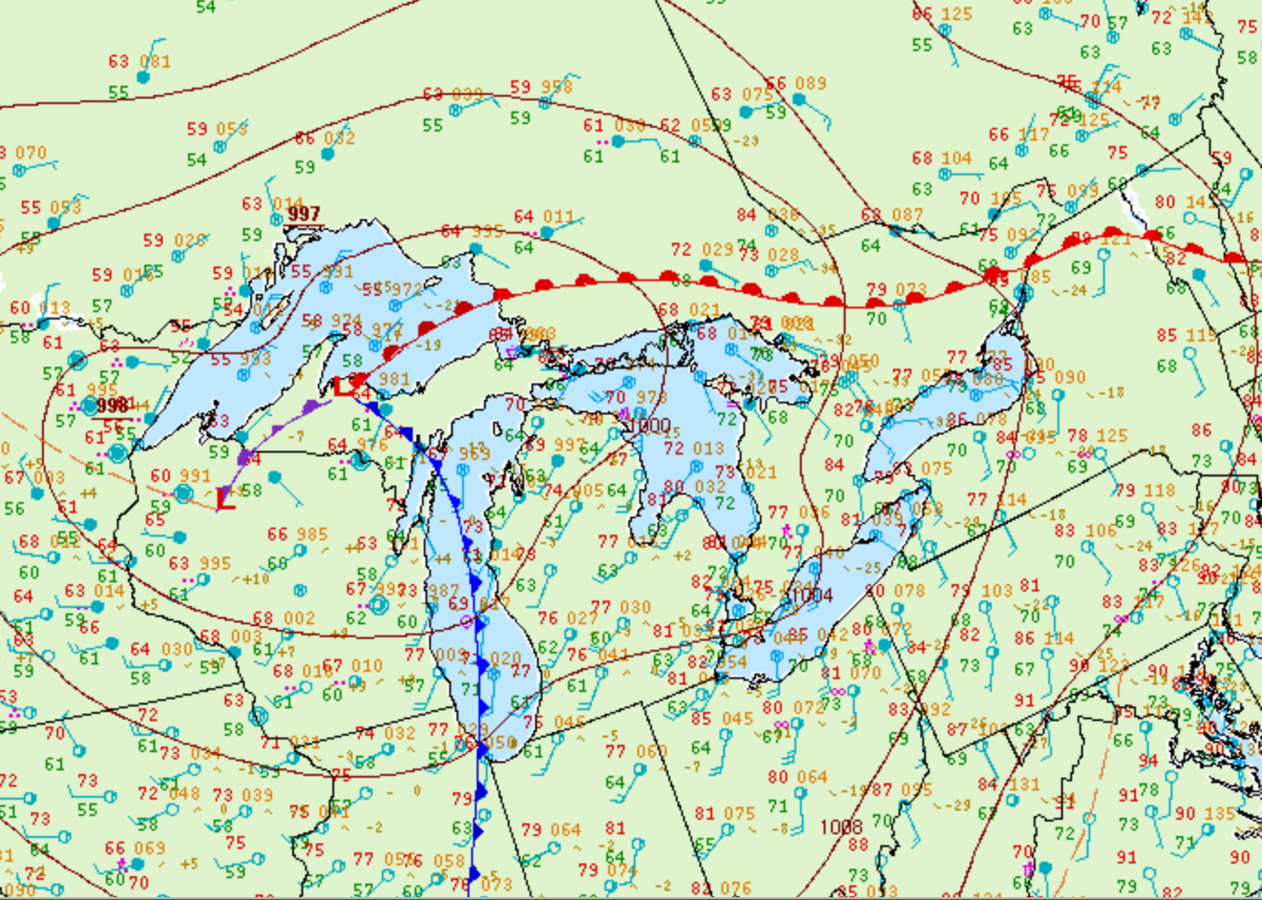
Figure 2 depicts the surface observations at 5:00 pm EDT, which shows a cold front moving through the Great Lakes and a warm front in central Ontario. The warm sector (southern Ontario), brought southerly winds moving across the open waters of Lake Ontario and Lake Erie. The advancing cold front and possible interactions with lake-breeze boundaries developed pre-frontal storms across southwestern Ontario, which moved east and brought one of the most significant tornado outbreak in Ontario’s history.
According to Environment and Climate Change Canada (2018), an F2 tornado touched down at 4:00 pm in Durham, ON. The tornado travelled for 48 km and had a maximum width of 400 metres. The tornado caused no injuries or property damage, but caused one fatality.
Sources
NWS Weather Prediction Center Surface Analysis Archive. (2017). Surface analysis 21Z Thu Aug 20 2009. Retrieved from: https://www.wpc.ncep.noaa.gov/archives/web_pages/sfc/sfc_archive.php
Environment and Climate Change Canada Data. (2018). Canadian National Tornado Database: Verified Events (1980-2009) – Public. Retrieved from: http://donnees.ec.gc.ca/data/weather/products/canadian-national-tornado-database-verified-events-1980-2009-public/