

The first of three tornadoes caused by low-topped supercells in the Muskoka region during the morning, this twister knocked down trees and hydro poles, and caused minor damage to a school. Its path was 1.5 kilometres long and 100 metres wide. Damage from the three tornadoes was estimated at around $50,000.
The other two tornadoes that touched down included an F0 at Vasey, and another F0 near Bracebridge.
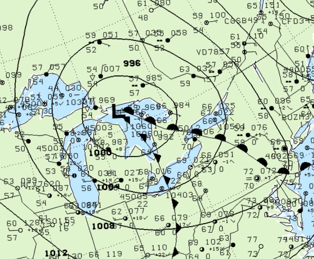
Figure 1 depicts the surface observations at 8:00 am EDT, which shows a low pressure over Lake Huron with a cold front extending into southwestern Ontario and a warm front extending into southern Ontario. These fronts became the focus of intense thunderstorms in the early morning hours of July 11th, which ultimately led to this tornado.
According to Environment and Climate Change Canada (2018), an F0 tornado touched down at 10:00 am EDT near Elmvale, ON. The tornado travelled for 1.5 km with a maximum width of 100 metres. The tornado caused no fatalities, injuries or property damage.
Sources
NWS Weather Prediction Center Surface Analysis Archive. (2017). Surface analysis 12Z Fri Jul 11 2003. Retrieved from: https://www.wpc.ncep.noaa.gov/archives/web_pages/sfc/sfc_archive.php
Environment and Climate Change Canada Data. (2018). Canadian National Tornado Database: Verified Events (1980-2009) – Public. Retrieved from: http://donnees.ec.gc.ca/data/weather/products/canadian-national-tornado-database-verified-events-1980-2009-public/