

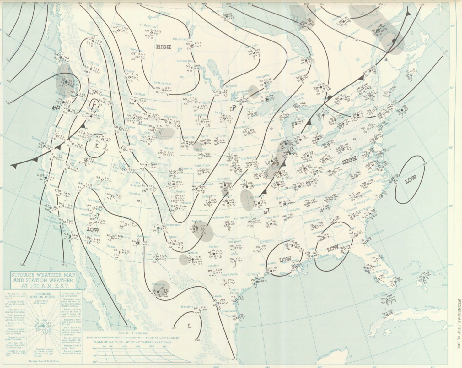
Figure 1 depicts the surface observations at 2:00 am EDT, which shows a stationary front across Ontario and Quebec and a cold front across the U.S. Midwest. This was Massachusetts only documented tornado of 1960.
The Essex County, MA F0 tornado of July 13, 1960 impacted Essex County in Massachusetts. According to NOAA (2019), the F0 tornado caused no fatalities or injuries, but caused $30 dollars in property damage. The tornado touched down in Essex County south of Riverside Drive at 5:00 pm EDT. The tornado travelled for 0.1 miles and had a maximum width of 33 yards.
Sources
NOAA Central Library. (2019). U.S. Daily Weather Maps. Wednesday July 13, 1960 [PDF]. Retrieved from https://library.noaa.gov/Collections/Digital-Collections/US-Daily-Weather-Maps
NOAA National Centers for Environmental Information (2019). Storm Events Database. Retrieved from: https://www.ncdc.noaa.gov/stormevents/