

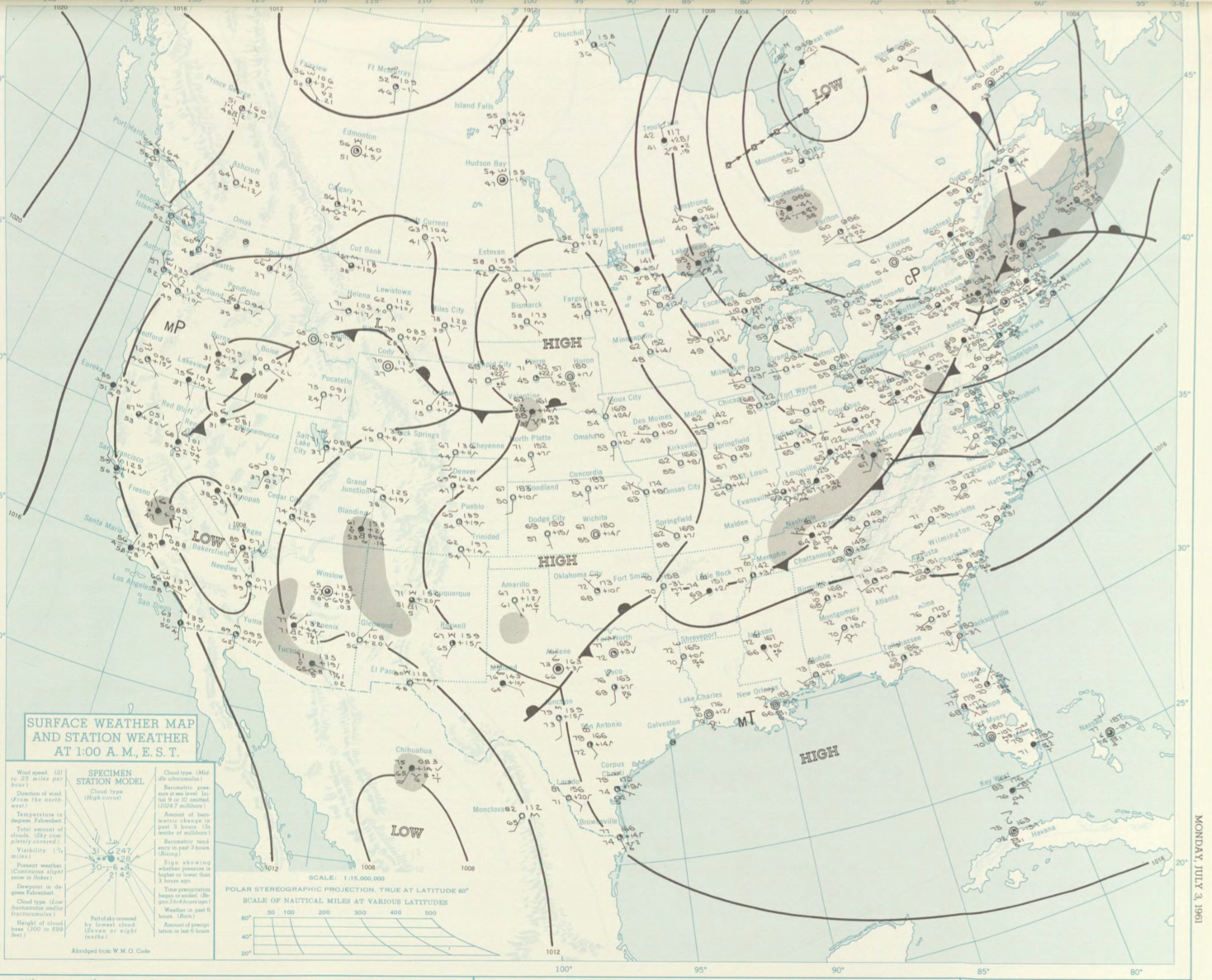
Figure 1 depicts the surface observations at 2:00 am EDT, which shows a cold front across the northeastern United States. This cold front likely became stationary throughout the day as the low pressure system over James Bay continued to occlude. This front then likely became the focus for thunderstorm activity throughout the afternoon hours of July 3rd, which ultimately led to this tornado.
The Farm Hill, MA F0 tornado of July 3, 1961 impacted Middlesex County in Massachusetts. According to NOAA (2019), the F0 tornado caused no fatalities or injuries, but caused $25 thousand dollars in property damage. The tornado touched down in Middlesex County near Main Street at 5:00 pm EDT. The tornado travelled for 0.5 miles and had a maximum width of 33 yards.
Sources
NOAA Central Library. (2019). U.S. Daily Weather Maps. Monday July 3, 1961 [PDF]. Retrieved from https://library.noaa.gov/Collections/Digital-Collections/US-Daily-Weather-Maps
NOAA National Centers for Environmental Information (2019). Storm Events Database. Retrieved from: https://www.ncdc.noaa.gov/stormevents/