

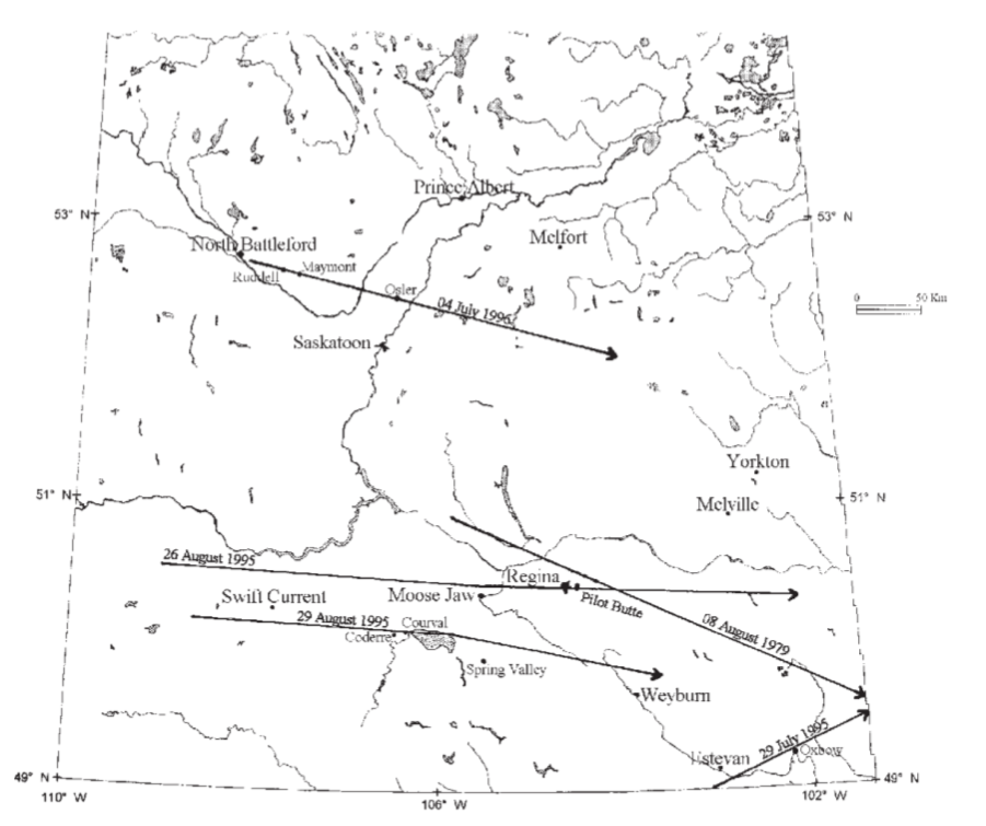
According to ECCC (2017), “severe thunderstorms on July 4 spawned at least eight tornadoes in Saskatchewan. Winds of 140 km/h and hail the size of golf balls produced $15 million in property damage”. According to McInnis (2001), a long-track supercell, which began near North Battleford, SK, laid down a 300 km long hailswath that extended from North Battleford to Watson area (Figure 11).
The Forecast
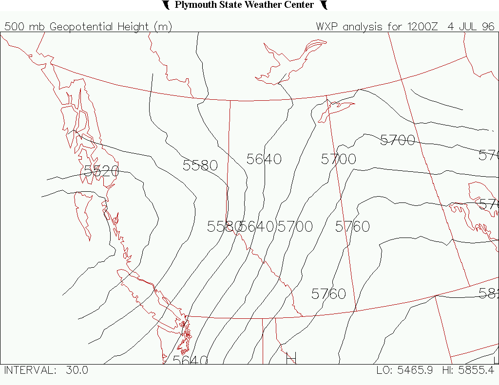
Figure 1 and Figure 2 depict the upper-levels of the atmosphere (500mb) on July 4, 1996. The synoptic pattern was characterized by an upper-level trough and its associated low pressure off the coast of British Columbia. A ridge was seen extending into Saskatchewan, bringing southerly winds and warm temperatures (Figure 5) into the province.

Figure 3 depicts the situation at the surface level. In Figure 3, we can see several low pressures. The low pressure of interest for this day is the one in southwestern Saskatchewan, with its associated cold front extending into Montana. From this low, a stationary front is extending across south-central Saskatchewan into the Manitoba low pressure. This stationary boundary will move north slowly and become the focus for convective development later in the day.
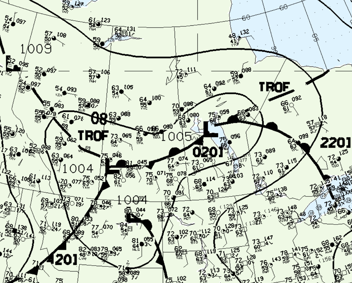
At 00Z (Figure 4) or 6:00 pm local time, the stationary front is just south of North Battleford, SK. The corridor along the Yellowhead Highway from North Battleford to Saskatoon will become the focus for intense convection during this time frame.

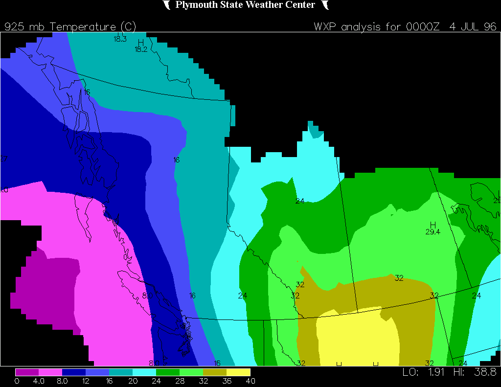
Figure 5 depicts the 925mb temperatures, which were in the mid to high 30 C. Dew points were quite low along the cold front, but were in the mid 60 F along the stationary boundary in south-central Saskatchewan (Figure 3 & 4).
Storm Evolution
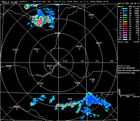
Below is a series of radar imagery from July 4, 1996. While these may be a bit confusing, please note that the station labelled “YQW” in the top left corner is North Battleford, SK and that station labelled “YXE” is Saskatoon, SK.
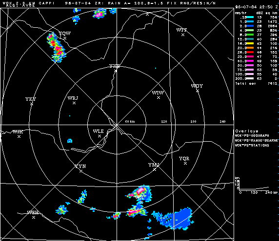
A cluster of thunderstorms can be observed initiating just south-southwest of North Battleford on Figure 6 at 4:50 pm local time (2250Z).
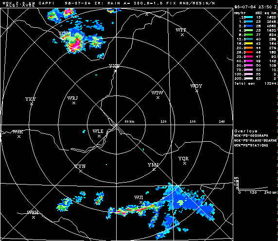
As this cluster moves east (Figure 7), it congeals into one single supercell and moves on the southeastern side of North Battleford. At 2350Z (5:50 pm local time), this supercell is exhibiting a classic “hook echo” on radar and tornado characteristics. According to ECCC (2018), this storm dropped an F2 tornado at 5:45 pm local time (Figure 7), referred to as the “Maymont, SK F2 tornado“.
Ten minutes later at 6:00 pm (00Z), a significant hook is seen on radar (Figure 8) just southeast of North Battleford (YQW). At 6:04 pm, the Fielding, SK F3 would develop just north of the Yellowhead Highway (ECCC, 2018).

At 7:00 pm local time (0100Z), a hook is still observed north of Saskatoon (YXE) on Figure 9. According to the University of Manitoba (2009), an estimated 11 documented tornadoes occurred, with three tornadoes estimated to have tracks greater than 10 km long.
Figure 10 depicts the radar loop of the entire life cycle of the tornadic supercell of July 4, 1996. University of Manitoba (2009) notes that as the thunderstorm approached the Osler and Saskatoon areas, it became outflow dominant but ” eight more tornadoes have been documented”. An F2 tornado developed west of Rheinland, SK and tracked 15 km southeast with a maximum width of one kilometre (University of Manitoba, 2009).
Recap
According to the University of Manitoba (2009), a single supercell thunderstorm formed 60 km south of North Battleford in Saskatchewan and moved east-northeastward. The storm began exhibiting tornadic characteristics as it moved north of the North Saskatchewan River basin, where it dropped an F2 tornado southeast of Maymont, SK (University of Manitoba, 2009). According to ECCC (2018), an F3 tornado developed at 6:04 pm local time near Fielding, SK and tracked northeast for 26.3 km. The F3 tornado had a maximum width of 1.5 km, caused no injuries/casualties and caused no property damage. However, ECCC (2017) reports that storms on July 4, 1996 dropped hail the size of golf balls and had damaging 140 km/h winds, which caused $15 million dollars in property damage.
There are many discrepancies about the amount of tornadoes that actually occurred on this day. Here are four different “versions” of the amount of tornadoes that occurred on July 4, 1996:
ECCC (2017): “severe thunderstorms on July 4 spawned at least eight tornadoes in Saskatchewan”.
University of Manitoba (2009): “an estimated 11 documented tornadoes occurred […]”.
ECCC (2018): three tornadoes, one F3 near Fielding, SK, one F2 near Maymont, SK and one F1 near Warman, SK.
McInnis (2001): “along the way 2 tornadoes were sighted, one at Ruddell (17:00), the other at Maymont (18:00)”.
Source of each statement is provided below with links.
Sources
Plymouth State University. (2019). Plymouth State Weather Center. Retrieved from: https://vortex.plymouth.edu/myo/upa/ctrmap-a.html
Environment and Climate Change Canada (2017). Top ten weather stories for 1996. Retrieved from: http://www.ec.gc.ca/meteo-weather/default.asp?lang=En&n=C9311AEB-1#t8
NWS Weather Prediction Center (2017). Surface analysis 15Z Thu Jul 4 1996. Retrieved from: https://www.wpc.ncep.noaa.gov/archives/web_pages/sfc/sfc_archive.php
University of Manitoba (2009). The RADAR imagery from a major supercell on July 4, 1996. Retrieved from: http://www.umanitoba.ca/environment/envirogeog/weather/radarstudies/jul496.html
Environment and Climate Change Canada (2018). Canadian National Tornado Database: Verified Events (1980-2009) – Public. Retrieved from: http://donnees.ec.gc.ca/data/weather/products/canadian-national-tornado-database-verified-events-1980-2009-public/
McInnis, K. (2001). Thunderstorm “disasters” in Saskatchewan. Prairie Perspectives: Geographical Essays, volume 4. Retrieved from: https://www.google.com/url?sa=t&rct=j&q=&esrc=s&source=web&cd=1&cad=rja&uact=8&ved=2ahUKEwjv2a6YuorkAhXHnOAKHa_WArQQFjAAegQIARAC&url=http%3A%2F%2Fpcag.uwinnipeg.ca%2FPrairie-Perspectives%2FPP-Vol04%2FMcInnis.pdf&usg=AOvVaw2pwV6OYKSTbwNLRRrT7HIX