

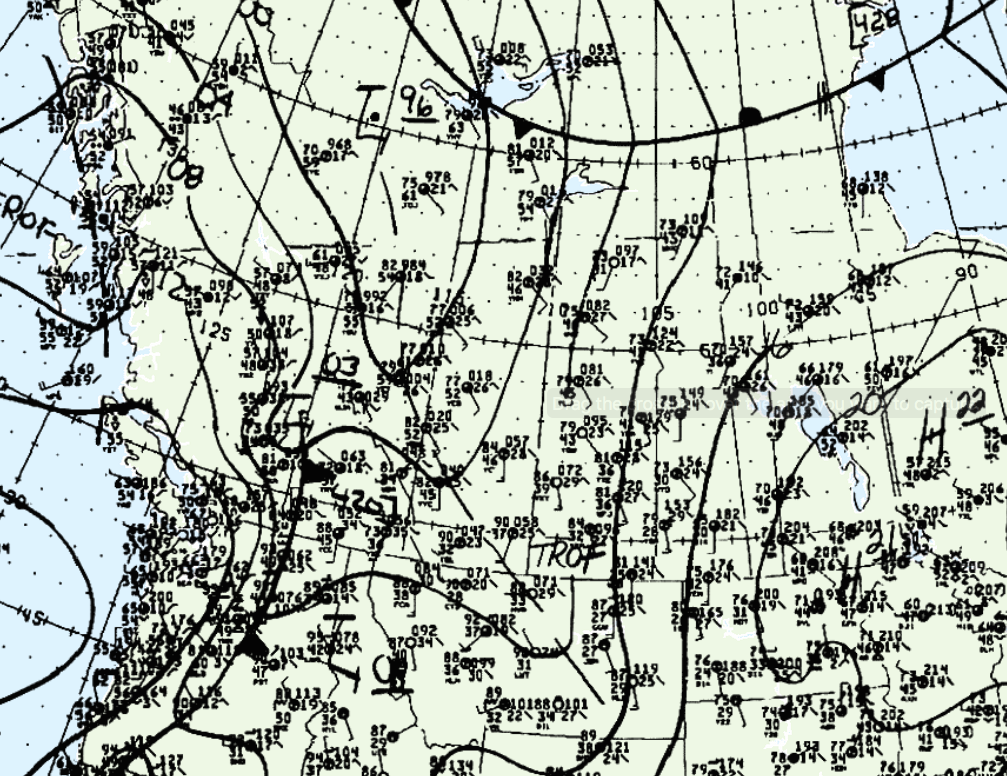
Figure 1 depicts the surface observations at 3:00 pm MDT, which shows a trough of low pressure. This trough became the focus for thunderstorms, which ultimately led to this tornado.
According to Environment and Climate Change Canada (2018), an F1 tornado touched down at 10:30 pm MDT near Fort Vermillion, AB. The path and width of the tornado was not documented by ECCC.
Sources
NWS Weather Prediction Center Surface Analysis Archive. (2017). Surface analysis 21Z Mon Aug 29 1988. Retrieved from: https://www.wpc.ncep.noaa.gov/archives/web_pages/sfc/sfc_archive.php
Environment and Climate Change Canada Data. (2018). Canadian National Tornado Database: Verified Events (1980-2009) – Public. Retrieved from: http://donnees.ec.gc.ca/data/weather/products/canadian-national-tornado-database-verified-events-1980-2009-public/