

Figure 1 depicts the surface observations at 8:00 am EDT, which shows a low pressure moving across northern Ontario with a trough extending into the northeastern United States. This front became the focus for thunderstorms across Massachusetts throughout the morning hours of May 18th, which ultimately led to this tornado.

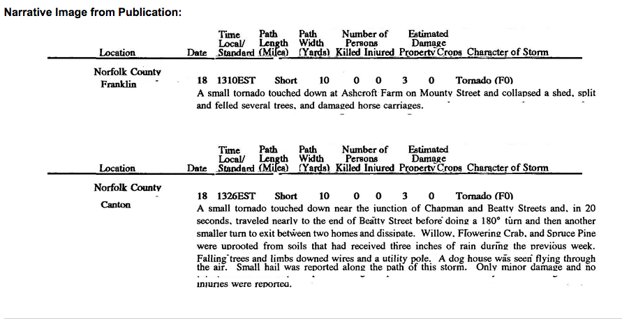
The Franklin, MA F0 tornado of May 18, 1990 impacted Norfolk County in Massachusetts. According to NOAA (2019), the F0 tornado caused no fatalities or injuries, but caused $2500 dollars in property damage. The tornado touched down near Cottage Street at 1:10 pm EDT. The tornado travelled for 0.2 mile and had a maximum width of 10 yards.
Sources
NOAA Central Library. (2020). U.S. Daily Weather Maps. Friday May 18, 1990 [PDF]. Retrieved from https://library.noaa.gov/Collections/Digital-Collections/US-Daily-Weather-Maps
NOAA National Centers for Environmental Information (2020). Storm Events Database. Retrieved from: https://www.ncdc.noaa.gov/stormevents/