

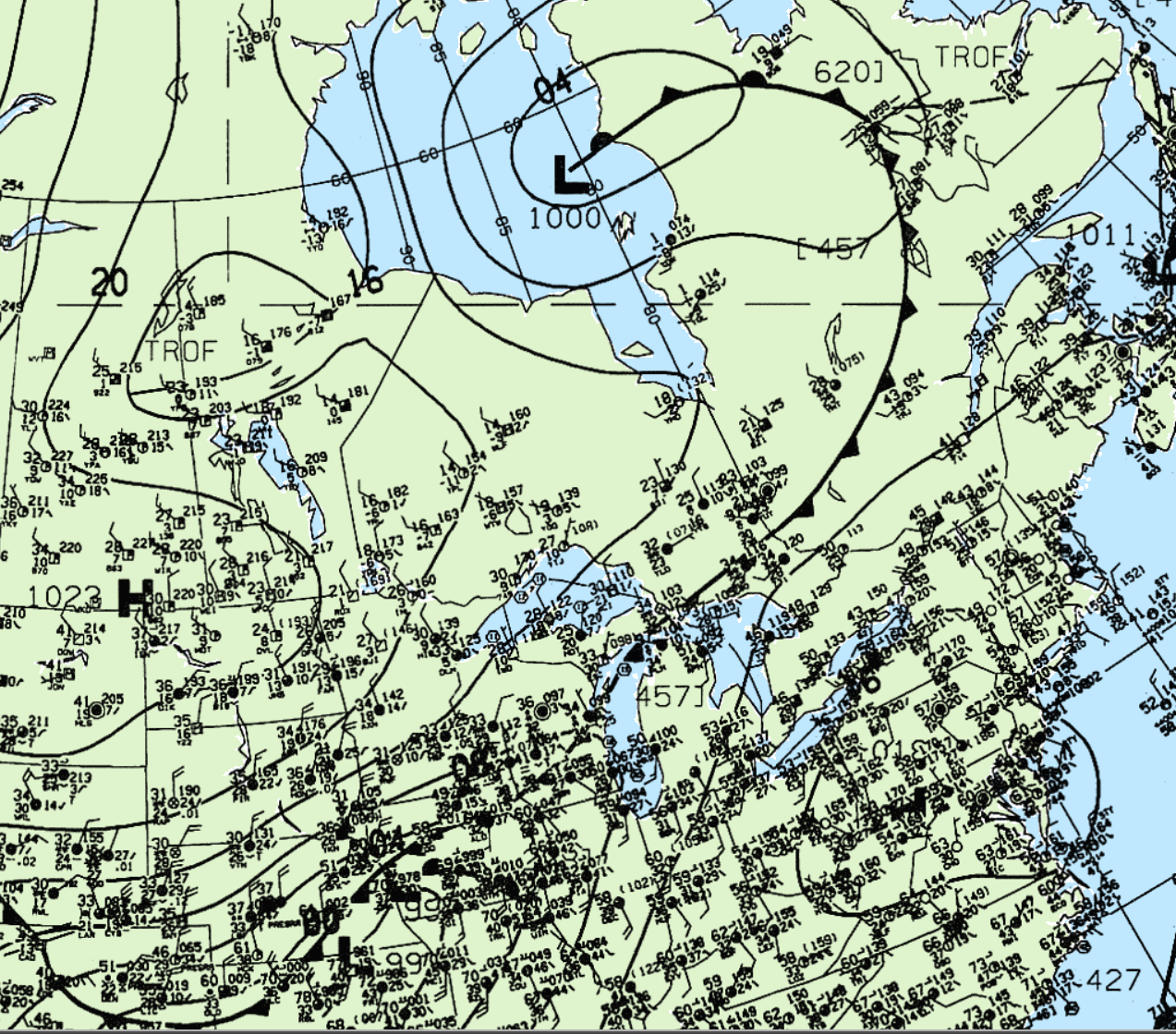
An unusual April tornado possibly occurred in southern Ontario on April 4, 1994. Figure 1 depicts the surface observations at 5:00 pm EDT (the time of the tornado), which depicts an occluding low over Hudson Bay, with a cold front extending into central Ontario.
Little is known about this tornado and we remain skeptical about it. Southerly winds ahead of the cold front would indicate vertical lift is occurring in the area in question. However, temperature profiles were in the single digits south of the front with some maximum temperatures of 10C possibly reaching the Franktown area with unfavourable dew points for convection.
With all of this said, the combination of wind vectors at a 90 degree angle from the front in the Franktown area and strong upper-level winds would have caused substantial veering in the area. While we are quite skeptical about the existence of this tornado, it is not entirely impossible that it occurred.
According to Environment and Climate Change Canada (2018), an F1 tornado touched down at 5:00 pm EDT near Franktown, ON. The path and width of the tornado was not documented by ECCC. The tornado caused no fatalities, injuries or property damage.
Source
NWS Weather Prediction Center Surface Analysis Archive. (2017). Surface analysis 21Z Sat Apr 4 1994. Retrieved from: https://www.wpc.ncep.noaa.gov/archives/web_pages/sfc/sfc_archive.php
Environment and Climate Change Canada Data. (2018). Canadian National Tornado Database: Verified Events (1980-2009) – Public. Retrieved from: http://donnees.ec.gc.ca/data/weather/products/canadian-national-tornado-database-verified-events-1980-2009-public/