

Figure 1 depicts the surface observations at 8:00 am EDT, which shows a stationary front across the northeastern United States with precipitation (shaded area) on its western side. This front was the focus for thunderstorm activity in the morning hours of August 10th, which ultimately led to this tornado.

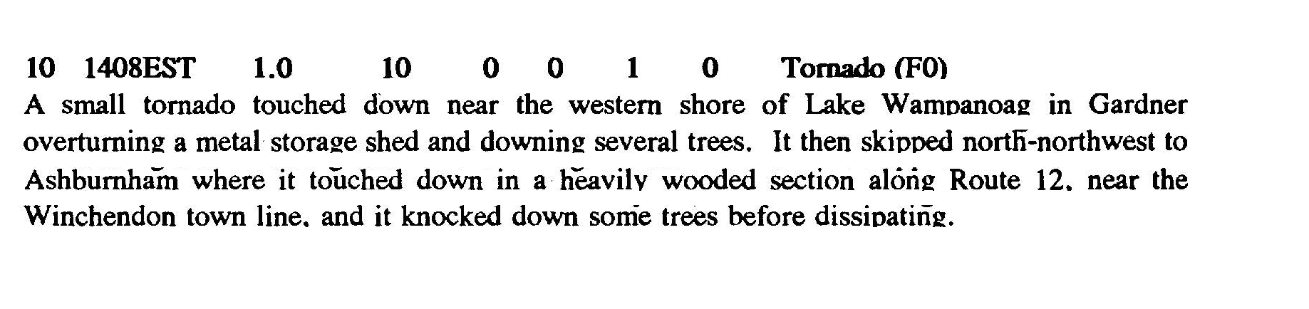
The Gardner, MA F0 tornado of August 10, 1990 impacted Worcester County in Massachusetts. According to NOAA (2019), the F0 tornado caused no fatalities or injuries, but caused $30 dollars in property damage. The tornado touched down near Crescent Road at 2:08 pm EDT. The tornado travelled for 1 mile and had a maximum width of 10 yards.
Sources
NOAA Central Library. (2020). U.S. Daily Weather Maps. Friday August 10, 1990 [PDF]. Retrieved from https://library.noaa.gov/Collections/Digital-Collections/US-Daily-Weather-Maps
NOAA National Centers for Environmental Information (2020). Storm Events Database. Retrieved from: https://www.ncdc.noaa.gov/stormevents/