

At 5:00 pm, the tornado touched down in a neighbourhood about 5 kilometres to the east of downtown Ottawa, and travelled for 3 kilometres along Ogilvie Road. Trees were snapped and uprooted, power poles knocked down and fences torn apart. An apartment building had most of its roof torn off, as did one nearby house, and the canopy was ripped off of a gas station and thrown 20 metres away. Witnesses reported observing a funnel cloud with debris.
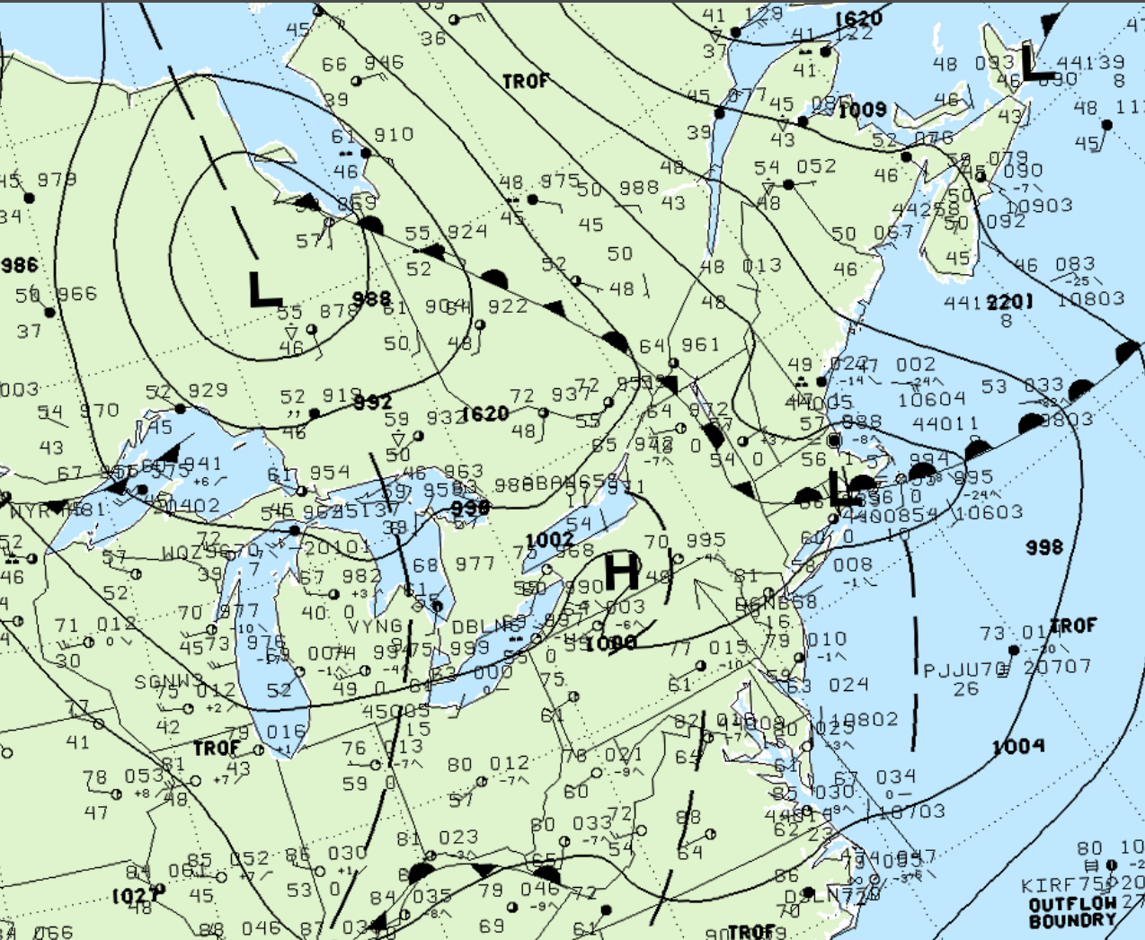
Figure 1 depicts the surface observations at 2:00 pm, which shows some pretty interesting features. A strong low pressure is seen over northern Ontario with a stationary front extending across Quebec and into New York, which is departing the area where this tornado occurred. A low pressure trough is seen developing off Lake Ontario into New York. While we don’t have the 21z maps, one would stipulate that this trough extended near Ottawa and played a role in triggering thunderstorms, which ultimately led to this F1 tornado.
According to Environment and Climate Change Canada (2018), an F1 tornado with winds up to 150 km/h touched down at 5:00 pm EDT near Gloucester, ON. The tornado travelled for 3 km with a maximum width of 150 metres. The tornado caused no fatalities or injuries, but caused $200 thousand dollars in property damage.
Sources
NWS Weather Prediction Center Surface Analysis Archive. (2017). Surface analysis 18Z Wed May 24 2000. Retrieved from: https://www.wpc.ncep.noaa.gov/archives/web_pages/sfc/sfc_archive.php
Environment and Climate Change Canada Data. (2018). Canadian National Tornado Database: Verified Events (1980-2009) – Public. Retrieved from: http://donnees.ec.gc.ca/data/weather/products/canadian-national-tornado-database-verified-events-1980-2009-public/