

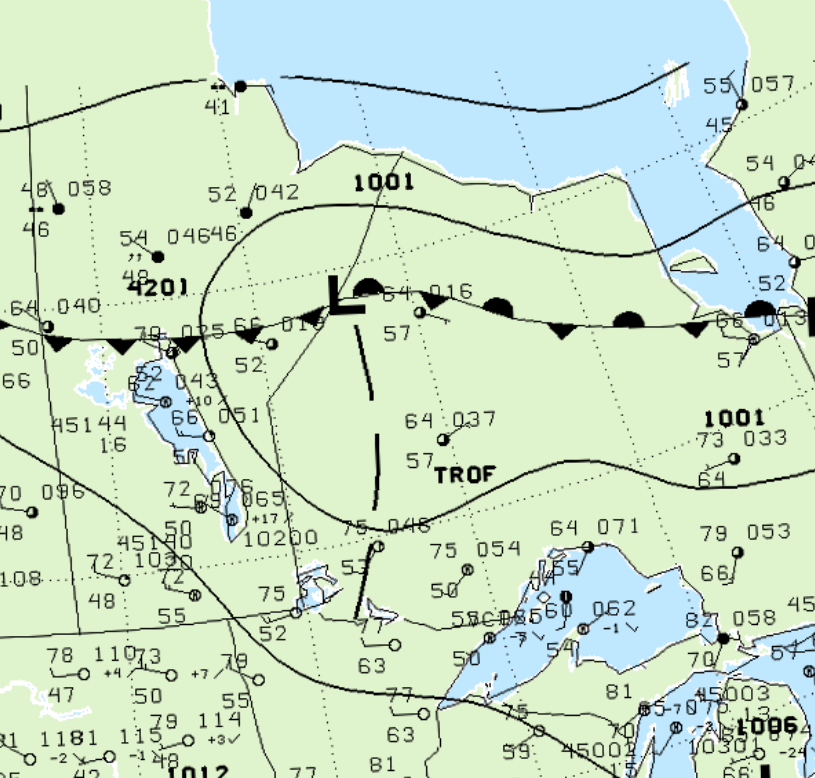
Figure 1 depicts the surface observations at 1:00 pm CDT, which shows a low pressure system on the Manitoba/Ontario border with a trough extending into northwestern Ontario. This trough became the focus for thunderstorm development in the early afternoon of July 4th, which ultimately led to this F1 tornado.
According to Environment and Climate Change Canada (2018), an F1 tornado touched down at 2:15 pm CDT near Goose Lake, ON. The tornado travelled for 16.2 km with a maximum width of 490 metres. The tornado caused no fatalities, injuries or property damage.
Sources
NWS Weather Prediction Center Surface Analysis Archive. (2017). Surface analysis 18Z Fri Jul 4 2003. Retrieved from: https://www.wpc.ncep.noaa.gov/archives/web_pages/sfc/sfc_archive.php
Environment and Climate Change Canada Data. (2018). Canadian National Tornado Database: Verified Events (1980-2009) – Public. Retrieved from: http://donnees.ec.gc.ca/data/weather/products/canadian-national-tornado-database-verified-events-1980-2009-public/