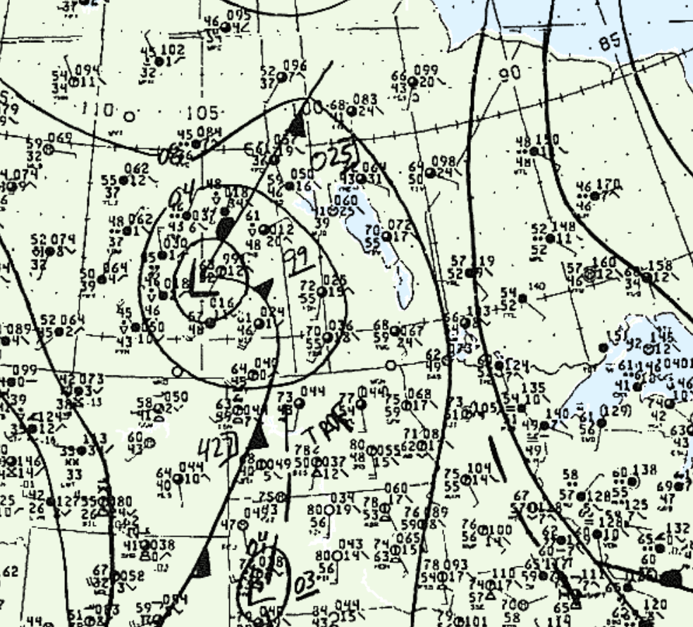
Figure 1 shows the surface observations at 4:00 pm CDT, which shows a low pressure system over Saskatchewan with a cold front extending south into western North Dakota and Wyoming and a stationary front extending northeast across Saskatchewan. A prefrontal trough is observed across central North Dakota. Prefrontal storms likely developed in the afternoon hours of May 11th across southern Manitoba, which ultimately led to this tornado.

According to Environment and Climate Change Canada (2018), an F1 tornado touched down at 5:25 pm CDT 19 km south of Morden, MB. The tornado travelled for 6.4 km and had a maximum width of 400 metres. The tornado caused no fatalities, injuries or property damage.
Sources
NWS Weather Prediction Center Surface Analysis Archive. (2017). Surface analysis 21Z Sun May 11 1986. Retrieved from: https://www.wpc.ncep.noaa.gov/archives/web_pages/sfc/sfc_archive.php
Environment and Climate Change Canada Data. (2018). Canadian National Tornado Database: Verified Events (1980-2009) – Public. Retrieved from: http://donnees.ec.gc.ca/data/weather/products/canadian-national-tornado-database-verified-events-1980-2009-public/

