

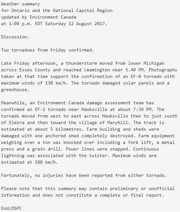
This tornado touched down at 7:30 pm and caused damage to farms northwest of Kitchener, near the town of Hawkesville. It tracked along the south edge of town, then passed south of Elmira and dissipated as it approached Maryhill. It was caught by storm chaser Mark Benest, whose photos show a dark, fat cone tornado wrapped in rain and fully-condensed to the ground. In some photos, debris can be seen lofted in the air around the funnel. The tornado tore across Ament Line on the south side of the town, leaving snapped trees and fallen power poles, as well as a wide swath of flattened corn fields. It struck several farms, damaging and destroying outbuildings. At one farm was particularly hard-hit, roofing was torn from a barn, the top was blown off of a silo, and a large well-anchored drive shed was ripped apart. In addition, heavy farm equipment including a forklift, a metal press and a grain drill were toppled over. Debris from that and other properties was scattered for hundreds of metres through fields and was left caught in fences and dangling from trees.
Meteorologists, storm chasers and residents tracked the event as it unfolded, and then documented the damage that was left behind. A post-storm survey by Environment Canada revealed that the tornado had a path that was 6 kilometres long and up to 250 metres wide. Emergency vehicles and EMS crews flooded to the area as the storm passed, though fortunately no injuries were reported.
This was the second of two tornadoes that touched down in Southern Ontario on August 11; the first was an EF0 tornado at Leamington.
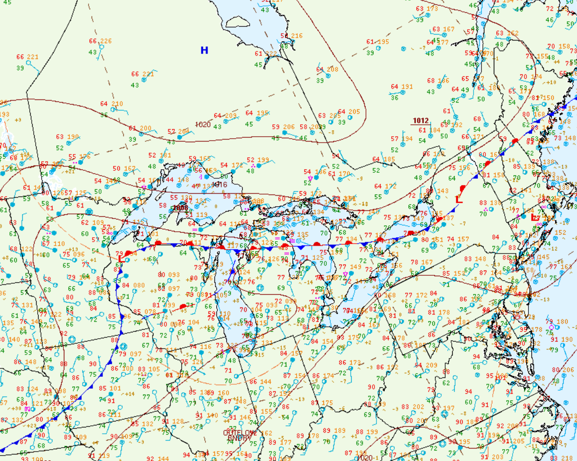
Figure 1 depicts the surface observations at 8:00 pm EDT, which shows a low pressure system over Owen Sound with a cold front extending south into southwestern Ontario and a warm front extending east into central Ontario/Quebec. A thunderstorm (marked as a red ‘R’) was also observed over London.
Damage Pictures
Sources
NWS Weather Prediction Center Surface Analysis Archive. (2017). Surface analysis 00Z Sat Aug 12 2017. Retrieved from: https://www.wpc.ncep.noaa.gov/archives/web_pages/sfc/sfc_archive.php