This EF0 tornado was spawned over Head Lake and was caught on camera by stunned cottagers as it touched down for several minutes. It formed beneath a broad and ragged wall cloud, first appearing as a circular spray of water beneath a slender cone; it then condensed downward to form a narrow elephant trunk. The tornado likely dissipated just as it reached the shoreline.
Several cottagers videotaped the event, with one video showing what may be a second rope tornado touching down alongside the first, but somewhat obscured by trees in the foreground. In another eyewitness video, a couple can be heard discussing two tornadoes over the lake and, indeed, their footage does seem to show two distinct circulations over the water; the second of which is more formidable and appears to reach the shore. Regardless, Environment Canada confirmed only one tornado at Head Lake and so this is officially documented as a single tornado.
This was one of five tornadoes that touched down on August 7, 2013. The others:
- Orillia (EF0)
- Carnarvon (EF1)
- Arthur (EF0)
- West Guilford (EF1)

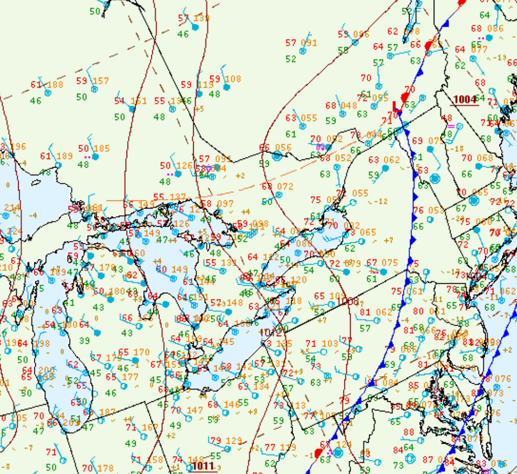
Figure 1 depicts the surface observations at 5:00 pm EDT, which shows a trough of low pressure in central Ontario behind a cold from over the northeastern United States. This trough promoted convergence and thunderstorm development in the afternoon and evening hours of August 7th, which led to a tornado outbreak across central Ontario.
Sources
NWS Weather Prediction Center Surface Analysis Archive. (2017). Surface analysis 21Z Tue Aug 13 2013. Retrieved from: https://www.wpc.ncep.noaa.gov/archives/web_pages/sfc/sfc_archive.php

