

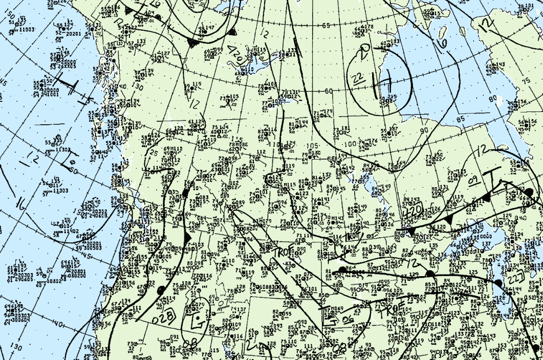
Figure 1 depicts the surface observations at 12:00 pm MDT.
According to Environment and Climate Change Canada (2018), an F0 tornado touched down 27 km west of High Prairie, AB. The path and width of the tornado was not documented by ECCC, but the tornado caused $25 thousand dollars in property damage.
Sources
NWS Weather Prediction Center Surface Analysis Archive. (2017). Surface analysis 18Z Wed Jul 29 1987. Retrieved from: https://www.wpc.ncep.noaa.gov/archives/web_pages/sfc/sfc_archive.php
Environment and Climate Change Canada Data. (2018). Canadian National Tornado Database: Verified Events (1980-2009) – Public. Retrieved from: http://donnees.ec.gc.ca/data/weather/products/canadian-national-tornado-database-verified-events-1980-2009-public/