

According to Shortt (2004), the Union City tornado provided researchers their first opportunity to see the entire life cycle of a tornado.
“While researchers from the NOAA National Severe Storms Laboratory filmed the tornado, other researchers collected data on the storm using experimental Doppler radar. When they were able to process the radar data and compare it with the time-stamped photos and movies, they discovered a unique pattern now known as the Tornadic Vortex Signature (TVS). This discovery revolutionized the National Weather Service’s ability to warn for tornado activity with sufficient lead time to save lives” (NOAA National Severe Storms Lab, 2019).
The Forecast
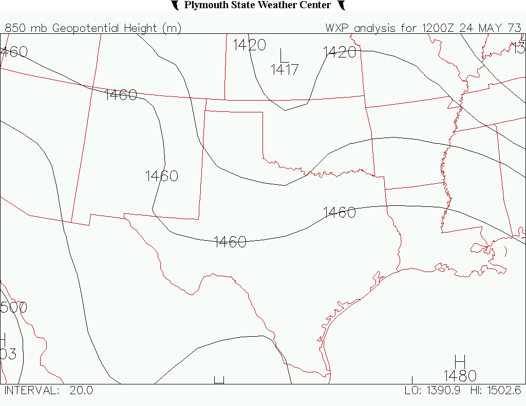
Figure 2 depicts the upper-levels on the morning of May 24, 1973. An upper-level low was seen in Kansas advecting warm/moist air from the Gulf of Mexico into the Southern Plains. Figure 3 depicts dewpoints in the 22 C range for most of the Southern Plains at 7:00 pm CDT.
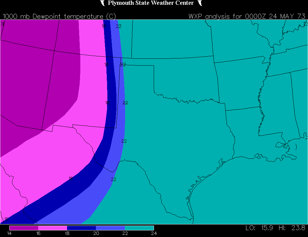
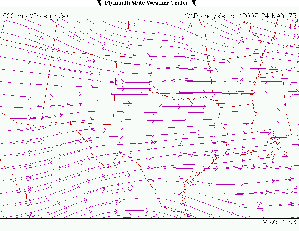
Westerlies were the predominate synoptic feature (Figure 4) at the 500mb level. Not much going on in terms of upper-level forcing. Looking at Figure 3, a dryline may have been the culprit in initiating storms on this day, with dewpoints in the 14-18 C range in New Mexico.
The combination of moisture, dryline and westerlies was enough to initiate a supercell thunderstorm near Union City, OK and the rest is history.
The Tornado
According to NOAA’s Environmental Data Service (1973), an intense tornado touched down several miles west-northwest of Union City moving east-southeastward through the city then turning more southeastward for several miles.
According to NOAA’s Environmental Data Service (1973), 22 homes and 18 mobile homes were destroyed. 20 homes sustained major damage and 23 homes sustained minor damage. Several commercial buildings and churches sustained heavy damage. Some farm animals were killed and crops damaged.
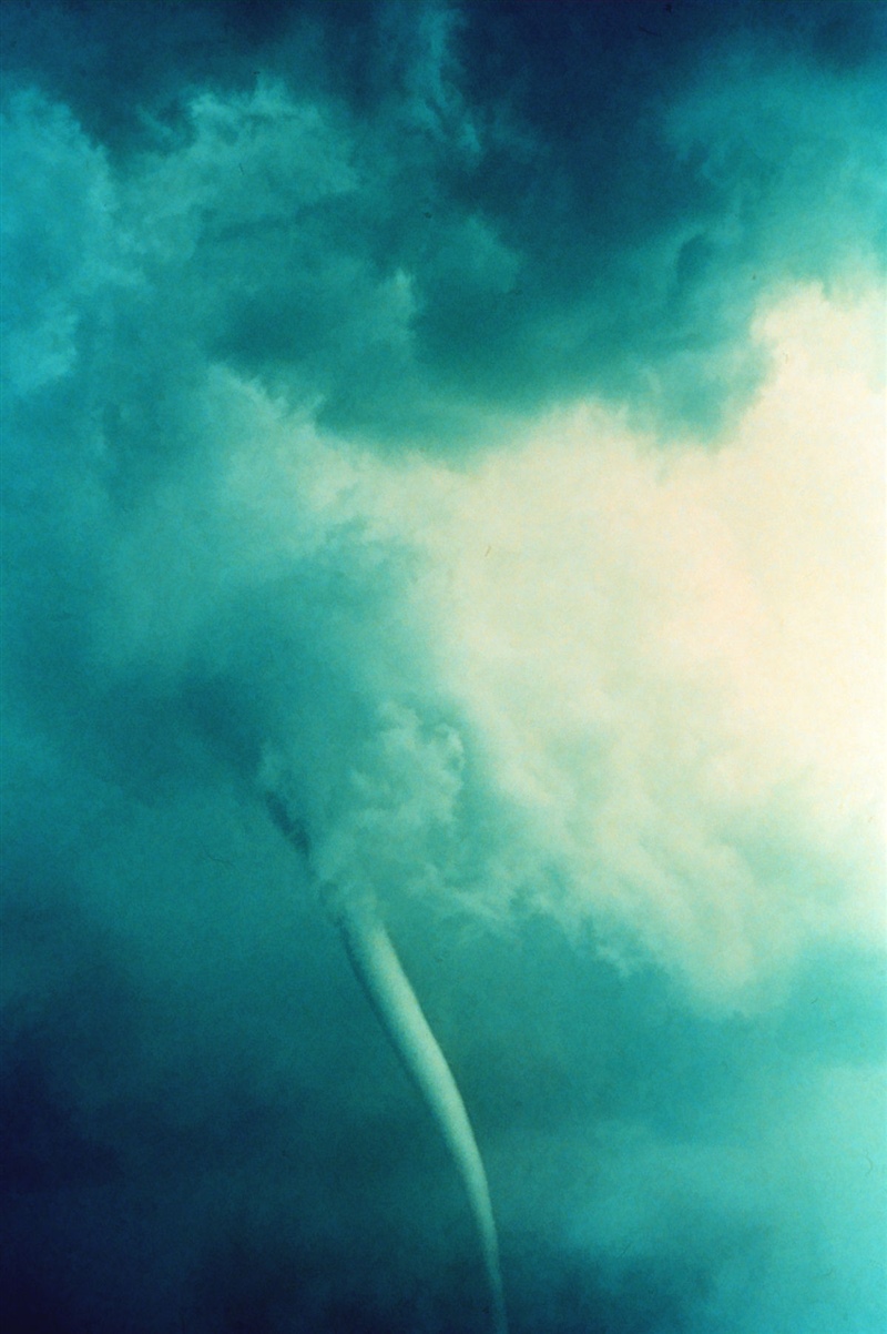
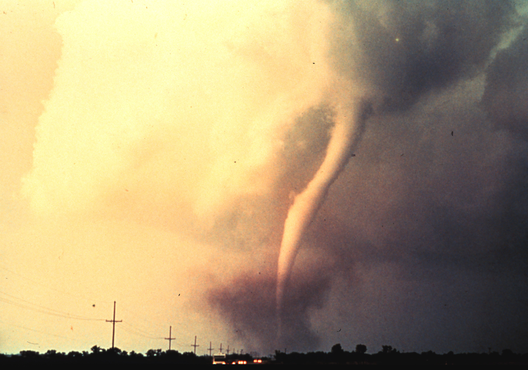
NOAA Photo Library (2018) 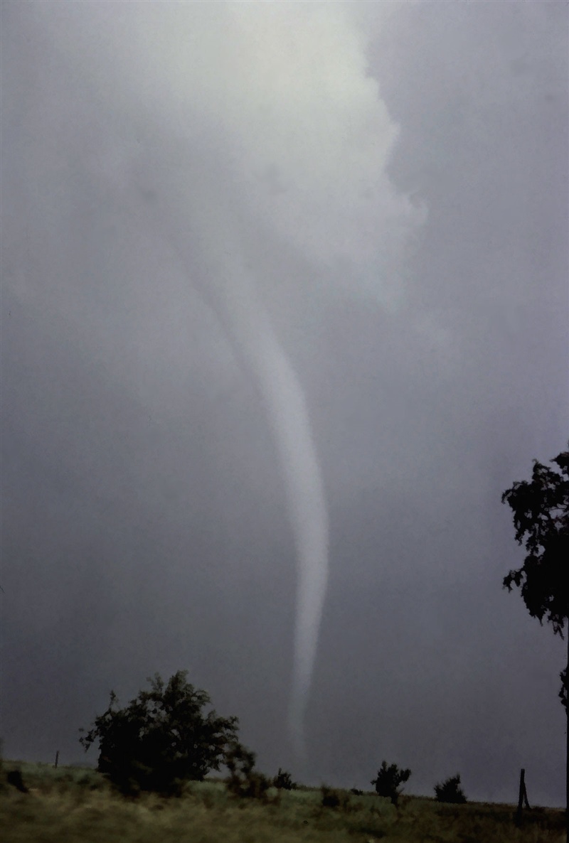
NOAA Photo Library (2018) 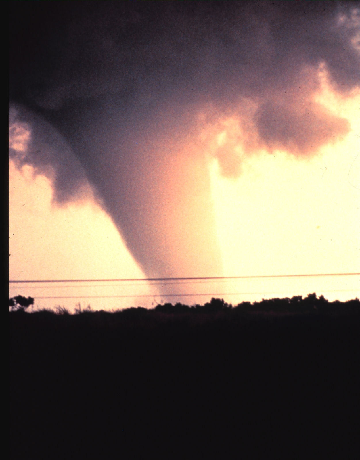
NOAA Photo Library (2018)
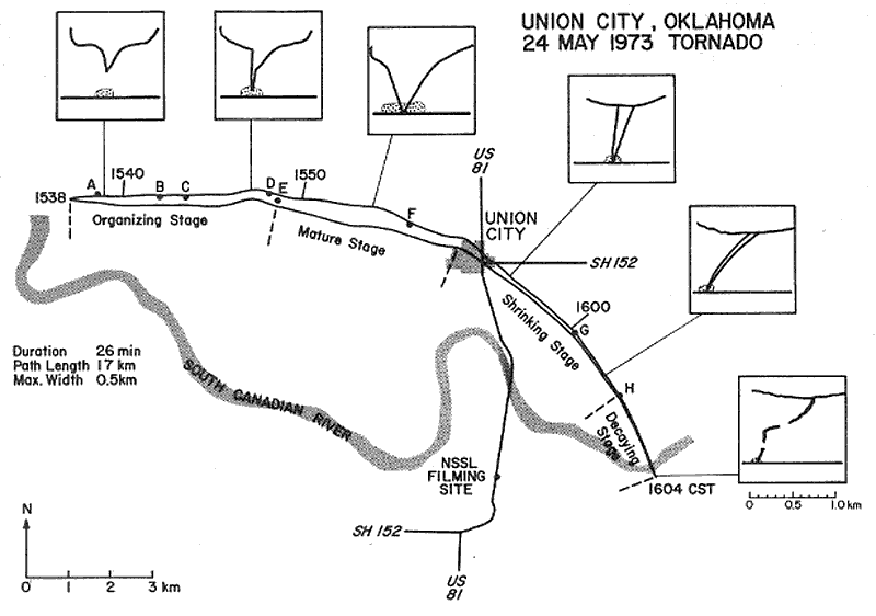
Figure 5 depicts the path of the Union City, OK tornado and sketches of the funnel cloud with its associated debris cloud as observed from the south.
Recap

According to NOAA’s Storm Events Database (2019), an F4 tornado occurred on May 24, 1973 west-northwest of Union City, Oklahoma at 4:00 pm local time (CST). The tornado travelled through Union City, moving southeast for 13.3 miles with a maximum width of 300 yards, killing two and injuring four in the process. The tornado caused $2.5 million dollars in property damage.
Sources
Shortt, R. (2004). Union City Tornado Makes History. Retrieved from: https://nssl.noaa.gov/about/events/40thanniversary/stories/unioncity.html
NOAA National Severe Storms Lab [NOAAWP]. (2019, March 14). Union City Tornado (24 May 1973) Film Preservation (Part 3 of 3) [Video file]. Retrieved from https://www.someaddress.com/full/url/
Doswell III, Charles. (2005). Progress toward developing a practical societal response to severe convection (2005 EGU Sergei Soloviev Medal Lecture). Natural Hazards and Earth System Sciences. 5. 10.5194/nhess-5-691-2005.
NOAA Environmental Data Service. (1973). Storm Data (U.S. Department of Commerce Publication No. 5, p. 16). Retrieved from: http://www1.ncdc.noaa.gov/pub/data/swdi/stormevents/pub-pdf/storm_1973_05.pdf
NOAA Photo Library, NOAA Central Library; OAR/ERL/National Severe Storms Laboratory (NSSL). (2018). The first tornado captured by the NSSL doppler radar and NSSL chase personnel. The tornado is here in its early stage of formation. Retrieved from: https://www.photolib.noaa.gov/Collections/National-Severe-Storms-Laboratory/Tornadoes/emodule/463/eitem/846
NOAA’s National Centers for Environmental Information. (2019). Storm Events Database. Retrieved from: https://www.ncdc.noaa.gov/stormevents/eventdetails.jsp?id=10093436