

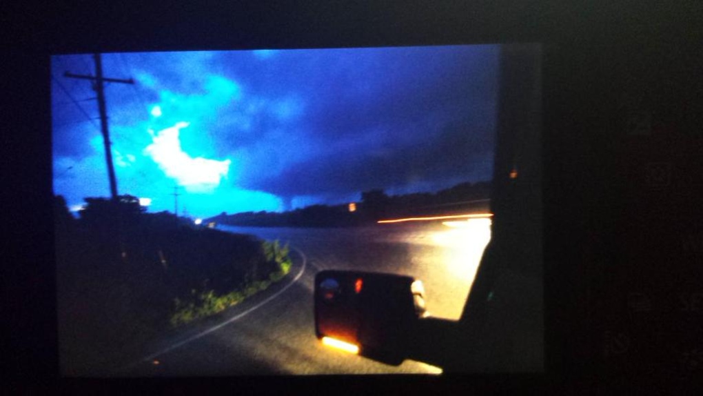
Touching down at around 9:45 pm to the southeast of Goderich, this EF0 tornado produced minimal damage. It was photographed by storm chaser Dave Patrick as it touched down briefly near Holmesville. The tornado appeared as a stout stovepipe beneath a large, bowled wall cloud.
Trees were snapped, a truck had its front grille torn off, and a large wagon was tossed into the side of a barn, puncturing the building. In addition, a house on the property was left splattered with leaves and mud, and had flashing torn from around its roof.
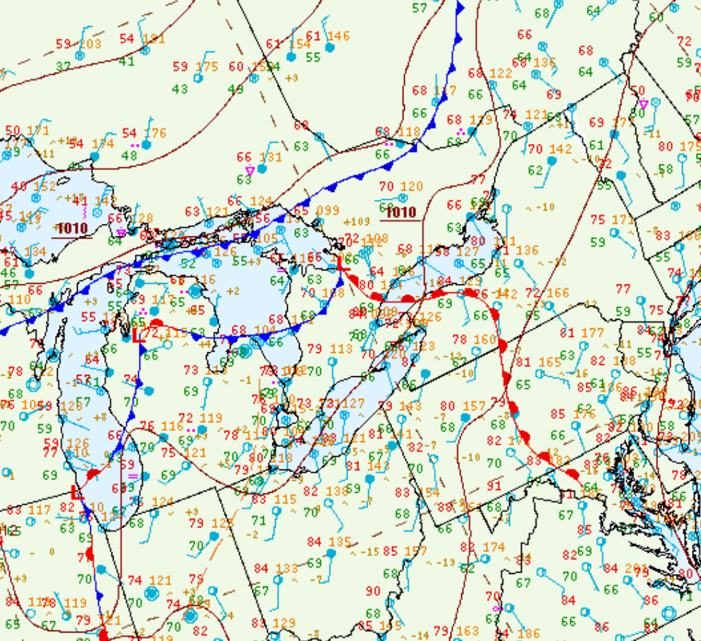
Figure 1 depicts the surface observations at 8:00 pm EDT, which shows a strong low pressure over Lake Superior with a cold front extending across the Midwest of the United States and a warm front extending across northern Michigan and southern Ontario. This warm front became the focus for thunderstorm activity in the late evening hours of June 22nd, which ultimately led to this tornado.
Sources
NWS Weather Prediction Center Surface Analysis Archive. (2017). Surface analysis 00Z Tue Jun 23 2015. Retrieved from: https://www.wpc.ncep.noaa.gov/archives/web_pages/sfc/sfc_archive.php