


The Forecast
Figure 2 depicts the surface observations at 8:00 am EDT, which shows a cold front moving through the Great Lakes and a warm front extending into western Massachusetts. The cold front moved southeast toward Massachusetts throughout the day, triggering thunderstorms, which ultimately led to several tornadoes across the state.

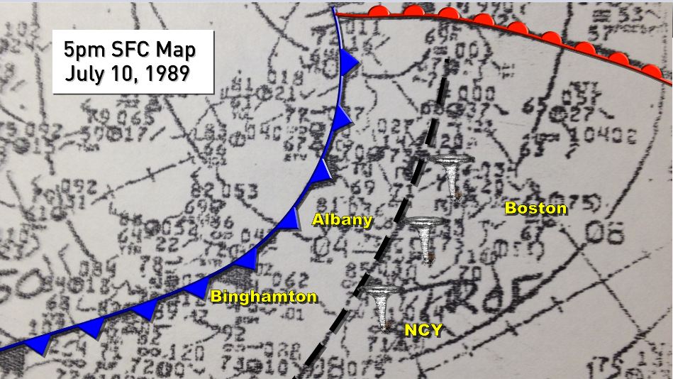
Figure 3 depicts the surface map at 5:00 pm (unclear which timezone the author used), which shows the cold front reaching Albany, NY in the late afternoon hours of July 10th. This front triggered pre-frontal storms, depicted as the black dashed line, which were responsible for a tornado outbreak across Massachusetts.
Recap
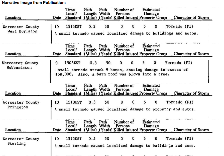
The Hubbardston, MA F1 tornado of July 10, 1989 impacted Worcester County in Massachusetts. According to NOAA (2019), the F1 tornado caused no fatalities or injuries, but caused $250 thousand dollars in property damage. The tornado touched down near Williamsville Road at 3:05 pm EDT. The tornado travelled for 0.3 miles and had a maximum width of 50 yards.
Sources
LaPointe, S. (March 15, 2016). Monday, July 10, 1989. Northeast Severe Weather – Tornado Outbreak. Retrieved from http://slapointewx.com/wrgb/weather_historical_daily/1989/July10_Tornado.html
NOAA Central Library. (2020). U.S. Daily Weather Maps. Monday July 10, 1989 [PDF]. Retrieved from https://library.noaa.gov/Collections/Digital-Collections/US-Daily-Weather-Maps
NOAA National Centers for Environmental Information (2020). Storm Events Database. Retrieved from: https://www.ncdc.noaa.gov/stormevents/