

Witnesses observed a funnel cloud that touched down at 4:35 pm. Although the tornado was brief and had a path that was only 210 metres long and 120 metres wide, it caused extreme damage to a swath of forest with all trees twisted, snapped and sheared off.
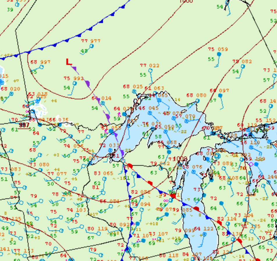
Figure 1 depicts the surface observations at 2:00 pm EDT, which show a low pressure in northwestern Ontario with a trowal extending into Lake Superior. This front was the focus of thunderstorms, marked as an “R”, which was responsible for this F1 tornado.
According to Environment and Climate Change Canada (2018), an F1 tornado touched down at 4:35 pm near Kakabeka Falls, ON. The tornado travelled for 210 metres with a maximum width of 120 metres. The tornado caused no fatalities, injuries or property damage.
Sources
NWS Weather Prediction Center Surface Analysis Archive. (2017). Surface analysis 18Z Wed Jun 21 2006. Retrieved from: https://www.wpc.ncep.noaa.gov/archives/web_pages/sfc/sfc_archive.php
Environment and Climate Change Canada Data. (2018). Canadian National Tornado Database: Verified Events (1980-2009) – Public. Retrieved from: http://donnees.ec.gc.ca/data/weather/products/canadian-national-tornado-database-verified-events-1980-2009-public/