

Several witnesses captured this F0 tornado in photos and on video as it touched down briefly near Kanata. It did not cause any notable damage.
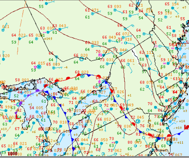
Figure 1 depicts the surface observations at 8:00 pm EDT, which shows an ongoing thunderstorm being reported in Ottawa. A stationary front is also seen across southern Ontario, which was likely responsible for initiating thunderstorms and ultimately this F0 tornado.
Sources
NWS Weather Prediction Center Surface Analysis Archive. (2017). Surface analysis 00Z Fri Jun 24 2011. Retrieved from: https://www.wpc.ncep.noaa.gov/archives/web_pages/sfc/sfc_archive.php